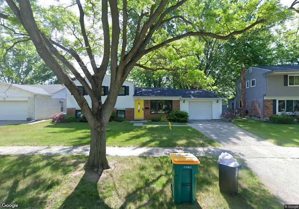
328 Crampton Dr Monroe, MI 48162
Northwest Monroe NeighborhoodEstimated Value: $226,351 - $273,000
3
Beds
2
Baths
1,617
Sq Ft
$157/Sq Ft
Est. Value
About This Home
This home is located at 328 Crampton Dr, Monroe, MI 48162 and is currently estimated at $253,338, approximately $156 per square foot. 328 Crampton Dr is a home located in Monroe County with nearby schools including Monroe High School, St Mary's Catholic Elementary School, and St Michaels Catholic Elementary School.
Ownership History
Date
Name
Owned For
Owner Type
Purchase Details
Closed on
Jul 25, 2011
Sold by
Secretary Of Hud
Bought by
Reed Amber
Current Estimated Value
Home Financials for this Owner
Home Financials are based on the most recent Mortgage that was taken out on this home.
Original Mortgage
$80,257
Outstanding Balance
$56,143
Interest Rate
4.87%
Mortgage Type
FHA
Estimated Equity
$197,195
Purchase Details
Closed on
Jan 26, 2011
Sold by
Us Bank National Association
Bought by
Secretary Of Hud
Purchase Details
Closed on
Jul 22, 2010
Sold by
Langton Michael
Bought by
Us Bank National Association
Create a Home Valuation Report for This Property
The Home Valuation Report is an in-depth analysis detailing your home's value as well as a comparison with similar homes in the area
Home Values in the Area
Average Home Value in this Area
Purchase History
| Date | Buyer | Sale Price | Title Company |
|---|---|---|---|
| Reed Amber | $60,000 | -- | |
| Secretary Of Hud | -- | -- | |
| Us Bank National Association | $186,359 | -- |
Source: Public Records
Mortgage History
| Date | Status | Borrower | Loan Amount |
|---|---|---|---|
| Open | Reed Amber | $80,257 |
Source: Public Records
Tax History
| Year | Tax Paid | Tax Assessment Tax Assessment Total Assessment is a certain percentage of the fair market value that is determined by local assessors to be the total taxable value of land and additions on the property. | Land | Improvement |
|---|---|---|---|---|
| 2025 | $2,198 | $98,000 | $98,000 | $0 |
| 2024 | $2,098 | $91,750 | $0 | $0 |
| 2023 | $2,682 | $73,700 | $0 | $0 |
| 2022 | $1,929 | $73,700 | $0 | $0 |
| 2021 | $2,581 | $66,120 | $0 | $0 |
| 2020 | $2,404 | $66,920 | $0 | $0 |
| 2019 | $2,278 | $66,920 | $0 | $0 |
| 2018 | $2,214 | $61,740 | $0 | $0 |
| 2017 | $2,168 | $61,740 | $0 | $0 |
| 2016 | $2,116 | $60,710 | $0 | $0 |
| 2015 | $2,030 | $53,910 | $0 | $0 |
| 2014 | $2,030 | $53,910 | $0 | $0 |
| 2013 | -- | $53,840 | $0 | $0 |
Source: Public Records
Map
Nearby Homes
- 329 Cranbrook Blvd
- 510 Ave de Lafayette
- 202 Orleans Ave
- 568 Rose Crest Blvd
- 664 Central Park Blvd
- 0 S Custer Lot B Rd
- 0 S Custer Lot A Rd
- 0 S Custer Lot C Rd
- 540 S Concetta Common
- 1910 S Custer Rd
- 505 John Anderson Ct Unit 62
- 2706 S Custer Rd
- 1724 S Custer Rd
- 2742 S Custer Rd
- 1703 S Custer Rd
- 1015 Donnalee Dr
- 0 N Telegraph Rd Unit 31361948
- 0 N Telegraph Rd Unit 20230102531
- 0 N Telegraph Rd Unit 50199091
- 469 Bentley Dr
- 334 Crampton Dr
- 322 Crampton Dr
- 340 Crampton Dr
- 337 Cranbrook Blvd
- 343 Cranbrook Blvd
- 316 Crampton
- 346 Crampton Dr
- 321 Cranbrook Blvd
- 327 Crampton Dr
- 317 Crampton Dr
- 333 Crampton Dr
- 352 Crampton Dr
- 311 Cranbrook Blvd
- 353 Cranbrook Blvd
- 339 Crampton Dr
- 345 Crampton Dr
- 302 Crampton Dr
- 359 Cranbrook Blvd
- 358 Crampton Dr
- 301 Crampton Dr
Your Personal Tour Guide
Ask me questions while you tour the home.