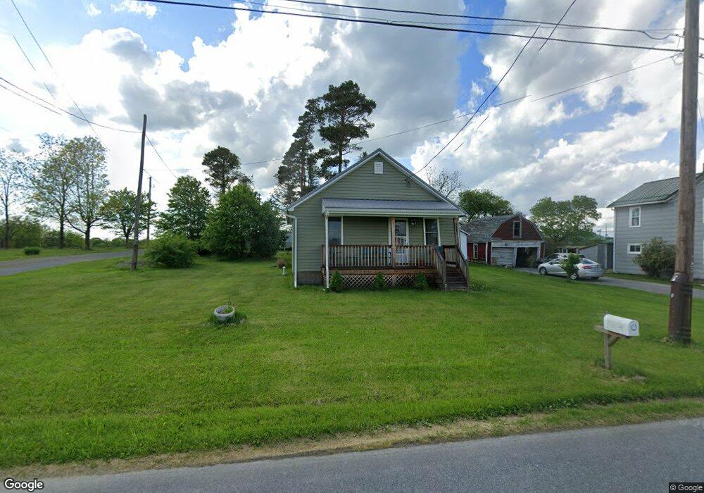
3281 Cookport Rd Commodore, PA 15729
Estimated Value: $55,741 - $63,000
2
Beds
1
Bath
1,008
Sq Ft
$59/Sq Ft
Est. Value
About This Home
This home is located at 3281 Cookport Rd, Commodore, PA 15729 and is currently estimated at $59,435, approximately $58 per square foot. 3281 Cookport Rd is a home with nearby schools including Purchase Line Elementary School, Purchase Line Junior/Senior High School, and Calvary Baptist Academy.
Ownership History
Date
Name
Owned For
Owner Type
Purchase Details
Closed on
Nov 20, 2025
Sold by
Cunningham Roberta Jean
Bought by
Piller Adam
Current Estimated Value
Home Financials for this Owner
Home Financials are based on the most recent Mortgage that was taken out on this home.
Original Mortgage
$43,000
Outstanding Balance
$43,000
Interest Rate
6.3%
Mortgage Type
New Conventional
Estimated Equity
$16,435
Purchase Details
Closed on
Nov 9, 2021
Sold by
Jean Cunninghan Roberta
Bought by
Cunningham Roberta Jean
Purchase Details
Closed on
Jan 11, 2019
Sold by
Davis Patricia V
Bought by
Cunningham Roberta Jane and Cunningham Dale C
Create a Home Valuation Report for This Property
The Home Valuation Report is an in-depth analysis detailing your home's value as well as a comparison with similar homes in the area
Purchase History
| Date | Buyer | Sale Price | Title Company |
|---|---|---|---|
| Piller Adam | $60,000 | Indiana Title Abstract | |
| Cunningham Roberta Jean | -- | None Listed On Document | |
| Cunningham Roberta Jane | -- | None Available |
Source: Public Records
Mortgage History
| Date | Status | Borrower | Loan Amount |
|---|---|---|---|
| Open | Piller Adam | $43,000 |
Source: Public Records
Tax History
| Year | Tax Paid | Tax Assessment Tax Assessment Total Assessment is a certain percentage of the fair market value that is determined by local assessors to be the total taxable value of land and additions on the property. | Land | Improvement |
|---|---|---|---|---|
| 2025 | $549 | $33,200 | $10,000 | $23,200 |
| 2024 | $524 | $33,200 | $10,000 | $23,200 |
| 2023 | $3,024 | $33,200 | $10,000 | $23,200 |
| 2022 | $466 | $33,200 | $10,000 | $23,200 |
| 2021 | $466 | $33,200 | $10,000 | $23,200 |
| 2020 | $451 | $33,200 | $10,000 | $23,200 |
| 2018 | $2,786 | $33,200 | $10,000 | $23,200 |
| 2017 | $813 | $33,200 | $10,000 | $23,200 |
| 2016 | -- | $33,200 | $10,000 | $23,200 |
| 2015 | -- | $3,780 | $410 | $3,370 |
| 2014 | -- | $3,780 | $410 | $3,370 |
Source: Public Records
Map
Nearby Homes
- 151 Hemlock Rd
- 5077 Purchase Line Rd
- 1427 Route 580 Hwy
- 0 Wise Ln Unit 1714499
- 0 Buck Run Rd Unit 1746912
- 1171 Churchill Rd
- 7175 Route 553 Hwy
- 4053 Pioneer Lake Rd
- 7703 Route 553 Hwy
- 660 Swamp Rd
- 000 Mumau Rd
- 19425 Pennsylvania 286
- 0 Wilgus Rd Unit 1738436
- 19189 Rte 286 Hwy E
- 620 1st St
- 397 Purchase Line Rd
- 172 Pine St
- 106 Pine St
- 295 Hancock St
- 2181 Barr Slope Rd
- 3297 Cookport Rd
- 3325 Cookport Rd
- 3359 Cookport Rd
- 3199 Cookport Rd
- 3379 Cookport Rd
- 3386 Cookport Rd
- 3153 Cookport Rd
- 3410 Cookport Rd
- 3418 Cookport Rd
- 3127 Cookport Rd
- 3441 Cookport Rd
- 3444 Cookport Rd
- 3444 Cookport Rd
- 3453 Cookport Rd
- 3456 Cookport Rd
- 2104 Route 240 Hwy
- 3465 Cookport Rd
- 3466 Cookport Rd
- 2072 Route 240 Hwy
- 2228 Route 240 Hwy
Your Personal Tour Guide
Ask me questions while you tour the home.