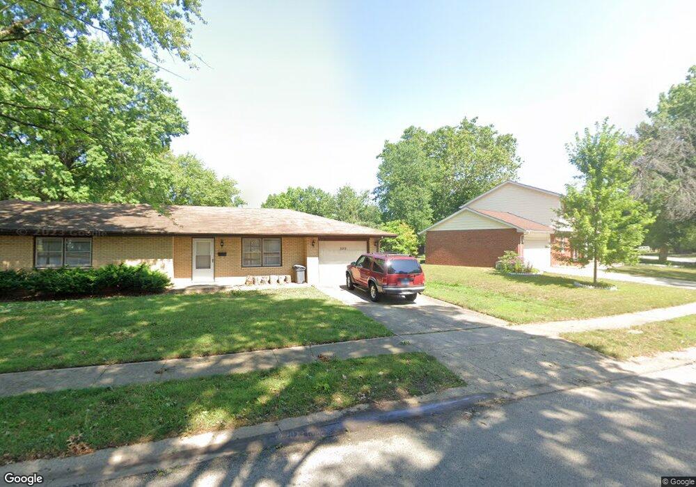
329 Astoria Rd Springfield, IL 62704
Pasfield Park Place NeighborhoodEstimated Value: $215,000 - $261,000
2
Beds
1
Bath
1,000
Sq Ft
$236/Sq Ft
Est. Value
About This Home
This home is located at 329 Astoria Rd, Springfield, IL 62704 and is currently estimated at $236,080, approximately $236 per square foot. 329 Astoria Rd is a home located in Sangamon County with nearby schools including Dubois Elementary School, U.S. Grant Middle School, and Springfield High School.
Ownership History
Date
Name
Owned For
Owner Type
Purchase Details
Closed on
Mar 3, 2022
Sold by
Jbav Llc
Bought by
Faine Reco
Current Estimated Value
Home Financials for this Owner
Home Financials are based on the most recent Mortgage that was taken out on this home.
Original Mortgage
$138,550
Outstanding Balance
$44,276
Interest Rate
3.69%
Mortgage Type
New Conventional
Estimated Equity
$191,804
Purchase Details
Closed on
Oct 29, 2012
Purchase Details
Closed on
Oct 23, 2002
Purchase Details
Closed on
Nov 20, 2001
Purchase Details
Closed on
Oct 3, 1994
Create a Home Valuation Report for This Property
The Home Valuation Report is an in-depth analysis detailing your home's value as well as a comparison with similar homes in the area
Home Values in the Area
Average Home Value in this Area
Purchase History
| Date | Buyer | Sale Price | Title Company |
|---|---|---|---|
| Faine Reco | $815,000 | Jones & Griffin Law Offices Pc | |
| -- | $130,000 | -- | |
| -- | -- | -- | |
| -- | $116,000 | -- | |
| -- | -- | -- |
Source: Public Records
Mortgage History
| Date | Status | Borrower | Loan Amount |
|---|---|---|---|
| Open | Faine Reco | $138,550 |
Source: Public Records
Tax History
| Year | Tax Paid | Tax Assessment Tax Assessment Total Assessment is a certain percentage of the fair market value that is determined by local assessors to be the total taxable value of land and additions on the property. | Land | Improvement |
|---|---|---|---|---|
| 2024 | $5,254 | $62,549 | $10,472 | $52,077 |
| 2023 | $5,051 | $57,133 | $9,565 | $47,568 |
| 2022 | $4,816 | $53,739 | $9,073 | $44,666 |
| 2021 | $4,656 | $51,727 | $8,733 | $42,994 |
| 2020 | $4,563 | $51,805 | $8,746 | $43,059 |
| 2019 | $4,479 | $51,624 | $8,715 | $42,909 |
| 2018 | $3,811 | $45,099 | $8,674 | $36,425 |
| 2017 | $3,732 | $44,516 | $8,562 | $35,954 |
| 2016 | $3,658 | $43,867 | $8,437 | $35,430 |
| 2015 | $3,623 | $43,342 | $8,336 | $35,006 |
| 2014 | $3,591 | $43,062 | $8,282 | $34,780 |
| 2013 | $3,849 | $47,507 | $8,282 | $39,225 |
Source: Public Records
Map
Nearby Homes
- 2637 Sarona Rd
- 232 Dickinson Rd
- 2651 W Lawrence Ave Unit 2
- 2229 Fairway Dr
- 2138 W Lawrence Ave
- 2134 W Lawrence Ave
- 2118 W Lawrence Ave
- 2223 Cardinal Dr
- 504 Brandywine Rd
- 6 Redwood Ln
- 2900 W Lawrence Ave
- 60 N Oxford Rd
- 97 Mccarthy Dr
- 1914 Jeanette Ln Unit 6
- 1913 Jeanette Ln Unit 8
- 1901 Jeanette Ln Unit 6
- 1909 Jeanette Ln Unit 4
- 812 Roanoke Dr
- 2000 Oak Creek Rd
- 3229 W Point Dr
- 325 Astoria Rd
- 320 S Oxford Rd
- 321 Astoria Rd
- 332 Astoria Rd
- 328 Astoria Rd
- 324 Astoria Rd
- 316 S Oxford Rd
- 317 Astoria Rd
- 2435 W Lawrence Ave
- 320 Astoria Rd
- 2437 W Lawrence Ave
- 2500 W Lawrence Ave
- 312 S Oxford Rd
- 319 S Oxford Rd
- 2446 W Lawrence Ave
- 313 Astoria Rd
- 2442 W Lawrence Ave
- 341 Norwalk Rd
- 316 Astoria Rd
- 345 Norwalk Rd
Your Personal Tour Guide
Ask me questions while you tour the home.