Estimated Value: $175,796 - $209,000
3
Beds
1
Bath
936
Sq Ft
$206/Sq Ft
Est. Value
About This Home
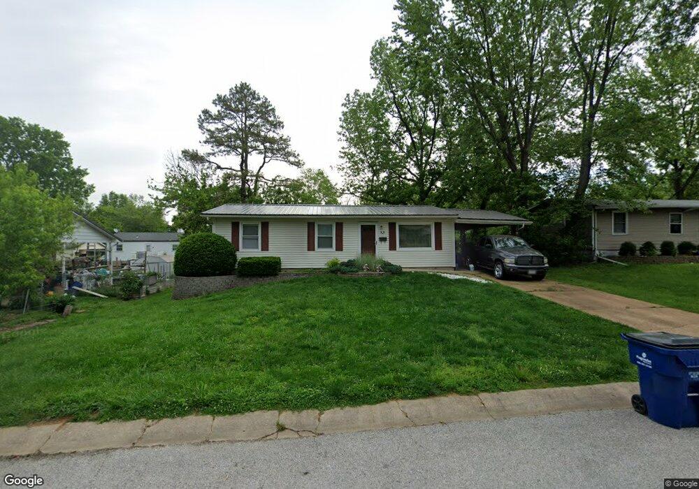
This home is located at 33 Circle Dr, Union, MO 63084 and is currently estimated at $192,449, approximately $205 per square foot. 33 Circle Dr is a home located in Franklin County with nearby schools including Union High School and Immaculate Conception School.
Ownership History
Date
Name
Owned For
Owner Type
Purchase Details
Closed on
Dec 5, 2015
Sold by
Yokley Tammy L and Hicks Tammy L
Bought by
Yokley Leon and Yokley Tammy L
Current Estimated Value
Home Financials for this Owner
Home Financials are based on the most recent Mortgage that was taken out on this home.
Original Mortgage
$83,600
Outstanding Balance
$65,776
Interest Rate
3.88%
Mortgage Type
New Conventional
Estimated Equity
$126,673
Purchase Details
Closed on
Jan 18, 2012
Sold by
Hicks Tammy L and Yokley Leon
Bought by
Springleaf Financial Services Inc
Create a Home Valuation Report for This Property
The Home Valuation Report is an in-depth analysis detailing your home's value as well as a comparison with similar homes in the area
Home Values in the Area
Average Home Value in this Area
Purchase History
| Date | Buyer | Sale Price | Title Company |
|---|---|---|---|
| Yokley Leon | -- | -- | |
| Springleaf Financial Services Inc | -- | None Available |
Source: Public Records
Mortgage History
| Date | Status | Borrower | Loan Amount |
|---|---|---|---|
| Open | Yokley Leon | $83,600 |
Source: Public Records
Tax History
| Year | Tax Paid | Tax Assessment Tax Assessment Total Assessment is a certain percentage of the fair market value that is determined by local assessors to be the total taxable value of land and additions on the property. | Land | Improvement |
|---|---|---|---|---|
| 2025 | $1,105 | $20,701 | $0 | $0 |
| 2024 | $1,105 | $18,379 | $0 | $0 |
| 2023 | $1,108 | $18,379 | $0 | $0 |
| 2022 | $1,014 | $16,798 | $0 | $0 |
| 2021 | $1,016 | $16,798 | $0 | $0 |
| 2020 | $937 | $15,248 | $0 | $0 |
| 2019 | $935 | $15,248 | $0 | $0 |
| 2018 | $864 | $14,792 | $0 | $0 |
| 2017 | $867 | $14,792 | $0 | $0 |
| 2016 | $891 | $14,870 | $0 | $0 |
| 2015 | $877 | $14,870 | $0 | $0 |
| 2014 | $888 | $15,037 | $0 | $0 |
Source: Public Records
Map
Nearby Homes
- 409 Hawthorne Dr
- 412 Hawthorne Dr
- 613 S Jefferson Ave
- 300 Bourbeuse Rd
- 614 E State St
- Lot 2 E State Highway 47
- Lot 1 E State Highway 47
- N Highway 47 E State Highway 47
- 410 Gruber Ave
- 413 W State St
- 413 Rosedale Ave
- 22 Gloria Dr
- 613 W State St
- 725 W Main St
- 154 Joel Ave
- 1122 Old County Farm Rd
- 910 N Church St
- 0 Lot 4 Clearview Dr Unit 19010507
- 0 Lot 6 Clearview Dr Unit 19010511
- 0 Clearview Unit 19010495
Your Personal Tour Guide
Ask me questions while you tour the home.