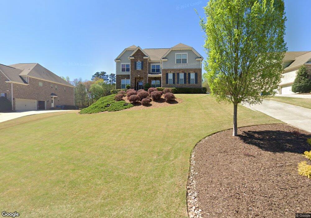
33 Dover Rd Alpharetta, GA 30004
Estimated Value: $1,021,203 - $1,487,000
4
Beds
5
Baths
4,422
Sq Ft
$287/Sq Ft
Est. Value
About This Home
This home is located at 33 Dover Rd, Alpharetta, GA 30004 and is currently estimated at $1,267,051, approximately $286 per square foot. 33 Dover Rd is a home with nearby schools including Summit Hill Elementary School, Hopewell Middle School, and Cambridge High School.
Ownership History
Date
Name
Owned For
Owner Type
Purchase Details
Closed on
Aug 15, 2014
Sold by
The Ryland Grp Inc
Bought by
Chehimi Jamal Khaled and Chehimi Danielle Salama
Current Estimated Value
Home Financials for this Owner
Home Financials are based on the most recent Mortgage that was taken out on this home.
Original Mortgage
$355,244
Outstanding Balance
$271,781
Interest Rate
4.2%
Mortgage Type
New Conventional
Estimated Equity
$995,270
Purchase Details
Closed on
May 30, 2012
Sold by
Longmeadow Properties Inc
Bought by
Cedar Park Financial Llc
Create a Home Valuation Report for This Property
The Home Valuation Report is an in-depth analysis detailing your home's value as well as a comparison with similar homes in the area
Home Values in the Area
Average Home Value in this Area
Purchase History
| Date | Buyer | Sale Price | Title Company |
|---|---|---|---|
| Chehimi Jamal Khaled | $575,244 | -- | |
| Cedar Park Financial Llc | -- | -- |
Source: Public Records
Mortgage History
| Date | Status | Borrower | Loan Amount |
|---|---|---|---|
| Open | Chehimi Jamal Khaled | $355,244 |
Source: Public Records
Tax History
| Year | Tax Paid | Tax Assessment Tax Assessment Total Assessment is a certain percentage of the fair market value that is determined by local assessors to be the total taxable value of land and additions on the property. | Land | Improvement |
|---|---|---|---|---|
| 2025 | $1,476 | $306,240 | $35,600 | $270,640 |
| 2023 | $8,777 | $310,960 | $35,600 | $275,360 |
| 2022 | $8,181 | $310,960 | $35,600 | $275,360 |
| 2021 | $8,191 | $301,920 | $34,560 | $267,360 |
| 2020 | $6,571 | $236,440 | $34,160 | $202,280 |
| 2019 | $1,240 | $233,160 | $66,080 | $167,080 |
| 2018 | $6,427 | $227,680 | $64,520 | $163,160 |
| 2017 | $6,387 | $218,920 | $62,040 | $156,880 |
| 2016 | $6,389 | $218,920 | $62,040 | $156,880 |
| 2015 | $7,451 | $218,920 | $62,040 | $156,880 |
| 2014 | $1,902 | $62,040 | $62,040 | $0 |
Source: Public Records
Map
Nearby Homes
- 0 Brock Trail Unit 3,4,5
- 640 Claxton Ln
- 0 Brock Trail Unit 7703958
- 5219 Union Hill #3
- 0 NE Clan St Unit 7505718
- 240 Thompson Trail
- 210 Thompson Trail
- 2135 Country Ridge Rd
- 2309 Dinsmore Rd
- 14801 Hopewell Rd
- 15154 Hopewell Rd
- 1010 Homestead Dr
- 135 Foxhollow Trail
- 15260 Thompson Oak Rd
- 2270 Dinsmore Rd
- 1040 Homestead Dr
- 14480 Hopewell Rd
- 1070 Homestead Dr Unit 21
- 1080 Homestead Dr
- 1050 Homestead Dr
Your Personal Tour Guide
Ask me questions while you tour the home.