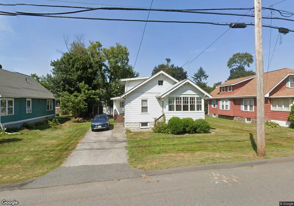
33 Westborough St Worcester, MA 01604
Broadmeadow Brook NeighborhoodEstimated Value: $323,000 - $408,000
3
Beds
1
Bath
883
Sq Ft
$406/Sq Ft
Est. Value
About This Home
This home is located at 33 Westborough St, Worcester, MA 01604 and is currently estimated at $358,712, approximately $406 per square foot. 33 Westborough St is a home located in Worcester County with nearby schools including Roosevelt Elementary School, Jacob Hiatt Magnet School, and Chandler Magnet.
Ownership History
Date
Name
Owned For
Owner Type
Purchase Details
Closed on
Dec 30, 1998
Sold by
Yager William J and Yager Sharon M
Bought by
Grant Charles H
Current Estimated Value
Home Financials for this Owner
Home Financials are based on the most recent Mortgage that was taken out on this home.
Original Mortgage
$78,600
Outstanding Balance
$18,356
Interest Rate
6.84%
Mortgage Type
Purchase Money Mortgage
Estimated Equity
$340,356
Purchase Details
Closed on
Mar 31, 1994
Sold by
Fnma
Bought by
Yager William J and Yager Sharon
Purchase Details
Closed on
Mar 2, 1987
Sold by
Tusing Ronald L
Bought by
Dassis Aecio P F
Create a Home Valuation Report for This Property
The Home Valuation Report is an in-depth analysis detailing your home's value as well as a comparison with similar homes in the area
Home Values in the Area
Average Home Value in this Area
Purchase History
| Date | Buyer | Sale Price | Title Company |
|---|---|---|---|
| Grant Charles H | $79,900 | -- | |
| Yager William J | $59,000 | -- | |
| Dassis Aecio P F | $94,000 | -- |
Source: Public Records
Mortgage History
| Date | Status | Borrower | Loan Amount |
|---|---|---|---|
| Open | Dassis Aecio P F | $46,899 | |
| Closed | Dassis Aecio P F | $34,398 | |
| Open | Dassis Aecio P F | $78,600 |
Source: Public Records
Tax History
| Year | Tax Paid | Tax Assessment Tax Assessment Total Assessment is a certain percentage of the fair market value that is determined by local assessors to be the total taxable value of land and additions on the property. | Land | Improvement |
|---|---|---|---|---|
| 2025 | $3,837 | $290,900 | $114,100 | $176,800 |
| 2024 | $3,717 | $270,300 | $114,100 | $156,200 |
| 2023 | $3,541 | $246,900 | $99,200 | $147,700 |
| 2022 | $3,226 | $212,100 | $79,400 | $132,700 |
| 2021 | $3,002 | $184,400 | $63,500 | $120,900 |
| 2020 | $2,892 | $170,100 | $63,500 | $106,600 |
| 2019 | $2,774 | $154,100 | $57,100 | $97,000 |
| 2018 | $2,782 | $147,100 | $57,100 | $90,000 |
| 2017 | $2,641 | $137,400 | $57,100 | $80,300 |
| 2016 | $2,539 | $123,200 | $42,100 | $81,100 |
| 2015 | $2,473 | $123,200 | $42,100 | $81,100 |
| 2014 | $2,407 | $123,200 | $42,100 | $81,100 |
Source: Public Records
Map
Nearby Homes
- 2 Salisbury St
- 15 Lakeside Dr
- 23 Bay View Dr
- 33 Lakeside Dr
- 53 Pointe Rok Dr Unit 53
- 47 Pointe Rok Dr Unit 47,G
- 16 Flint Pond Rd
- 81 Bay View Dr
- 469 Lake Ave
- 12 Bruce St
- 7 Atlas St
- 10 George St
- 1195 Grafton St Unit 19
- 1195 Grafton St Unit 39
- 1205 Grafton St Unit 31
- 1257 Grafton St
- 1459 Grafton Rd
- 11 Maplewood Rd
- 1260 Grafton St
- 151 Hartford Turnpike Unit 16
Your Personal Tour Guide
Ask me questions while you tour the home.