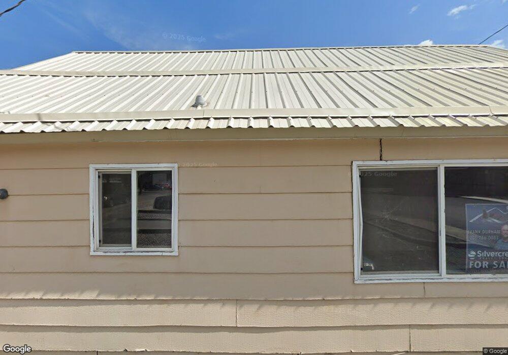
330 Cedar St Kellogg, ID 83837
Estimated Value: $247,000 - $276,000
2
Beds
1
Bath
796
Sq Ft
$327/Sq Ft
Est. Value
About This Home
This home is located at 330 Cedar St, Kellogg, ID 83837 and is currently estimated at $260,414, approximately $327 per square foot. 330 Cedar St is a home located in Shoshone County with nearby schools including Pinehurst Elementary School, Kellogg Middle School, and Kellogg High School.
Ownership History
Date
Name
Owned For
Owner Type
Purchase Details
Closed on
Oct 6, 2025
Sold by
Pw Assets Trust and Wessel Peter James
Bought by
Kimberley Dawn-Findley Trust and Dawn-Findley
Current Estimated Value
Purchase Details
Closed on
May 12, 2020
Sold by
D2t Llc
Bought by
Wessel Peter James and Pw Assets Trust
Purchase Details
Closed on
Jan 10, 2008
Sold by
Bq2 Llc
Bought by
D2t Llc
Purchase Details
Closed on
Jan 30, 2006
Sold by
Bisaro Derino and Bisaro Jonnie
Bought by
Branch Thomas I and Branch Karen A
Home Financials for this Owner
Home Financials are based on the most recent Mortgage that was taken out on this home.
Original Mortgage
$98,400
Interest Rate
2.5%
Mortgage Type
Adjustable Rate Mortgage/ARM
Create a Home Valuation Report for This Property
The Home Valuation Report is an in-depth analysis detailing your home's value as well as a comparison with similar homes in the area
Home Values in the Area
Average Home Value in this Area
Purchase History
| Date | Buyer | Sale Price | Title Company |
|---|---|---|---|
| Kimberley Dawn-Findley Trust | -- | Alliance Title | |
| Wessel Peter James | -- | First American Ttl Co Kello | |
| D2t Llc | -- | -- | |
| Branch Thomas I | -- | -- |
Source: Public Records
Mortgage History
| Date | Status | Borrower | Loan Amount |
|---|---|---|---|
| Previous Owner | Branch Thomas I | $98,400 |
Source: Public Records
Tax History
| Year | Tax Paid | Tax Assessment Tax Assessment Total Assessment is a certain percentage of the fair market value that is determined by local assessors to be the total taxable value of land and additions on the property. | Land | Improvement |
|---|---|---|---|---|
| 2025 | $2,618 | $254,137 | $7,164 | $246,973 |
| 2024 | $2,721 | $254,137 | $7,164 | $246,973 |
| 2023 | $2,721 | $220,520 | $72,382 | $148,138 |
| 2022 | $2,592 | $191,325 | $67,346 | $123,979 |
| 2021 | $2,654 | $139,610 | $26,902 | $112,708 |
| 2020 | $2,246 | $113,917 | $25,202 | $88,715 |
| 2019 | $2,179 | $101,004 | $20,846 | $80,158 |
| 2018 | $1,985 | $78,770 | $18,951 | $59,819 |
| 2017 | $1,829 | $73,426 | $18,951 | $54,475 |
| 2016 | $1,800 | $70,011 | $18,951 | $51,060 |
| 2015 | $1,778 | $70,011 | $18,951 | $51,060 |
| 2014 | $1,795 | $70,011 | $18,951 | $51,060 |
Source: Public Records
Map
Nearby Homes
- 303 W Mission Ave
- 204 Chestnut St
- 134 W Riverside Ave
- 0 Vergobbi Unit 25-11458
- 11 W Mission Ave
- 140 Railroad Ave Units 1-5
- 140 Railroad Ave Unit 6
- 140 Railroad Ave Unit 5
- 140 Railroad Ave Unit 2
- 140 Railroad Ave Unit 4
- 140 Railroad Ave Unit 3
- 140 Railroad Ave Unit 1
- 607 W Riverside Ave
- 110 Morning Star Dr Unit 345
- 150 Morning Star Dr Unit 478
- 110 Morning Star Dr Unit 244
- 110 Morning Star Dr Unit 548
- 150 Morning Star Dr Unit 371
- 150 Morning Star Dr Unit 181
- 150 Morning Star Dr Unit 471
- 303 W Riverside Ave
- 302 W Cameron Ave
- 217 W Riverside Ave
- 307 W Riverside Ave
- 218 W Cameron Ave
- 215 Riverside Ave W
- 309 W Riverside Ave
- 304 W Riverside Ave
- 215 Riverside
- 310 W Cameron Ave
- 220 W Riverside Ave
- 218 W Riverside Ave
- 306 W Riverside Ave
- 216 W Cameron Ave
- 313 W Riverside Ave
- 308 Riverside Ave W
- 216 Riverside Ave W
- 219 W Cameron Ave
- 312 Riverside Ave W Unit o
- 312 Riverside Ave W
Your Personal Tour Guide
Ask me questions while you tour the home.