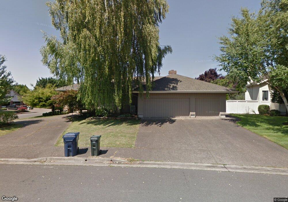
3303 King Edwards Ct Eugene, OR 97401
Harlow NeighborhoodEstimated Value: $809,020 - $978,000
3
Beds
3
Baths
2,781
Sq Ft
$325/Sq Ft
Est. Value
About This Home
This home is located at 3303 King Edwards Ct, Eugene, OR 97401 and is currently estimated at $904,255, approximately $325 per square foot. 3303 King Edwards Ct is a home located in Lane County with nearby schools including Holt Elementary School, Monroe Middle School, and Sheldon High School.
Ownership History
Date
Name
Owned For
Owner Type
Purchase Details
Closed on
Feb 25, 2013
Sold by
Duncan Gretchen M and Weza Gretchen M
Bought by
Bogart David W and Bogart Anne G
Current Estimated Value
Home Financials for this Owner
Home Financials are based on the most recent Mortgage that was taken out on this home.
Original Mortgage
$200,000
Outstanding Balance
$138,865
Interest Rate
3.34%
Mortgage Type
New Conventional
Estimated Equity
$765,390
Purchase Details
Closed on
Feb 5, 2013
Sold by
Weza David L
Bought by
Duncan Gretchen M and Weza Gretchen M
Home Financials for this Owner
Home Financials are based on the most recent Mortgage that was taken out on this home.
Original Mortgage
$200,000
Outstanding Balance
$138,865
Interest Rate
3.34%
Mortgage Type
New Conventional
Estimated Equity
$765,390
Create a Home Valuation Report for This Property
The Home Valuation Report is an in-depth analysis detailing your home's value as well as a comparison with similar homes in the area
Home Values in the Area
Average Home Value in this Area
Purchase History
We collect this data history from publicly available records. To have your information removed, we recommend requesting removal directly through your county’s website.
| Date | Buyer | Sale Price | Title Company |
|---|---|---|---|
| Bogart David W | $410,000 | Cascade Title Company | |
| Duncan Gretchen M | -- | Cascade Title Company |
Source: Public Records
Mortgage History
We collect this data history from publicly available records. To have your information removed, we recommend requesting removal directly through your county’s website.
| Date | Status | Borrower | Loan Amount |
|---|---|---|---|
| Open | Bogart David W | $200,000 |
Source: Public Records
Tax History
| Year | Tax Paid | Tax Assessment Tax Assessment Total Assessment is a certain percentage of the fair market value that is determined by local assessors to be the total taxable value of land and additions on the property. | Land | Improvement |
|---|---|---|---|---|
| 2025 | $12,261 | $641,245 | -- | -- |
| 2024 | $12,177 | $622,568 | -- | -- |
| 2023 | $12,177 | $604,435 | $0 | $0 |
| 2022 | $11,280 | $586,831 | $0 | $0 |
| 2021 | $10,118 | $569,739 | $0 | $0 |
| 2020 | $9,976 | $553,145 | $0 | $0 |
| 2019 | $9,629 | $537,034 | $0 | $0 |
| 2018 | $9,060 | $506,207 | $0 | $0 |
| 2017 | $8,623 | $506,207 | $0 | $0 |
| 2016 | $8,381 | $491,463 | $0 | $0 |
| 2015 | $8,159 | $477,149 | $0 | $0 |
| 2014 | $8,033 | $463,251 | $0 | $0 |
Source: Public Records
Map
Nearby Homes
- 1564 Regency Dr
- 0 Sprig Ln Unit Lot 3
- 0 Sprig Ln Unit Lot 3 766109892
- 3387 Winchester Way
- 1625 Victorian Way
- 1639 Victorian Way
- 3424 Sussex St
- 3381 Rosemont Way
- 1271 Arcadia Dr
- 3528 Berkshire St
- 1798 Duke Ct
- 1050 President St
- 1040 Martha Ct
- 3700 Babcock Ln Unit 87
- 825 Waverly St
- 3735 Harlow Rd
- 2775 Elysium Ave
- 2010 Valhalla St
- 654 N Garden Way
- 640 N Garden Way
- 1455 Victorian Way
- 3306 King Edwards Ct
- 1488 Victorian Way
- 1456 Regency Dr
- 3307 King Edwards Ct
- 1500 Victorian Way
- 1454 Victorian Way
- 1415 Victorian Way
- 3311 King Edwards Ct
- 1522 Victorian Way
- 1543 Victorian Way
- 1449 Barrington Ave
- 1453 Barrington Ave
- 1400 Regency Dr
- 1414 Victorian Way
- 1459 Barrington Ave
- 1526 Regency Dr
- 1499 Regency Dr
- 1397 Victorian Way
- 1465 Barrington Ave
Your Personal Tour Guide
Ask me questions while you tour the home.