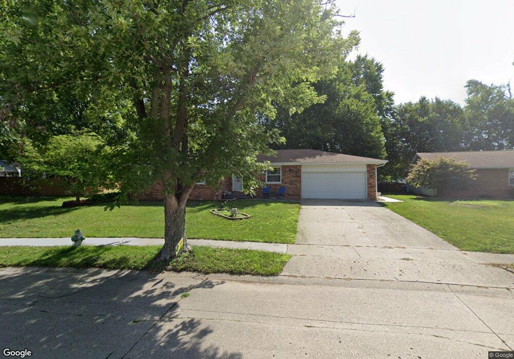
3304 Jennings Dr Springfield, IL 62704
Westchester NeighborhoodEstimated Value: $200,846 - $256,000
Studio
--
Bath
--
Sq Ft
15,420
Sq Ft Lot
About This Home
This home is located at 3304 Jennings Dr, Springfield, IL 62704 and is currently estimated at $233,212. 3304 Jennings Dr is a home located in Sangamon County with nearby schools including Sandburg Elementary School, Benjamin Franklin Middle School, and Springfield Southeast High School.
Ownership History
Date
Name
Owned For
Owner Type
Purchase Details
Closed on
Apr 1, 2021
Sold by
Missel Craig D
Bought by
Chestnut Michael A and Davlantis Donna G
Current Estimated Value
Home Financials for this Owner
Home Financials are based on the most recent Mortgage that was taken out on this home.
Original Mortgage
$150,000
Outstanding Balance
$134,993
Interest Rate
2.8%
Mortgage Type
New Conventional
Estimated Equity
$98,219
Purchase Details
Closed on
Sep 9, 1995
Create a Home Valuation Report for This Property
The Home Valuation Report is an in-depth analysis detailing your home's value as well as a comparison with similar homes in the area
Home Values in the Area
Average Home Value in this Area
Purchase History
| Date | Buyer | Sale Price | Title Company |
|---|---|---|---|
| Chestnut Michael A | $155,000 | Illinois Real Estate Title | |
| -- | -- | -- |
Source: Public Records
Mortgage History
| Date | Status | Borrower | Loan Amount |
|---|---|---|---|
| Open | Chestnut Michael A | $150,000 |
Source: Public Records
Tax History
| Year | Tax Paid | Tax Assessment Tax Assessment Total Assessment is a certain percentage of the fair market value that is determined by local assessors to be the total taxable value of land and additions on the property. | Land | Improvement |
|---|---|---|---|---|
| 2024 | $4,213 | $61,163 | $11,243 | $49,920 |
| 2023 | $4,409 | $55,866 | $10,269 | $45,597 |
| 2022 | $4,176 | $52,602 | $9,742 | $42,860 |
| 2021 | $3,567 | $50,632 | $9,377 | $41,255 |
| 2020 | $3,498 | $50,708 | $9,391 | $41,317 |
| 2019 | $3,430 | $50,531 | $9,358 | $41,173 |
| 2018 | $3,498 | $52,396 | $9,312 | $43,084 |
| 2017 | $3,413 | $51,719 | $9,192 | $42,527 |
| 2016 | $3,333 | $50,965 | $9,058 | $41,907 |
| 2015 | $3,290 | $50,356 | $8,950 | $41,406 |
| 2014 | $3,213 | $50,031 | $8,892 | $41,139 |
| 2013 | $3,547 | $49,775 | $8,892 | $40,883 |
Source: Public Records
Map
Nearby Homes
- 3308 Rawlings Dr
- 3304 Ellendale Dr
- 3608 Wittington Ct
- 2317 Grinnell Dr
- 3434 Freedom Dr
- 41 Belhaven Dr
- 3804 Greenfield Dr
- 3506 Aberdeen Ct
- 3833 Wexford Dr
- 3813 Brandonshire Dr
- 51 Squires Rd
- 100 Andover Dr
- 10 Andover Dr
- 49 Foresters Ln
- 53 Friars Ln
- 0 Interstate 72
- 21 Drawbridge Rd
- 4351 Conestoga Dr
- 2709 Clifton Dr
- 3120 Cascade Dr
- 3308 Jennings Dr
- 2440 Lindbergh Blvd
- 3301 Ivyton Dr
- 3305 Ivyton Dr
- 2436 Lindbergh Blvd
- 3312 Jennings Dr
- 3305 Jennings Dr
- 3301 Jennings Dr
- 3309 Ivyton Dr
- 3221 Ivyton Dr
- 3309 Jennings Dr
- 2432 Lindbergh Blvd
- 3316 Jennings Dr
- 3313 Ivyton Dr
- 3217 Ivyton Dr
- 3313 Jennings Dr
- 2447 Lindbergh Blvd
- 3300 Ivyton Dr
- 2500 Winfield Dr
- 3317 Ivyton Dr
Your Personal Tour Guide
Ask me questions while you tour the home.