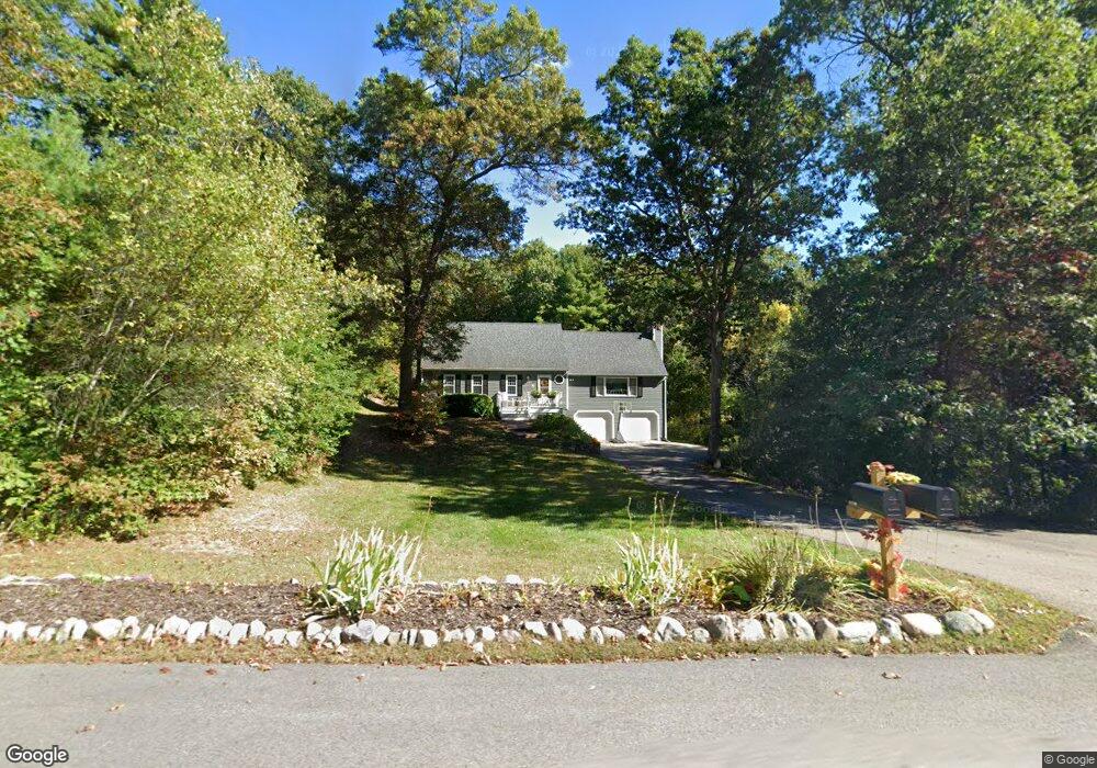
331 Bennett St Wrentham, MA 02093
Estimated Value: $677,943 - $794,000
3
Beds
2
Baths
1,942
Sq Ft
$371/Sq Ft
Est. Value
About This Home
This home is located at 331 Bennett St, Wrentham, MA 02093 and is currently estimated at $720,486, approximately $371 per square foot. 331 Bennett St is a home located in Norfolk County with nearby schools including Delaney Elementary School, Charles E Roderick, and Mercymount Country Day School.
Ownership History
Date
Name
Owned For
Owner Type
Purchase Details
Closed on
Jun 17, 1994
Sold by
Amato Michael L and Amato Lynne A
Bought by
Costanzo Philip
Current Estimated Value
Purchase Details
Closed on
Dec 27, 1990
Sold by
Demers John E
Bought by
Amato Michael L
Create a Home Valuation Report for This Property
The Home Valuation Report is an in-depth analysis detailing your home's value as well as a comparison with similar homes in the area
Purchase History
| Date | Buyer | Sale Price | Title Company |
|---|---|---|---|
| Costanzo Philip | $184,500 | -- | |
| Amato Michael L | $175,000 | -- |
Source: Public Records
Mortgage History
| Date | Status | Borrower | Loan Amount |
|---|---|---|---|
| Open | Amato Michael L | $100,000 | |
| Closed | Amato Michael L | $21,000 |
Source: Public Records
Tax History
| Year | Tax Paid | Tax Assessment Tax Assessment Total Assessment is a certain percentage of the fair market value that is determined by local assessors to be the total taxable value of land and additions on the property. | Land | Improvement |
|---|---|---|---|---|
| 2025 | $7,284 | $628,500 | $303,000 | $325,500 |
| 2024 | $7,030 | $585,800 | $303,000 | $282,800 |
| 2023 | $6,887 | $545,700 | $275,400 | $270,300 |
| 2022 | $6,849 | $501,000 | $256,900 | $244,100 |
| 2021 | $6,420 | $456,300 | $224,300 | $232,000 |
| 2020 | $6,162 | $432,400 | $199,500 | $232,900 |
| 2019 | $5,939 | $420,600 | $199,500 | $221,100 |
| 2018 | $6,053 | $425,100 | $199,700 | $225,400 |
| 2017 | $5,700 | $400,000 | $195,900 | $204,100 |
| 2016 | $5,575 | $390,400 | $190,200 | $200,200 |
| 2015 | $5,372 | $358,600 | $182,800 | $175,800 |
| 2014 | $5,314 | $347,100 | $175,900 | $171,200 |
Source: Public Records
Map
Nearby Homes
- 440 Chestnut St
- 613 West St
- 10 Earle Stewart Ln Unit Lot 5
- 12 Earle Stewart Ln
- 2 Earle Stewart Ln
- 1222 South St
- 3 Earle Stewart Ln
- 135 Creek St Unit 2
- 20 Field Cir
- 440 South St
- 19 Chestnut St Lot 2
- 19 Chestnut St Lot 3
- 6 Woodchester Rd
- 165 Wampum St
- 23 Horseshoe Dr
- 1 Chestnut St
- 0 Berry St
- 11 Amber Dr
- 0 Fall Ln
- 500 Franklin St
- 325 Bennett St
- 330 Bennett St
- 345 Bennett St
- 337 Bennett St
- 320 Bennett St
- 305 Bennett St
- 305 Bennett St Unit 305
- 355 Bennett St
- 365 Bennett St
- 315 Bennett St
- 350 Bennett St
- 318 Bennett St
- 295 Bennett St
- 285 Bennett St
- 275 Bennett St
- 370 Bennett St
- 304 Bennett St
- 314 Bennett St
- 375 Bennett St
- 265 Bennett St
Your Personal Tour Guide
Ask me questions while you tour the home.