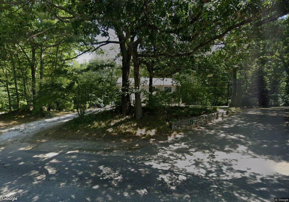
331 North Rd Wakefield, RI 02879
Estimated Value: $429,000 - $670,986
3
Beds
2
Baths
1,920
Sq Ft
$299/Sq Ft
Est. Value
About This Home
This home is located at 331 North Rd, Wakefield, RI 02879 and is currently estimated at $573,247, approximately $298 per square foot. 331 North Rd is a home located in Washington County with nearby schools including South Kingstown High School, Monsignor Matthew Clarke Catholic Regional School, and South Shore School.
Ownership History
Date
Name
Owned For
Owner Type
Purchase Details
Closed on
Jan 24, 2000
Sold by
Graney Helen E
Bought by
Diomandes Dean D and Diomandes Louann
Current Estimated Value
Purchase Details
Closed on
May 27, 1994
Sold by
Tri Level Constr Co In
Bought by
Graney Helen E
Create a Home Valuation Report for This Property
The Home Valuation Report is an in-depth analysis detailing your home's value as well as a comparison with similar homes in the area
Home Values in the Area
Average Home Value in this Area
Purchase History
| Date | Buyer | Sale Price | Title Company |
|---|---|---|---|
| Diomandes Dean D | $160,000 | -- | |
| Graney Helen E | $150,000 | -- |
Source: Public Records
Mortgage History
| Date | Status | Borrower | Loan Amount |
|---|---|---|---|
| Open | Graney Helen E | $191,700 | |
| Closed | Graney Helen E | $201,000 | |
| Closed | Graney Helen E | $158,500 |
Source: Public Records
Tax History
| Year | Tax Paid | Tax Assessment Tax Assessment Total Assessment is a certain percentage of the fair market value that is determined by local assessors to be the total taxable value of land and additions on the property. | Land | Improvement |
|---|---|---|---|---|
| 2025 | $5,382 | $602,000 | $314,400 | $287,600 |
| 2024 | $5,201 | $470,700 | $243,000 | $227,700 |
| 2023 | $5,201 | $470,700 | $243,000 | $227,700 |
| 2022 | $5,154 | $470,700 | $243,000 | $227,700 |
| 2021 | $5,251 | $363,400 | $201,000 | $162,400 |
| 2020 | $5,251 | $363,400 | $201,000 | $162,400 |
| 2019 | $5,251 | $363,400 | $201,000 | $162,400 |
| 2018 | $5,217 | $332,700 | $194,200 | $138,500 |
| 2017 | $5,094 | $332,700 | $194,200 | $138,500 |
| 2016 | $5,020 | $332,700 | $194,200 | $138,500 |
| 2015 | $4,960 | $319,600 | $183,100 | $136,500 |
| 2014 | $4,947 | $319,600 | $183,100 | $136,500 |
Source: Public Records
Map
Nearby Homes
- 57 Rocky Brook Way
- 15 Jessica Ln
- 301 Church St Unit 103
- 228 Rodman St
- 42 Vespia Ln
- 54 Vespia Ln
- 48 Stone Bridge Dr
- 131 Columbia St
- 261 Saugatucket Rd
- 95 S Woods Dr
- 37 Columbia St
- 20 Cleveland St
- 222 Sweet Allen Farm Rd Unit D3
- 260 Sweet Allen Farm Rd Unit 3
- 40 Northup St
- 45 Cherry Ln Unit C
- 39 Hazard Ave
- 23 Rockland Dr
- 106 Winter St
- 143 Summit Ave
- 327 North Rd
- 311 North Rd
- 351 North Rd
- 285 North Rd
- 0 Sophia Ct Unit 1011853
- 0 Sophia Ct Unit 1012033
- 0 Sophia Ct Unit 1015143
- 0 Sophia Ct Unit 1015182
- 0 Sophia Ct Unit 1033960
- 0 Sophia Ct Unit 1016544
- 0 Sophia Ct Unit 1017722
- 0 Sophia Ct Unit 1022993
- 0 Sophia Ct Unit 1023535
- 0 Sophia Ct Unit 1011856
- 0 Sophia Ct Unit 1012923
- 0 Sophia Ct Unit 1012921
- 0 Sophia Ct Unit 1012738
- 0 Sophia Ct Unit 1025958
- 24 Sophia Ct
- 32 Sophia Ct
Your Personal Tour Guide
Ask me questions while you tour the home.