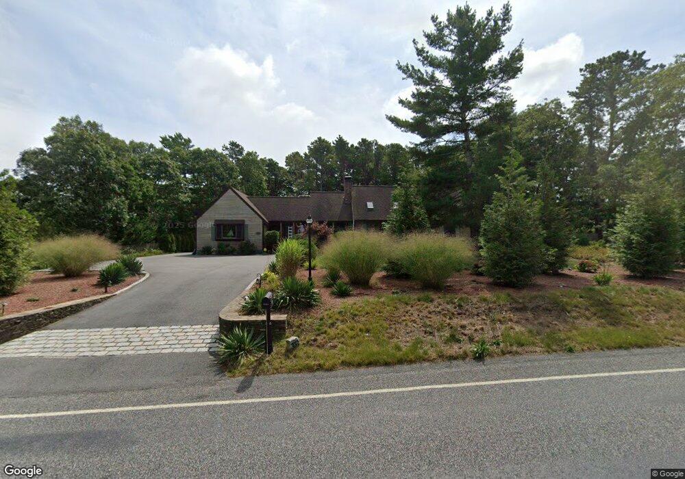
331 Setucket Rd Dennis, MA 02638
East Dennis NeighborhoodEstimated Value: $789,000 - $979,000
4
Beds
2
Baths
1,801
Sq Ft
$496/Sq Ft
Est. Value
About This Home
This home is located at 331 Setucket Rd, Dennis, MA 02638 and is currently estimated at $893,034, approximately $495 per square foot. 331 Setucket Rd is a home located in Barnstable County with nearby schools including Dennis-Yarmouth Regional High School and Latham School.
Ownership History
Date
Name
Owned For
Owner Type
Purchase Details
Closed on
May 28, 1999
Sold by
Dantonio Connie A
Bought by
Roome Everett J and Roome Belkis D
Current Estimated Value
Purchase Details
Closed on
Jul 11, 1990
Sold by
Doane Russell L
Bought by
Dantonio Michael N
Home Financials for this Owner
Home Financials are based on the most recent Mortgage that was taken out on this home.
Original Mortgage
$105,750
Interest Rate
10.17%
Mortgage Type
Purchase Money Mortgage
Create a Home Valuation Report for This Property
The Home Valuation Report is an in-depth analysis detailing your home's value as well as a comparison with similar homes in the area
Home Values in the Area
Average Home Value in this Area
Purchase History
| Date | Buyer | Sale Price | Title Company |
|---|---|---|---|
| Roome Everett J | $159,900 | -- | |
| Dantonio Michael N | $141,000 | -- |
Source: Public Records
Mortgage History
| Date | Status | Borrower | Loan Amount |
|---|---|---|---|
| Previous Owner | Dantonio Michael N | $105,750 |
Source: Public Records
Tax History
| Year | Tax Paid | Tax Assessment Tax Assessment Total Assessment is a certain percentage of the fair market value that is determined by local assessors to be the total taxable value of land and additions on the property. | Land | Improvement |
|---|---|---|---|---|
| 2025 | $3,880 | $896,000 | $186,700 | $709,300 |
| 2024 | $3,831 | $872,600 | $179,500 | $693,100 |
| 2023 | $3,705 | $793,300 | $163,200 | $630,100 |
| 2022 | $3,577 | $638,700 | $163,300 | $475,400 |
| 2021 | $2,983 | $571,000 | $160,100 | $410,900 |
| 2020 | $2,993 | $490,600 | $160,100 | $330,500 |
| 2019 | $2,974 | $451,400 | $157,000 | $294,400 |
| 2018 | $2,791 | $419,200 | $134,500 | $284,700 |
| 2017 | $2,578 | $419,200 | $134,500 | $284,700 |
| 2016 | $2,562 | $392,400 | $149,400 | $243,000 |
| 2015 | $2,511 | $392,400 | $149,400 | $243,000 |
| 2014 | $2,442 | $384,600 | $149,400 | $235,200 |
Source: Public Records
Map
Nearby Homes
- 32 Captain Walsh Dr
- 52 Uncle Bobs Way
- 4 Surrey Ln
- 16 Hazelwood Rd
- 18 Asack Dr
- 10 Uncle Bills Way
- 61 Terrace Hill Dr
- 58 Terrace Hill Dr
- 149 Greenland Cir
- 31 High Head Rd
- 360 Airline Rd
- 36 Island St
- 102 Prince Way
- 39 Whittier Dr
- 1354 Route 134
- 26 S West Dr
- 7 Vinland Dr
- 310 Old Chatham Rd Unit E29
- 310 Old Chatham Rd Unit A21
- 310 Old Chatham Rd Unit D-30
- 321 Setucket Rd
- 339 Setucket Rd
- 336 Setucket Rd
- 160 Setucket Rd
- 503 Setucket Rd
- 526 Setucket Rd
- 536 Setucket Rd
- 0 Setucket Rd
- 553 Setucket Rd
- 662 Setucket Rd
- 680 Setucket Rd
- 336 Setucket Rd
- 17 Grassy Pond Dr
- 332 Setucket Rd
- 9 Grassy Pond Dr
- 313 Setucket Rd
- 312 Setucket Rd
- 3 Grassy Pond Dr
- 346 Setucket Rd
- 29 Grassy Pond Dr
Your Personal Tour Guide
Ask me questions while you tour the home.