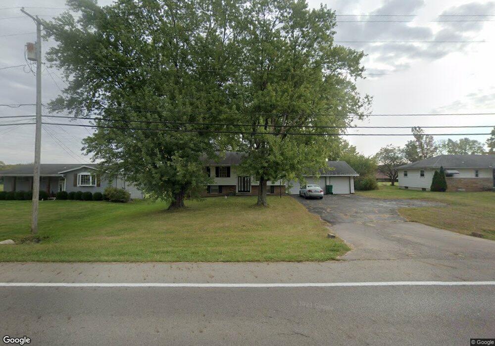
3310 Derr Rd Springfield, OH 45503
Estimated Value: $194,000 - $226,379
3
Beds
2
Baths
1,146
Sq Ft
$186/Sq Ft
Est. Value
About This Home
This home is located at 3310 Derr Rd, Springfield, OH 45503 and is currently estimated at $213,095, approximately $185 per square foot. 3310 Derr Rd is a home located in Clark County with nearby schools including Northridge Elementary School, Kenton Ridge Middle & High School, and Emmanuel Christian Academy.
Ownership History
Date
Name
Owned For
Owner Type
Purchase Details
Closed on
Apr 2, 2018
Sold by
Roberson Thomas D and Roberson Janice B
Bought by
Findora James and Findora Karen
Current Estimated Value
Home Financials for this Owner
Home Financials are based on the most recent Mortgage that was taken out on this home.
Original Mortgage
$100,395
Outstanding Balance
$85,820
Interest Rate
4.46%
Mortgage Type
New Conventional
Estimated Equity
$127,275
Purchase Details
Closed on
Jan 19, 2016
Sold by
Roberson Thomas D and Roberson Janice B
Bought by
Roberson Thomas D and Roberson Janice B
Purchase Details
Closed on
Oct 31, 1986
Sold by
Kuebler Carl R and Kuebler Karen R
Bought by
Roberson Thomas D and Roberson Janice B
Purchase Details
Closed on
Jul 1, 1985
Create a Home Valuation Report for This Property
The Home Valuation Report is an in-depth analysis detailing your home's value as well as a comparison with similar homes in the area
Home Values in the Area
Average Home Value in this Area
Purchase History
| Date | Buyer | Sale Price | Title Company |
|---|---|---|---|
| Findora James | $103,500 | None Available | |
| Roberson Thomas D | -- | None Available | |
| Roberson Thomas D | $63,500 | -- | |
| -- | $62,000 | -- |
Source: Public Records
Mortgage History
| Date | Status | Borrower | Loan Amount |
|---|---|---|---|
| Open | Findora James | $100,395 |
Source: Public Records
Tax History
| Year | Tax Paid | Tax Assessment Tax Assessment Total Assessment is a certain percentage of the fair market value that is determined by local assessors to be the total taxable value of land and additions on the property. | Land | Improvement |
|---|---|---|---|---|
| 2025 | $2,330 | $67,790 | $14,090 | $53,700 |
| 2024 | $2,253 | $53,280 | $13,600 | $39,680 |
| 2023 | $2,253 | $53,280 | $13,600 | $39,680 |
| 2022 | $2,261 | $53,280 | $13,600 | $39,680 |
| 2021 | $2,291 | $45,730 | $10,710 | $35,020 |
| 2020 | $2,293 | $45,730 | $10,710 | $35,020 |
| 2019 | $2,336 | $45,730 | $10,710 | $35,020 |
| 2018 | $1,714 | $40,930 | $8,820 | $32,110 |
| 2017 | $1,470 | $39,351 | $8,817 | $30,534 |
| 2016 | $1,459 | $39,351 | $8,817 | $30,534 |
| 2015 | $1,613 | $39,351 | $8,817 | $30,534 |
| 2014 | $1,613 | $39,351 | $8,817 | $30,534 |
| 2013 | $1,575 | $39,351 | $8,817 | $30,534 |
Source: Public Records
Map
Nearby Homes
- 1136 Foxboro Rd Unit 202
- 1013 Abington Place
- 1139 Bradford Dr
- 3052 Brixton Dr E
- 1039 Bradford Dr Unit 42
- 1201 Kingsgate Rd
- 615 Villa Rd Unit B
- 3124 El Camino Dr
- 3135 Imperial Blvd
- 3631 Kingsgate Ln
- 1500 Kingsgate Rd Unit 19430
- 1502 Kingsgate Rd Unit 19432
- 1500 Kingsgate Rd
- 1502 Kingsgate Rd
- 1503 Kingsgate Rd
- 1505 Kingsgate Rd
- 1507 Kingsgate Rd
- 732 Grandview Dr Unit 732
- 3211 Haverhill St
- 1525 Providence Ave
- 3300 Derr Rd
- 3324 Derr Rd
- 3071 Brixton Dr W Unit 123
- 3067 Brixton Dr W
- 3075 Brixton Dr W Unit 122
- 3240 Derr Rd
- 3326 Derr Rd
- 3063 Brixton Dr W
- 3059 Brixton Dr W
- 3059 Brixton Dr W Unit 126
- 3066 Brixton Dr W
- 3062 Brixton Dr W
- 3070 Brixton Dr W
- 3070 Brixton Dr W Unit 222
- 3232 Derr Rd
- 3338 Derr Rd
- 3083 Brixton Dr W
- 3083 Brixton Dr W
- 3083 Brixton Dr W Unit 3083
- 3083 Brixton Dr W
Your Personal Tour Guide
Ask me questions while you tour the home.