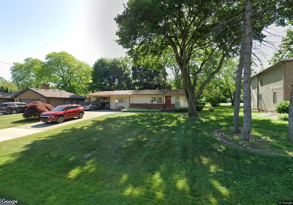
3325 Circle Dr Flint, MI 48507
Circle Neighborhood NeighborhoodEstimated Value: $132,449 - $181,000
3
Beds
2
Baths
1,686
Sq Ft
$90/Sq Ft
Est. Value
About This Home
This home is located at 3325 Circle Dr, Flint, MI 48507 and is currently estimated at $152,112, approximately $90 per square foot. 3325 Circle Dr is a home located in Genesee County with nearby schools including Freeman Elementary School, Flint Southwestern Classical Academy, and International Academy of Flint (K-12).
Ownership History
Date
Name
Owned For
Owner Type
Purchase Details
Closed on
Apr 13, 2021
Sold by
Stewart Carrenea
Bought by
Stewart Vernon E
Current Estimated Value
Home Financials for this Owner
Home Financials are based on the most recent Mortgage that was taken out on this home.
Original Mortgage
$82,000
Outstanding Balance
$48,889
Interest Rate
3.1%
Mortgage Type
New Conventional
Estimated Equity
$103,223
Purchase Details
Closed on
Nov 21, 2001
Sold by
Seybold Darrieux and Boven Darrieux D
Bought by
Stewart Vernon E and Stewart Carrenea
Create a Home Valuation Report for This Property
The Home Valuation Report is an in-depth analysis detailing your home's value as well as a comparison with similar homes in the area
Home Values in the Area
Average Home Value in this Area
Purchase History
| Date | Buyer | Sale Price | Title Company |
|---|---|---|---|
| Stewart Vernon E | -- | None Available | |
| Stewart Vernon E | $113,500 | Guaranty Title Company |
Source: Public Records
Mortgage History
| Date | Status | Borrower | Loan Amount |
|---|---|---|---|
| Open | Stewart Vernon E | $82,000 |
Source: Public Records
Tax History
| Year | Tax Paid | Tax Assessment Tax Assessment Total Assessment is a certain percentage of the fair market value that is determined by local assessors to be the total taxable value of land and additions on the property. | Land | Improvement |
|---|---|---|---|---|
| 2025 | $1,998 | $61,900 | $0 | $0 |
| 2024 | $1,775 | $61,600 | $0 | $0 |
| 2023 | $1,723 | $57,000 | $0 | $0 |
| 2022 | $0 | $47,000 | $0 | $0 |
| 2021 | $1,814 | $45,300 | $0 | $0 |
| 2020 | $1,601 | $42,800 | $0 | $0 |
| 2019 | $1,537 | $35,100 | $0 | $0 |
| 2018 | $1,614 | $32,800 | $0 | $0 |
| 2017 | $1,561 | $0 | $0 | $0 |
| 2016 | $1,549 | $0 | $0 | $0 |
| 2015 | -- | $0 | $0 | $0 |
| 2014 | -- | $0 | $0 | $0 |
| 2012 | -- | $31,800 | $0 | $0 |
Source: Public Records
Map
Nearby Homes
- 720 Algonquin Ave
- 3505 Comanche Ave
- 3617 Circle Dr
- 630 Buckingham Ave
- 2910 Shawnee Ave
- 621 Burroughs Ave
- 3110 Menominee Ave
- 3009 Menominee Ave
- 366 E Atherton Rd
- 420 Burroughs Ave
- 4126 Circle Dr
- 352 Buckingham Ave
- 4127 Custer Ave
- 326 Burroughs Ave
- 3056 Shaw St
- 617 McKeighan Ave
- 3914 Red Arrow Rd
- 530 McKeighan Ave
- 4424 Cheyenne Ave
- 3218 Collingwood Pkwy
- 3317 Circle Dr
- 3401 Circle Dr
- 3309 Circle Dr
- 3402 Dearborn Ave
- 3406 Dearborn Ave
- 3410 Dearborn Ave
- 3314 Dearborn Ave
- 3414 Dearborn Ave
- 3417 Circle Dr
- 3301 Circle Dr
- 3402 Circle Dr
- 3314 Circle Dr
- 3502 Dearborn Ave
- 712 Eldon Baker Dr
- 3501 Circle Dr
- 3412 Circle Dr
- 3306 Circle Dr
- 719 Algonquin Ave
- 3506 Dearborn Ave
- 3401 Dearborn Ave
Your Personal Tour Guide
Ask me questions while you tour the home.