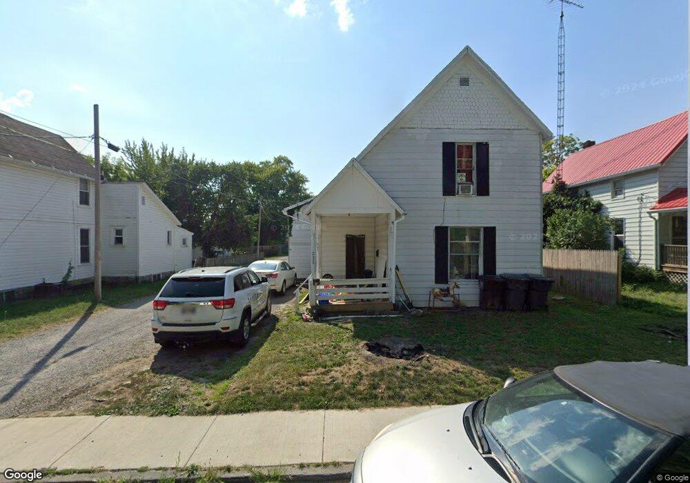
333 Maple Ln Lima, OH 45805
Central Lima NeighborhoodEstimated Value: $49,000 - $130,000
3
Beds
1
Bath
1,715
Sq Ft
$44/Sq Ft
Est. Value
About This Home
This home is located at 333 Maple Ln, Lima, OH 45805 and is currently estimated at $76,001, approximately $44 per square foot. 333 Maple Ln is a home located in Allen County with nearby schools including Heritage Elementary School, Lima West Middle School, and Lima North Middle School.
Ownership History
Date
Name
Owned For
Owner Type
Purchase Details
Closed on
Sep 30, 2024
Sold by
Anderson Emmaline R
Bought by
Vanvoorhis Bryan A
Current Estimated Value
Purchase Details
Closed on
Apr 13, 2022
Sold by
Pittman Nicholas J and Pittman Lynda M
Bought by
Davidson Gary
Purchase Details
Closed on
May 6, 2005
Sold by
Pittman Nicholas J and Pittman Lynda M
Bought by
Pittman Kenneth R and Pittman Marilyn L
Purchase Details
Closed on
Aug 1, 1986
Bought by
Pittman Kenneth
Create a Home Valuation Report for This Property
The Home Valuation Report is an in-depth analysis detailing your home's value as well as a comparison with similar homes in the area
Home Values in the Area
Average Home Value in this Area
Purchase History
| Date | Buyer | Sale Price | Title Company |
|---|---|---|---|
| Vanvoorhis Bryan A | -- | None Listed On Document | |
| Davidson Gary | $5,000 | Splain Law Llc | |
| Pittman Kenneth R | $170,000 | None Available | |
| Pittman Nicholas J | $175,000 | None Available | |
| Pittman Kenneth | -- | -- |
Source: Public Records
Tax History
| Year | Tax Paid | Tax Assessment Tax Assessment Total Assessment is a certain percentage of the fair market value that is determined by local assessors to be the total taxable value of land and additions on the property. | Land | Improvement |
|---|---|---|---|---|
| 2024 | $401 | $9,520 | $2,450 | $7,070 |
| 2023 | $431 | $9,070 | $2,350 | $6,720 |
| 2022 | $712 | $9,070 | $2,350 | $6,720 |
| 2021 | $1,705 | $9,070 | $2,350 | $6,720 |
| 2020 | $599 | $9,980 | $2,240 | $7,740 |
| 2019 | $599 | $9,980 | $2,240 | $7,740 |
| 2018 | $1,244 | $9,980 | $2,240 | $7,740 |
| 2017 | $550 | $9,980 | $2,240 | $7,740 |
| 2016 | $609 | $9,980 | $2,240 | $7,740 |
| 2015 | $696 | $9,980 | $2,240 | $7,740 |
| 2014 | $696 | $11,590 | $2,310 | $9,280 |
| 2013 | $629 | $11,590 | $2,310 | $9,280 |
Source: Public Records
Map
Nearby Homes
- 1023 Brice Ave
- 503 N Charles St
- 1027 Brice Ave
- 513 N Charles St
- 508 N Collett St
- 3 House Package
- 618 Woodward Ave
- 615 N Collett St
- 625 N Charles St
- 809 Rice Ave
- 956 Rice Ave
- 1150 Brice Ave
- 1160 W High St
- 703 N Collett St
- 949 Leland Ave
- 1160 Richie Ave
- 745 Richie Ave
- 1209 Rice Ave
- 631 Hazel Ave
- 555 Haller St
Your Personal Tour Guide
Ask me questions while you tour the home.