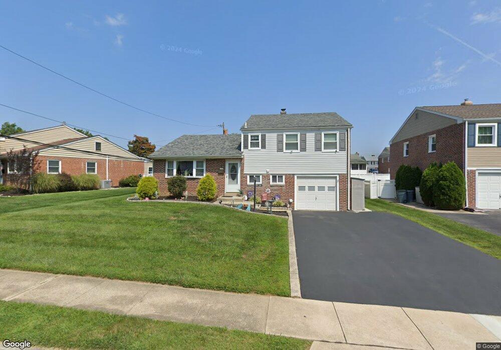
333 Parham Rd Springfield, PA 19064
Estimated Value: $457,605 - $534,000
3
Beds
2
Baths
1,878
Sq Ft
$269/Sq Ft
Est. Value
About This Home
This home is located at 333 Parham Rd, Springfield, PA 19064 and is currently estimated at $504,401, approximately $268 per square foot. 333 Parham Rd is a home located in Delaware County with nearby schools including Springfield High School, St Francis Of Assisi School, and Holy Cross School.
Ownership History
Date
Name
Owned For
Owner Type
Purchase Details
Closed on
Aug 11, 2011
Sold by
Kloss Linda
Bought by
Cavaliere Stephen G and Cavaliere Jean
Current Estimated Value
Home Financials for this Owner
Home Financials are based on the most recent Mortgage that was taken out on this home.
Original Mortgage
$204,676
Outstanding Balance
$137,951
Interest Rate
4.62%
Mortgage Type
FHA
Estimated Equity
$366,450
Purchase Details
Closed on
Mar 27, 2001
Sold by
Kloss Robert Pearson and Kloss Jeanne F
Bought by
Kloss Robert Pearson
Create a Home Valuation Report for This Property
The Home Valuation Report is an in-depth analysis detailing your home's value as well as a comparison with similar homes in the area
Home Values in the Area
Average Home Value in this Area
Purchase History
We collect this data history from publicly available records. To have your information removed, we recommend requesting removal directly through your county’s website.
| Date | Buyer | Sale Price | Title Company |
|---|---|---|---|
| Cavaliere Stephen G | $210,000 | Stewart Title | |
| Kloss Robert Pearson | -- | -- |
Source: Public Records
Mortgage History
We collect this data history from publicly available records. To have your information removed, we recommend requesting removal directly through your county’s website.
| Date | Status | Borrower | Loan Amount |
|---|---|---|---|
| Open | Cavaliere Stephen G | $204,676 |
Source: Public Records
Tax History
| Year | Tax Paid | Tax Assessment Tax Assessment Total Assessment is a certain percentage of the fair market value that is determined by local assessors to be the total taxable value of land and additions on the property. | Land | Improvement |
|---|---|---|---|---|
| 2026 | $8,023 | $267,680 | $95,120 | $172,560 |
| 2025 | $7,524 | $267,680 | $95,120 | $172,560 |
| 2024 | $7,524 | $267,680 | $95,120 | $172,560 |
| 2023 | $7,245 | $267,680 | $95,120 | $172,560 |
| 2022 | $7,088 | $267,680 | $95,120 | $172,560 |
| 2021 | $10,977 | $267,680 | $95,120 | $172,560 |
| 2020 | $6,449 | $142,310 | $45,730 | $96,580 |
| 2019 | $6,297 | $142,310 | $45,730 | $96,580 |
| 2018 | $6,207 | $142,310 | $0 | $0 |
| 2017 | $6,063 | $142,310 | $0 | $0 |
| 2016 | $781 | $142,310 | $0 | $0 |
| 2015 | $797 | $142,310 | $0 | $0 |
| 2014 | $781 | $142,310 | $0 | $0 |
Source: Public Records
Map
Nearby Homes
- 306 Sedgewood Rd
- 527 Saxer Ave
- 225 Lynbrooke Rd
- 610 Saxer Ave
- 270 Sunnybrook Rd
- 271 Ballymore Rd
- 320 Prospect Rd
- 304 Carolee Cir
- 93 Saxer Ave
- 311 Carolee Cir
- 231 E Woodland Ave
- 405 E Woodland Ave
- 111 S Norwinden Dr
- 212 E Woodland Ave
- 649 Andrew Rd
- 29 Schuyler Rd
- 251 School Ln
- 43 Lownes Ln
- 416 Glendale Cir
- 224 Wayne Ave
Your Personal Tour Guide
Ask me questions while you tour the home.