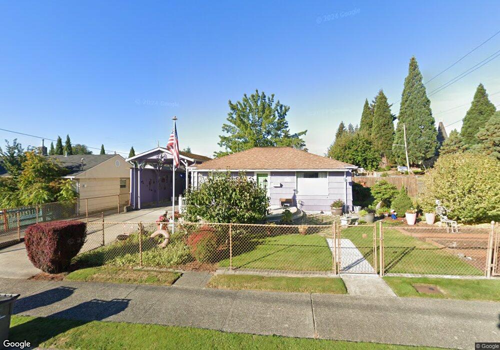
3335 Robin Ave Bremerton, WA 98310
East Bremerton NeighborhoodEstimated Value: $367,000 - $426,000
2
Beds
1
Bath
845
Sq Ft
$470/Sq Ft
Est. Value
About This Home
This home is located at 3335 Robin Ave, Bremerton, WA 98310 and is currently estimated at $397,403, approximately $470 per square foot. 3335 Robin Ave is a home located in Kitsap County with nearby schools including Armin Jahr Elementary School, Mountain View Middle School, and Bremerton High School.
Ownership History
Date
Name
Owned For
Owner Type
Purchase Details
Closed on
Oct 20, 2011
Sold by
Sinnock Larry G
Bought by
Collier Edward L and Collier Raylene J
Current Estimated Value
Home Financials for this Owner
Home Financials are based on the most recent Mortgage that was taken out on this home.
Original Mortgage
$78,975
Outstanding Balance
$53,734
Interest Rate
4.05%
Mortgage Type
VA
Estimated Equity
$343,669
Purchase Details
Closed on
Jul 31, 2005
Sold by
Sinnock Delila L
Bought by
Sinnock Larry G
Create a Home Valuation Report for This Property
The Home Valuation Report is an in-depth analysis detailing your home's value as well as a comparison with similar homes in the area
Home Values in the Area
Average Home Value in this Area
Purchase History
| Date | Buyer | Sale Price | Title Company |
|---|---|---|---|
| Collier Edward L | $130,280 | Land Title | |
| Sinnock Larry G | -- | Land Title Company |
Source: Public Records
Mortgage History
| Date | Status | Borrower | Loan Amount |
|---|---|---|---|
| Open | Collier Edward L | $78,975 |
Source: Public Records
Tax History
| Year | Tax Paid | Tax Assessment Tax Assessment Total Assessment is a certain percentage of the fair market value that is determined by local assessors to be the total taxable value of land and additions on the property. | Land | Improvement |
|---|---|---|---|---|
| 2026 | $2,803 | $324,850 | $94,160 | $230,690 |
| 2025 | $2,803 | $324,850 | $94,160 | $230,690 |
| 2024 | $2,703 | $324,850 | $94,160 | $230,690 |
| 2023 | $2,795 | $324,850 | $94,160 | $230,690 |
| 2022 | $2,608 | $272,900 | $78,470 | $194,430 |
| 2021 | $2,221 | $212,800 | $52,440 | $160,360 |
| 2020 | $2,084 | $199,750 | $48,890 | $150,860 |
| 2019 | $1,812 | $180,510 | $43,460 | $137,050 |
| 2018 | $1,943 | $135,370 | $35,050 | $100,320 |
| 2017 | $1,725 | $135,370 | $35,050 | $100,320 |
| 2016 | $1,610 | $119,650 | $30,750 | $88,900 |
| 2015 | $1,519 | $112,370 | $31,150 | $81,220 |
| 2014 | -- | $108,840 | $31,150 | $77,690 |
| 2013 | -- | $115,960 | $33,330 | $82,630 |
Source: Public Records
Map
Nearby Homes
- 3252 Herren Ave
- 3514 Parker Ln
- 3517 Parker Ln
- 401 Pennie Ln
- 654 E 31st St
- 1022 Sheridan Rd
- 949 Tetherow St
- 2877 Clare Ave
- 3218 Halverson Ave
- 1305 Hollis St
- 1412 Sheridan Rd
- 4262 Pronghorn Place
- 213 Willow St
- 427 NE Nantucket St
- 3400 Narrows View Ln NE Unit 204
- 3390 Narrows Ln NE Unit 101
- 119 Sarette Place NE
- 118 Sarette Place NE
- 119
- 3560 Narrows View Ln NE Unit 202
Your Personal Tour Guide
Ask me questions while you tour the home.