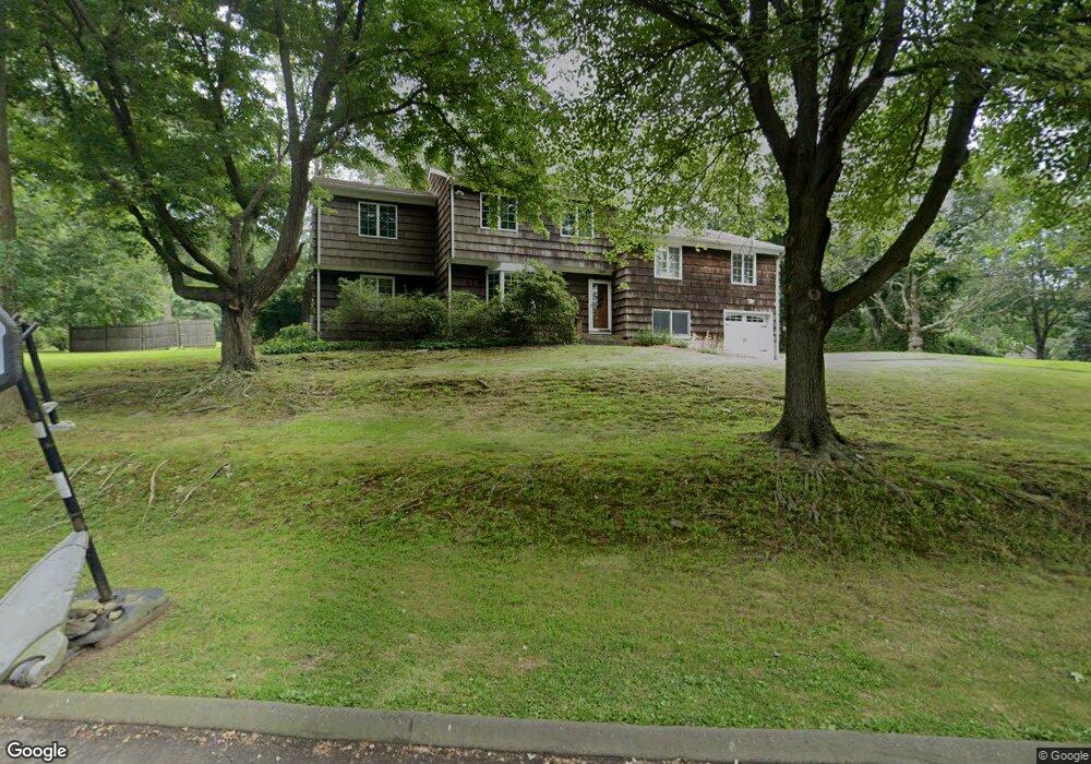
335 Barryscott Dr Fairfield, CT 06825
Fairfield Woods NeighborhoodEstimated Value: $728,000 - $967,000
About This Home
This home is located at 335 Barryscott Dr, Fairfield, CT 06825 and is currently estimated at $852,790, approximately $414 per square foot. 335 Barryscott Dr is a home located in Fairfield County with nearby schools including Jennings Elementary School, Fairfield Woods Middle School, and Fairfield Warde High School.
Ownership History
We collect this data history from publicly available records. To have your information removed, we recommend requesting removal directly through your county’s website.
Purchase Details
Home Values in the Area
Average Home Value in this Area
Purchase History
We collect this data history from publicly available records. To have your information removed, we recommend requesting removal directly through your county’s website.
| Date | Buyer | Sale Price | Title Company |
|---|---|---|---|
| $218,000 | -- |
Tax History
We collect this data history from publicly available records. To have your information removed, we recommend requesting removal directly through your county’s website.
| Year | Tax Paid | Tax Assessment Tax Assessment Total Assessment is a certain percentage of the fair market value that is determined by local assessors to be the total taxable value of land and additions on the property. | Land | Improvement |
|---|---|---|---|---|
| 2025 | $10,276 | $361,970 | $242,410 | $119,560 |
| 2024 | $10,099 | $361,970 | $242,410 | $119,560 |
| 2023 | $9,958 | $361,970 | $242,410 | $119,560 |
| 2022 | $9,860 | $361,970 | $242,410 | $119,560 |
| 2021 | $9,766 | $361,970 | $242,410 | $119,560 |
| 2020 | $8,880 | $331,450 | $208,320 | $123,130 |
| 2019 | $8,880 | $331,450 | $208,320 | $123,130 |
| 2018 | $8,737 | $331,450 | $208,320 | $123,130 |
| 2017 | $8,558 | $331,450 | $208,320 | $123,130 |
| 2016 | $8,435 | $331,450 | $208,320 | $123,130 |
| 2015 | $8,354 | $336,980 | $219,240 | $117,740 |
| 2014 | $8,222 | $336,980 | $219,240 | $117,740 |
Map
- 529 Burroughs Rd
- 130 Stillson Rd
- 439 Stillson Rd
- 41 Stillson Place
- 41 Candlewood Rd
- 127 Moritz Place
- 43 Green Knolls Ln
- 245 Oakwood Dr
- 98 Youngstown Rd
- 84 Youngstown Rd
- 1 Campfield Dr
- 125 Coleman Rd
- 126 Homefair Dr
- 41 Pepperbush Ln
- 83 Morehouse Hwy
- 781 Tunxis Hill Rd
- 30 Country Rd
- 11 Greenlawn Dr
- 309 Hunyadi Ave
- 153 Knapps Hwy Unit 153
Ask me questions while you tour the home.