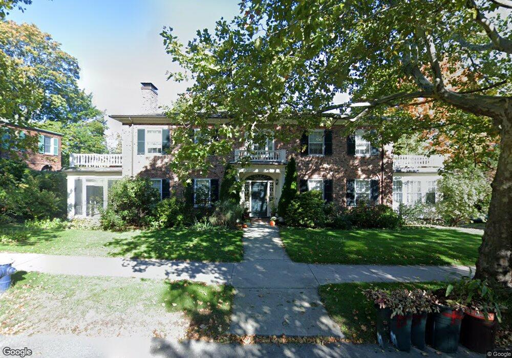
335 Clinton Rd Brookline, MA 02445
Cleveland Circle NeighborhoodEstimated Value: $2,480,016 - $3,141,000
4
Beds
5
Baths
3,596
Sq Ft
$741/Sq Ft
Est. Value
About This Home
This home is located at 335 Clinton Rd, Brookline, MA 02445 and is currently estimated at $2,664,504, approximately $740 per square foot. 335 Clinton Rd is a home located in Norfolk County with nearby schools including John D. Runkle School, Brookline High School, and Torah Academy.
Ownership History
Date
Name
Owned For
Owner Type
Purchase Details
Closed on
Dec 13, 2006
Sold by
Crum Christopher and Crum Tucker
Bought by
Clinton Road 335 Rt and Crum Christopher P
Current Estimated Value
Purchase Details
Closed on
Jun 27, 1990
Sold by
Seegel Virginia F
Bought by
Crum Tucker
Home Financials for this Owner
Home Financials are based on the most recent Mortgage that was taken out on this home.
Original Mortgage
$187,450
Interest Rate
10.27%
Mortgage Type
Purchase Money Mortgage
Create a Home Valuation Report for This Property
The Home Valuation Report is an in-depth analysis detailing your home's value as well as a comparison with similar homes in the area
Home Values in the Area
Average Home Value in this Area
Purchase History
| Date | Buyer | Sale Price | Title Company |
|---|---|---|---|
| Clinton Road 335 Rt | -- | -- | |
| Crum Tucker | $468,000 | -- |
Source: Public Records
Mortgage History
| Date | Status | Borrower | Loan Amount |
|---|---|---|---|
| Previous Owner | Crum Tucker | $322,700 | |
| Previous Owner | Crum Tucker | $170,000 | |
| Previous Owner | Crum Tucker | $187,000 | |
| Previous Owner | Crum Tucker | $187,450 |
Source: Public Records
Tax History
| Year | Tax Paid | Tax Assessment Tax Assessment Total Assessment is a certain percentage of the fair market value that is determined by local assessors to be the total taxable value of land and additions on the property. | Land | Improvement |
|---|---|---|---|---|
| 2025 | $22,189 | $2,248,100 | $1,376,000 | $872,100 |
| 2024 | $21,126 | $2,162,300 | $1,323,000 | $839,300 |
| 2023 | $18,241 | $1,829,600 | $945,200 | $884,400 |
| 2022 | $17,756 | $1,742,500 | $900,200 | $842,300 |
| 2021 | $16,420 | $1,675,500 | $865,600 | $809,900 |
| 2020 | $14,982 | $1,585,400 | $786,900 | $798,500 |
| 2019 | $14,148 | $1,509,900 | $749,400 | $760,500 |
| 2018 | $13,453 | $1,422,100 | $715,300 | $706,800 |
| 2017 | $13,174 | $1,333,400 | $674,900 | $658,500 |
| 2016 | $12,984 | $1,246,100 | $630,800 | $615,300 |
| 2015 | $12,438 | $1,164,600 | $589,500 | $575,100 |
| 2014 | $12,467 | $1,094,600 | $542,200 | $552,400 |
Source: Public Records
Map
Nearby Homes
- 9 Clinton Path Unit 1
- 1874 Beacon St Unit 4
- 8 Penniman Rd
- 355 Buckminster Rd
- 48 Strathmore Rd Unit 26
- 40 Orkney Rd Unit 1
- 401 Clinton Rd
- 31 Orkney Rd Unit 54
- 4 7 Englewood Ave
- 55 Penniman Rd
- 41 Orkney Rd
- 43 Druce St
- 47 Englewood Ave
- 37 Englewood Ave Unit 3
- 6 Sutherland Rd Unit 41
- 282 Buckminster Rd
- 155 Kilsyth Rd
- 370 Chestnut Hill Ave Unit 3
- 370 Chestnut Hill Ave Unit B
- 8 Kilsyth Terrace Unit 44
- 327 Clinton Rd
- 338 Clinton Rd
- 330 Clinton Rd
- 345 Clinton Rd
- 351 Clinton Rd
- 319 Clinton Rd
- 266 Fisher Ave
- 452 Chestnut Hill Ave
- 357 Clinton Rd
- 462 Chestnut Hill Ave
- 462 Chestnut Hill Ave Unit 2
- 260 Fisher Ave
- 311 Clinton Rd
- 25 Willard Rd
- 459 Chestnut Hill Ave
- 19 Willard Rd
- 24 Strathmore Rd
- 24 Strathmore Rd
- 24 Strathmore Rd Unit 3
- 24 Strathmore Rd Unit 1
Your Personal Tour Guide
Ask me questions while you tour the home.