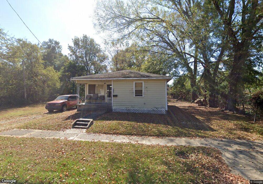
337 E 79th St Shreveport, LA 71106
Cedar Grove/Lynbrook NeighborhoodEstimated Value: $45,000 - $64,000
3
Beds
1
Bath
1,079
Sq Ft
$49/Sq Ft
Est. Value
About This Home
This home is located at 337 E 79th St, Shreveport, LA 71106 and is currently estimated at $52,516, approximately $48 per square foot. 337 E 79th St is a home with nearby schools including Fairfield Magnet School, Forest Hill Elementary School, and Judson Fundamental Elementary School.
Ownership History
Date
Name
Owned For
Owner Type
Purchase Details
Closed on
Feb 6, 2025
Sold by
Orion 2012 Llc and Orion 2013 Llc
Bought by
Drake Land Company Llc
Current Estimated Value
Purchase Details
Closed on
May 18, 2018
Sold by
Caddo County Collector
Bought by
Pintail Land Co Llc
Purchase Details
Closed on
Jun 2, 2006
Sold by
United Tax Group Llc
Bought by
Mooring Tax Asset Group I
Create a Home Valuation Report for This Property
The Home Valuation Report is an in-depth analysis detailing your home's value as well as a comparison with similar homes in the area
Home Values in the Area
Average Home Value in this Area
Purchase History
We collect this data history from publicly available records. To have your information removed, we recommend requesting removal directly through your county’s website.
| Date | Buyer | Sale Price | Title Company |
|---|---|---|---|
| Drake Land Company Llc | -- | None Listed On Document | |
| Pintail Land Co Llc | $143 | None Available | |
| Mooring Tax Asset Group I | $442 | None Available |
Source: Public Records
Tax History
| Year | Tax Paid | Tax Assessment Tax Assessment Total Assessment is a certain percentage of the fair market value that is determined by local assessors to be the total taxable value of land and additions on the property. | Land | Improvement |
|---|---|---|---|---|
| 2025 | $430 | $2,745 | $415 | $2,330 |
| 2024 | $425 | $2,725 | $395 | $2,330 |
| 2023 | $434 | $2,725 | $395 | $2,330 |
| 2022 | $435 | $2,725 | $395 | $2,330 |
| 2021 | $428 | $2,725 | $395 | $2,330 |
| 2020 | $428 | $2,725 | $395 | $2,330 |
| 2019 | $441 | $2,724 | $395 | $2,329 |
| 2018 | $351 | $2,724 | $395 | $2,329 |
| 2017 | $448 | $2,724 | $395 | $2,329 |
| 2015 | $391 | $3,020 | $400 | $2,620 |
| 2014 | $394 | $3,020 | $400 | $2,620 |
| 2013 | -- | $3,020 | $400 | $2,620 |
Source: Public Records
Map
Nearby Homes
- 0 83rd Unit 21271255
- 357 E 75th St
- 450 E 84th St
- 462 E 84th St
- 403 E 85th St
- 567 E 73rd St
- 220 Naomi St
- 109 N Greenbrook Loop
- 7507 Liberty St
- 552 E 71st St
- 356 W 77th St
- 0 Turner Ln
- 724 Saint Peter Blvd
- 637 Ashbourne Dr
- 7642 Harris St
- 725 Rainbow Dr
- 8316 Linwood Ave
- 634 Balmoral Dr
- 8607 Nesom Ct
- 636 E 70th St
- 344 E 79th St
- 348 E 79th St
- 340 E 79th St
- 310 E 79th St
- 351 E 79th St
- 367 E 79th St
- 371 E 79th St
- 371 E 79th St
- 7923 Henderson Ave
- 7923 Henderson Ave
- 358 E 80th St
- 358 W 80th St
- 366 E 80th St
- 7910 Henderson Ave
- 7914 Henderson Ave
- 7916 Henderson Ave
- 333 E 78th St
- 7918 Henderson Ave
- 338 E 80th St
- 329 E 78th St
Your Personal Tour Guide
Ask me questions while you tour the home.