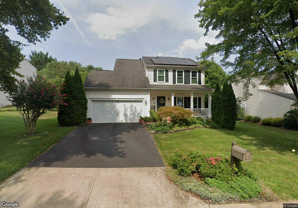
337 Singleton Cir Warrenton, VA 20186
Estimated Value: $621,000 - $667,000
About This Home
This home is located at 337 Singleton Cir, Warrenton, VA 20186 and is currently estimated at $644,461, approximately $317 per square foot. 337 Singleton Cir is a home located in Fauquier County with nearby schools including James G. Brumfield Elementary School, W.C. Taylor Middle School, and Fauquier High School.
Ownership History
We collect this data history from publicly available records. To have your information removed, we recommend requesting removal directly through your county’s website.
Purchase Details
Home Financials for this Owner
Home Financials are based on the most recent Mortgage that was taken out on this home.Purchase Details
Home Values in the Area
Average Home Value in this Area
Purchase History
We collect this data history from publicly available records. To have your information removed, we recommend requesting removal directly through your county’s website.
| Date | Buyer | Sale Price | Title Company |
|---|---|---|---|
| $207,665 | -- | ||
| $56,564 | -- |
Mortgage History
We collect this data history from publicly available records. To have your information removed, we recommend requesting removal directly through your county’s website.
| Date | Status | Borrower | Loan Amount |
|---|---|---|---|
| Open | $180,000 |
Tax History
We collect this data history from publicly available records. To have your information removed, we recommend requesting removal directly through your county’s website.
| Year | Tax Paid | Tax Assessment Tax Assessment Total Assessment is a certain percentage of the fair market value that is determined by local assessors to be the total taxable value of land and additions on the property. | Land | Improvement |
|---|---|---|---|---|
| 2026 | $5,158 | $576,300 | $175,000 | $401,300 |
| 2025 | $4,540 | $469,500 | $135,000 | $334,500 |
| 2024 | $4,427 | $469,500 | $135,000 | $334,500 |
| 2023 | $4,334 | $479,900 | $135,000 | $344,900 |
| 2022 | $4,334 | $479,900 | $135,000 | $344,900 |
| 2021 | $3,755 | $377,800 | $125,000 | $252,800 |
| 2020 | $3,755 | $377,800 | $125,000 | $252,800 |
| 2019 | $3,755 | $377,800 | $125,000 | $252,800 |
| 2018 | $3,710 | $377,800 | $125,000 | $252,800 |
| 2016 | $3,427 | $329,800 | $125,000 | $204,800 |
| 2015 | -- | $329,800 | $125,000 | $204,800 |
| 2014 | -- | $329,800 | $125,000 | $204,800 |
Map
- 202 Cannon Way
- 97 John Ct
- 235 Cannon Way
- 0 Walker Dr Unit A-103 VAFQ2015990
- 0 Walker Dr Unit A-104 VAFQ2015992
- 0 Walker Dr Unit A-102 VAFQ2015988
- 0 Walker Dr Unit A-113 VAFQ2015994
- 0 Walker Dr Unit A-101 VAFQ2015948
- 0 Walker Dr Unit A-112 VAFQ2015996
- 226 Breezewood Dr
- 159 Haiti St
- 141 Haiti St
- 135 Haiti St
- 134 Haiti St
- 2 Millfield Dr
- 6415 Academy Hill Rd
- 79 Horner St
- 173 Autumn Wind Ct
- 122 Dorset Ln
- 526 Highland Towne Ln
- 335 Singleton Cir
- 325 Singleton Cir
- 84 John Ct
- 92 John Ct
- 343 Singleton Cir
- 321 Singleton Cir
- 78 John Ct
- 98 John Ct
- 334 Singleton Cir
- 336 Singleton Cir
- 345 Singleton Cir
- 338 Singleton Cir
- 355 Singleton Cir
- 322 Singleton Cir
- 796 Colonel Edmonds
- 363 Singleton Cir
- 340 Singleton Cir
- 320 Singleton Cir
- 371 Singleton Cir
- 344 Singleton Cir
Ask me questions while you tour the home.