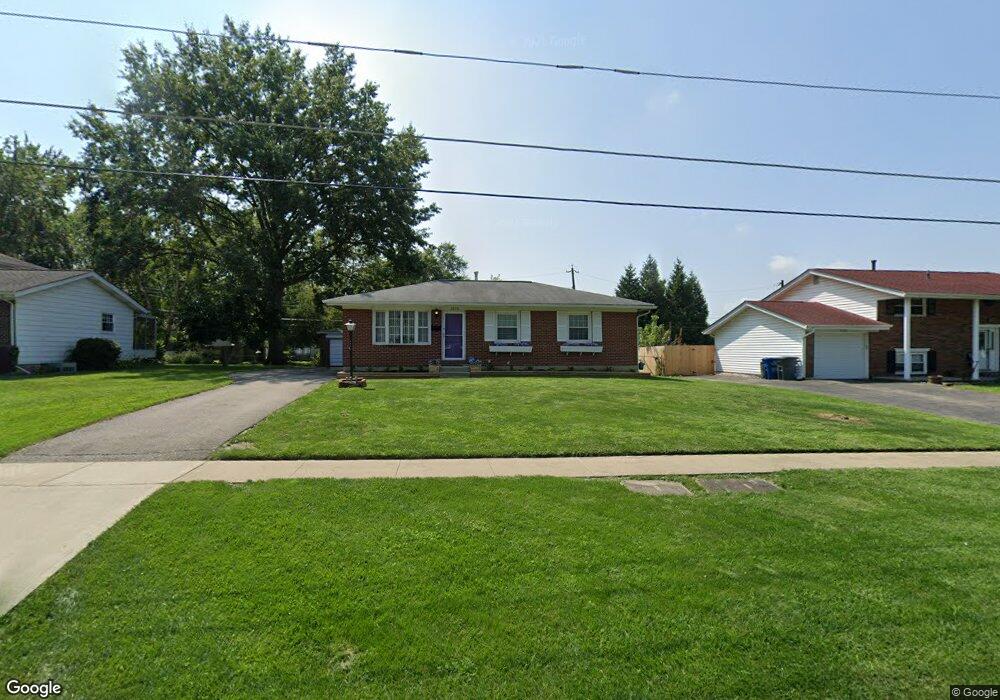
3373 Dempsey Rd Westerville, OH 43081
Estimated Value: $247,000 - $271,000
3
Beds
1
Bath
1,025
Sq Ft
$254/Sq Ft
Est. Value
About This Home
This home is located at 3373 Dempsey Rd, Westerville, OH 43081 and is currently estimated at $260,847, approximately $254 per square foot. 3373 Dempsey Rd is a home located in Franklin County with nearby schools including Huber Ridge Elementary School, Walnut Springs Middle School, and Westerville Central High School.
Ownership History
Date
Name
Owned For
Owner Type
Purchase Details
Closed on
Jul 14, 2020
Sold by
Williams Linda C
Bought by
Kristos Masika
Current Estimated Value
Home Financials for this Owner
Home Financials are based on the most recent Mortgage that was taken out on this home.
Original Mortgage
$152,000
Outstanding Balance
$133,840
Interest Rate
3.2%
Mortgage Type
New Conventional
Estimated Equity
$127,007
Purchase Details
Closed on
Sep 27, 2016
Sold by
The Ralph J Gorusuch Revocable Lving Tru
Bought by
Gorsuch Ralph J
Purchase Details
Closed on
Dec 15, 1992
Bought by
Gorsuch Ralph J Trust
Purchase Details
Closed on
May 14, 1991
Create a Home Valuation Report for This Property
The Home Valuation Report is an in-depth analysis detailing your home's value as well as a comparison with similar homes in the area
Home Values in the Area
Average Home Value in this Area
Purchase History
| Date | Buyer | Sale Price | Title Company |
|---|---|---|---|
| Kristos Masika | $165,000 | First American Title Ins Co | |
| Gorsuch Ralph J | -- | None Available | |
| Gorsuch Ralph J Trust | -- | -- | |
| -- | -- | -- |
Source: Public Records
Mortgage History
| Date | Status | Borrower | Loan Amount |
|---|---|---|---|
| Open | Kristos Masika | $152,000 |
Source: Public Records
Tax History
| Year | Tax Paid | Tax Assessment Tax Assessment Total Assessment is a certain percentage of the fair market value that is determined by local assessors to be the total taxable value of land and additions on the property. | Land | Improvement |
|---|---|---|---|---|
| 2025 | $4,600 | $74,590 | $21,810 | $52,780 |
| 2024 | $4,600 | $74,590 | $21,810 | $52,780 |
| 2023 | $4,501 | $74,585 | $21,805 | $52,780 |
| 2022 | $4,142 | $51,280 | $11,830 | $39,450 |
| 2021 | $4,170 | $51,280 | $11,830 | $39,450 |
| 2020 | $4,458 | $53,690 | $11,830 | $41,860 |
| 2019 | $2,848 | $40,880 | $11,830 | $29,050 |
| 2018 | $2,724 | $40,880 | $11,830 | $29,050 |
| 2017 | $2,740 | $40,880 | $11,830 | $29,050 |
| 2016 | $2,864 | $39,210 | $9,140 | $30,070 |
| 2015 | $2,713 | $39,210 | $9,140 | $30,070 |
| 2014 | $2,714 | $39,210 | $9,140 | $30,070 |
| 2013 | $1,320 | $39,200 | $9,135 | $30,065 |
Source: Public Records
Map
Nearby Homes
- 3391 Arnett Ct
- 6100 Reno Rd
- 5794 Buenos Aires Blvd
- 3627 Manila Dr
- 3678 Paris Blvd
- 3661 Paris Blvd
- 5730 Crossing Ct Unit 1
- 3137 Heron Pointe Unit 202
- 281 Cross Country Dr S Unit C
- 5660 Buenos Aires Blvd
- 5700 Crossing Ct Unit 4
- 6200 Harbour Pointe Unit 301
- 6220 Harbour Pointe Unit 101
- 6170 Harbour Pointe Unit 101
- 3113 Highcliff Ct Unit 3113
- 3050 Cooper Bluff Dr
- 748 Palermo Place
- 304 Crosswind Dr Unit A, B, C, D, E, F
- 3675 Santiago Dr
- 322 Huber Village Blvd
- 3369 Dempsey Rd
- 3377 Dempsey Rd
- 6089 Dakar Rd W
- 6083 Dakar Rd W
- 3385 Dempsey Rd
- 6095 Dakar Rd W
- 3374 Dempsey Rd
- 3370 Dempsey Rd
- 3378 Dempsey Rd
- 3391 Dempsey Rd
- 6100 Dakar Rd E
- 3366 Dempsey Rd
- 6077 Dakar Rd W
- 3360 Dempsey Rd
- 6094 Dakar Rd E
- 3390 Dempsey Rd
- 6060 Dakar Rd W
- 3395 Dempsey Rd
- 6055 Dakar Rd W
Your Personal Tour Guide
Ask me questions while you tour the home.