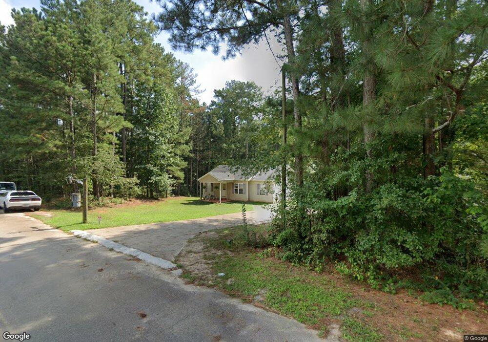
339 Pinecrest Rd Auburn, GA 30011
Auburn AreaEstimated Value: $277,731 - $304,000
About This Home
This home is located at 339 Pinecrest Rd, Auburn, GA 30011 and is currently estimated at $290,433, approximately $264 per square foot. 339 Pinecrest Rd is a home located in Barrow County with nearby schools including Auburn Elementary School, Westside Middle School, and Apalachee High School.
Ownership History
We collect this data history from publicly available records. To have your information removed, we recommend requesting removal directly through your county’s website.
Purchase Details
Purchase Details
Purchase Details
Home Values in the Area
Average Home Value in this Area
Purchase History
We collect this data history from publicly available records. To have your information removed, we recommend requesting removal directly through your county’s website.
| Date | Buyer | Sale Price | Title Company |
|---|---|---|---|
| -- | -- | ||
| $104,300 | -- | ||
| $18,500 | -- |
Mortgage History
We collect this data history from publicly available records. To have your information removed, we recommend requesting removal directly through your county’s website.
| Date | Status | Borrower | Loan Amount |
|---|---|---|---|
| Open | $50,000 | ||
| Open | $142,000 | ||
| Closed | $115,200 | ||
| Closed | $111,161 | ||
| Closed | $104,360 | ||
| Closed | $6,000 |
Tax History
We collect this data history from publicly available records. To have your information removed, we recommend requesting removal directly through your county’s website.
| Year | Tax Paid | Tax Assessment Tax Assessment Total Assessment is a certain percentage of the fair market value that is determined by local assessors to be the total taxable value of land and additions on the property. | Land | Improvement |
|---|---|---|---|---|
| 2025 | $1,659 | $71,522 | $20,000 | $51,522 |
| 2024 | $1,741 | $69,948 | $20,000 | $49,948 |
| 2023 | $1,919 | $70,548 | $20,000 | $50,548 |
| 2022 | $1,086 | $40,327 | $14,288 | $26,039 |
| 2021 | $1,135 | $40,327 | $14,288 | $26,039 |
| 2020 | $1,135 | $40,327 | $14,288 | $26,039 |
| 2019 | $1,084 | $38,014 | $14,288 | $23,726 |
| 2018 | $1,063 | $38,014 | $14,288 | $23,726 |
| 2017 | $993 | $34,107 | $14,288 | $19,819 |
| 2016 | $922 | $34,326 | $14,288 | $20,038 |
| 2015 | $933 | $34,544 | $14,288 | $20,256 |
| 2014 | $715 | $27,476 | $7,001 | $20,474 |
| 2013 | -- | $26,490 | $7,001 | $19,489 |
Map
- 356 Meadow Trace Dr
- 213 Wynfield Way
- 1727 Wynfield Ln
- 1581 Branthaven Ln
- 60 Wood Chuck Ct
- 1854 Westfall Landing
- 1814 Westfall Landing
- 3576 Cavell Ct
- 1549 Wynfield Dr
- 280 Etheridge Rd
- 322 Wyngate Rd
- 441 Wages Rd
- 102 Pinetree Ln
- 1525 Wynfield Dr Unit 1
- 491 Natasha Dr Unit 2
- 313 Brook Landing Cir
- 317 Brook Landing Cir
- 320 Rainer Ln Unit 48
- 328 Rainer Ln Unit 46
- 321 Brook Landing Cir
- 1743 Maston Rd
- 1343 Maston Rd
- 1333 Maston Rd
- 1756 Maston Rd
- 1283 Maston Rd
- 1336 Maston Rd
- 1303 Maston Rd
- 1266 Maston Rd
- 1356 Maston Rd
- 1193 Maston Rd
- 1316 Maston Rd
- 1346 Maston Rd
- 1363 Maston Rd
- 1263 Maston Rd
- 63 Arnold Poplar Ln Unit 26
- 1456 Maston Rd
- 1426 Maston Rd
- 1546 Maston Rd
- 1566 Maston Rd
- 1326 Maston Rd
Ask me questions while you tour the home.