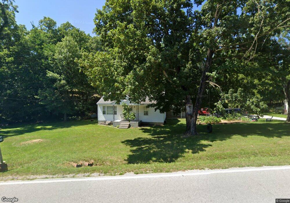
3390 State Highway Bb Seymour, MO 65746
Estimated Value: $214,000
2
Beds
--
Bath
1,178
Sq Ft
$182/Sq Ft
Est. Value
About This Home
This home is located at 3390 State Highway Bb, Seymour, MO 65746 and is currently estimated at $214,000, approximately $181 per square foot. 3390 State Highway Bb is a home with nearby schools including Seymour Elementary School, Seymour Middle School, and Seymour High School.
Ownership History
Date
Name
Owned For
Owner Type
Purchase Details
Closed on
May 29, 2024
Sold by
Bledsoe John M and Bledsoe Dawn
Bought by
Meyer John and Meyer Kourtney
Current Estimated Value
Home Financials for this Owner
Home Financials are based on the most recent Mortgage that was taken out on this home.
Original Mortgage
$119,200
Outstanding Balance
$117,065
Interest Rate
7.1%
Mortgage Type
New Conventional
Estimated Equity
$96,935
Purchase Details
Closed on
May 22, 2024
Sold by
Bledsoe James C
Bought by
Bledsoe John M and Bledsoe Dawn
Home Financials for this Owner
Home Financials are based on the most recent Mortgage that was taken out on this home.
Original Mortgage
$119,200
Outstanding Balance
$117,065
Interest Rate
7.1%
Mortgage Type
New Conventional
Estimated Equity
$96,935
Create a Home Valuation Report for This Property
The Home Valuation Report is an in-depth analysis detailing your home's value as well as a comparison with similar homes in the area
Purchase History
| Date | Buyer | Sale Price | Title Company |
|---|---|---|---|
| Meyer John | -- | None Listed On Document | |
| Bledsoe John M | -- | None Listed On Document |
Source: Public Records
Mortgage History
| Date | Status | Borrower | Loan Amount |
|---|---|---|---|
| Open | Meyer John | $119,200 |
Source: Public Records
Tax History
| Year | Tax Paid | Tax Assessment Tax Assessment Total Assessment is a certain percentage of the fair market value that is determined by local assessors to be the total taxable value of land and additions on the property. | Land | Improvement |
|---|---|---|---|---|
| 2025 | $4 | $100 | $0 | $0 |
| 2024 | $4 | $100 | $0 | $0 |
| 2023 | $350 | $8,440 | $0 | $0 |
| 2022 | $346 | $8,360 | $0 | $0 |
| 2021 | $346 | $8,360 | $0 | $0 |
| 2020 | $338 | $7,760 | $0 | $0 |
| 2019 | $280 | $7,760 | $0 | $0 |
| 2018 | $280 | $7,760 | $0 | $0 |
| 2017 | $280 | $7,760 | $0 | $0 |
| 2016 | $240 | $6,570 | $0 | $0 |
| 2015 | $240 | $6,570 | $0 | $0 |
| 2012 | -- | $6,110 | $0 | $0 |
Source: Public Records
Map
Nearby Homes
- 5679 State Highway Bb
- 114 E South St
- 753 Boardwalk
- 735 Boardwalk
- 522 S Division St
- 735 S Water St
- 219 Melinda St
- 510 W Park St
- Tract 2 Summit St
- 885 W Thoroughfare St Unit 1-8
- 412 S Court St
- 101 Bonnie Ln
- 000 State Highway K
- Tract 1 State Highway K
- 203 S Division St
- 233 Bruce Dr
- 104 N Frances St
- 000 Preston Hollow Rd
- 256 Velma Dr
- 270 Velma Dr
- 3455 State Highway Bb
- 3134 State Highway Bb
- 3645 State Highway Bb
- 3643 State Highway Bb
- 3091 State Highway Bb
- 1306 Panther Hollow Rd
- 3650 State Highway Bb
- 000 Eagle Dr
- 285 Eagle Dr
- 3815 State Highway Bb
- 2921 State Highway Bb
- 2911 State Highway Bb
- 553 Eagle Dr
- 883 Eagle Dr
- 2670 State Highway Bb
- 2771 State Highway Bb
- 0 Kanel Rolling Acres Unit 11215628
- 2675 State Highway Bb
- 0 Bb Hwy Unit 11114332
- 148 Brianna Dr
Your Personal Tour Guide
Ask me questions while you tour the home.