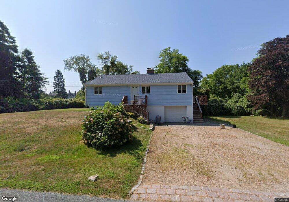
34 Baltimore Ave Narragansett, RI 02882
Estimated Value: $638,000 - $824,000
3
Beds
1
Bath
1,200
Sq Ft
$621/Sq Ft
Est. Value
About This Home
This home is located at 34 Baltimore Ave, Narragansett, RI 02882 and is currently estimated at $744,624, approximately $620 per square foot. 34 Baltimore Ave is a home located in Washington County with nearby schools including Narragansett Elementary School, Narragansett Pier Middle School, and Narragansett High School.
Ownership History
Date
Name
Owned For
Owner Type
Purchase Details
Closed on
Feb 26, 2010
Sold by
Maguire Ann E and Eaton Denise J
Bought by
Mccormick Richard G
Current Estimated Value
Purchase Details
Closed on
Sep 6, 2001
Sold by
Maguire Ann F and Eaton Denise J
Bought by
Maguire Ann F and Eaton Denise J
Home Financials for this Owner
Home Financials are based on the most recent Mortgage that was taken out on this home.
Original Mortgage
$55,000
Interest Rate
7.05%
Create a Home Valuation Report for This Property
The Home Valuation Report is an in-depth analysis detailing your home's value as well as a comparison with similar homes in the area
Home Values in the Area
Average Home Value in this Area
Purchase History
| Date | Buyer | Sale Price | Title Company |
|---|---|---|---|
| Mccormick Richard G | $300,000 | -- | |
| Maguire Ann F | $50,000 | -- |
Source: Public Records
Mortgage History
| Date | Status | Borrower | Loan Amount |
|---|---|---|---|
| Previous Owner | Maguire Ann F | $55,000 |
Source: Public Records
Tax History
| Year | Tax Paid | Tax Assessment Tax Assessment Total Assessment is a certain percentage of the fair market value that is determined by local assessors to be the total taxable value of land and additions on the property. | Land | Improvement |
|---|---|---|---|---|
| 2025 | $2,924 | $430,600 | $180,700 | $249,900 |
| 2024 | $2,821 | $430,700 | $180,700 | $250,000 |
| 2023 | $2,746 | $295,000 | $124,700 | $170,300 |
| 2022 | $2,655 | $295,000 | $124,700 | $170,300 |
| 2021 | $2,614 | $295,000 | $124,700 | $170,300 |
| 2020 | $2,821 | $269,200 | $103,200 | $166,000 |
| 2019 | $2,754 | $269,200 | $103,200 | $166,000 |
| 2018 | $2,679 | $269,200 | $103,200 | $166,000 |
| 2017 | $2,661 | $252,000 | $124,200 | $127,800 |
| 2016 | $2,540 | $252,000 | $124,200 | $127,800 |
| 2015 | $2,505 | $252,000 | $124,200 | $127,800 |
| 2014 | $2,549 | $253,900 | $117,600 | $136,300 |
Source: Public Records
Map
Nearby Homes
- 0 Fairway Dr
- 2 Bristol Rd
- 811 Ocean Rd
- 813 Ocean Rd
- 815 Ocean Rd
- 200 Clarke Rd Unit A208
- 576 Point Judith Rd
- 609 Point Judith Rd
- 0 Daytona Ave
- 28 Palm Beach Ave
- 60 Daytona Ave
- 62 Daytona Ave
- 5 Brandywine Ln
- 6 Brandywine Ln
- 4 Meadowbrook Way
- 2 Stevenson Way
- 0 Hazard Ave
- 1048 Ocean Rd
- 4 Wayne St
- 87 Woodward Ave
- 0 Baltimore Ave
- 41 Baltimore Ave
- 26 Baltimore Ave
- 40 Pennsylvania Ave
- 280 Pennsylvania Ave
- 4 Pennsylvania Ave
- 22 Baltimore Ave
- 695 Ocean Rd
- 56 Pennsylvania Ave
- 56 Pennsylvania Ave Unit 2
- 56 Pennsylvania Ave Unit 3
- 49 Baltimore Ave
- 37 Pennsylvania Ave
- 15 Baltimore Ave
- 16 Baltimore Ave
- 18 Pennsylvania Ave
- 53 Baltimore Ave
- 55 Baltimore Ave
- 55 Baltimore Ave Unit 1
- 28 Rhode Island Ave
Your Personal Tour Guide
Ask me questions while you tour the home.