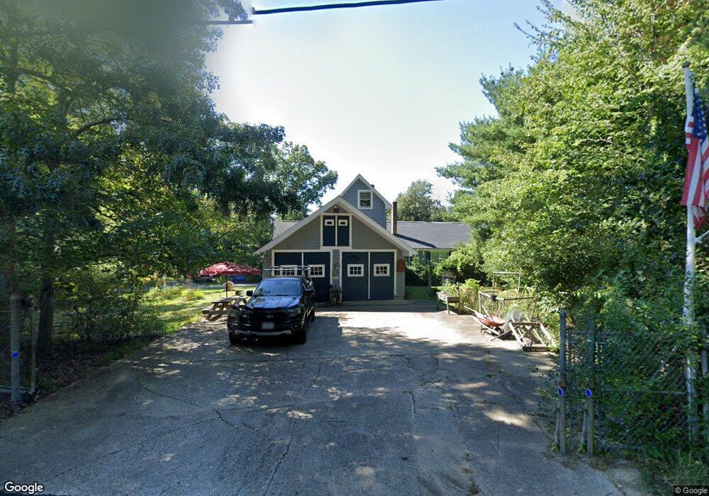
34 Bridge St Millis, MA 02054
Estimated Value: $686,000 - $700,248
6
Beds
2
Baths
2,198
Sq Ft
$315/Sq Ft
Est. Value
About This Home
This home is located at 34 Bridge St, Millis, MA 02054 and is currently estimated at $691,812, approximately $314 per square foot. 34 Bridge St is a home located in Norfolk County with nearby schools including Clyde F Brown, Millis Middle School, and Millis High School.
Ownership History
Date
Name
Owned For
Owner Type
Purchase Details
Closed on
Jul 24, 2025
Sold by
Douglas H Mccarter Ret and Mccarter
Bought by
Bridge Street Terrace Llc
Current Estimated Value
Home Financials for this Owner
Home Financials are based on the most recent Mortgage that was taken out on this home.
Original Mortgage
$429,594
Outstanding Balance
$426,628
Interest Rate
6.84%
Mortgage Type
New Conventional
Estimated Equity
$265,184
Purchase Details
Closed on
Jun 1, 1970
Bought by
Mccarter Douglas H and Mccarter Marjorie H
Create a Home Valuation Report for This Property
The Home Valuation Report is an in-depth analysis detailing your home's value as well as a comparison with similar homes in the area
Home Values in the Area
Average Home Value in this Area
Purchase History
| Date | Buyer | Sale Price | Title Company |
|---|---|---|---|
| Bridge Street Terrace Llc | $650,000 | -- | |
| Mccarter Douglas H | -- | -- |
Source: Public Records
Mortgage History
| Date | Status | Borrower | Loan Amount |
|---|---|---|---|
| Open | Bridge Street Terrace Llc | $429,594 |
Source: Public Records
Tax History
| Year | Tax Paid | Tax Assessment Tax Assessment Total Assessment is a certain percentage of the fair market value that is determined by local assessors to be the total taxable value of land and additions on the property. | Land | Improvement |
|---|---|---|---|---|
| 2025 | $9,415 | $574,100 | $239,600 | $334,500 |
| 2024 | $9,256 | $563,700 | $239,600 | $324,100 |
| 2023 | $8,617 | $492,700 | $208,300 | $284,400 |
| 2022 | $9,047 | $479,200 | $178,100 | $301,100 |
| 2021 | $8,482 | $432,300 | $178,100 | $254,200 |
| 2020 | $8,471 | $420,600 | $166,400 | $254,200 |
| 2019 | $7,682 | $410,800 | $156,600 | $254,200 |
| 2018 | $7,159 | $397,300 | $143,100 | $254,200 |
| 2017 | $7,346 | $398,800 | $162,000 | $236,800 |
| 2016 | $6,955 | $398,800 | $162,000 | $236,800 |
| 2015 | $6,186 | $363,900 | $162,000 | $201,900 |
Source: Public Records
Map
Nearby Homes
- 2 Lincoln Ct
- 11 Parnell St
- 64 Village St
- 5 Spring St Unit A
- 46 Timberline Rd
- 94 North St Unit 94
- 94 North St
- 125 North St Unit 1
- 488R Main St
- 1280 Main St
- 215 Causeway St
- 156 R North St
- 324 Union St Unit 1
- 5 Prentiss Place Unit 5
- 329 Orchard St
- 4 Maple St Unit 4
- 22 South St
- 80 Pleasant St
- 82 Pleasant St
- 5 Nye Rd
Your Personal Tour Guide
Ask me questions while you tour the home.