Estimated Value: $903,000 - $1,030,000
4
Beds
2
Baths
2,726
Sq Ft
$351/Sq Ft
Est. Value
About This Home
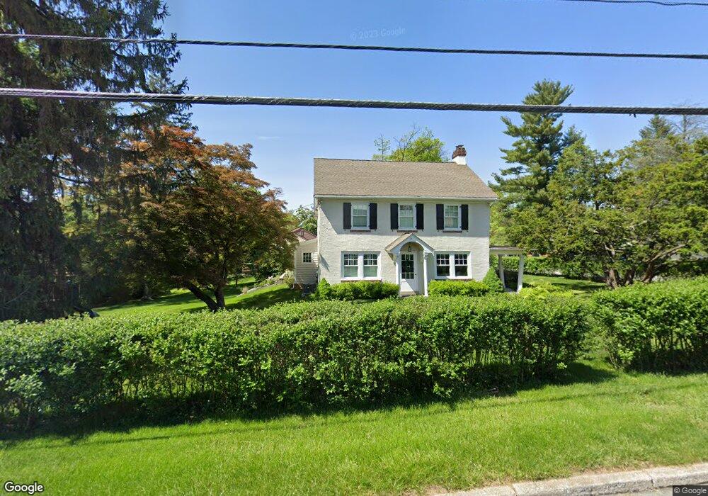
This home is located at 34 E Central Ave, Paoli, PA 19301 and is currently estimated at $956,884, approximately $351 per square foot. 34 E Central Ave is a home located in Chester County with nearby schools including Hillside Elementary School, Valley Forge Middle School, and Conestoga Senior High School.
Ownership History
Date
Name
Owned For
Owner Type
Purchase Details
Closed on
Jul 10, 2020
Sold by
Macfarland Jeffrey A and Macfarland Kirsten R
Bought by
Stiefel Robert and Stiefel Alyssa
Current Estimated Value
Home Financials for this Owner
Home Financials are based on the most recent Mortgage that was taken out on this home.
Original Mortgage
$552,000
Outstanding Balance
$490,385
Interest Rate
3.2%
Mortgage Type
New Conventional
Estimated Equity
$466,499
Purchase Details
Closed on
Dec 3, 2012
Sold by
Macfarland Jeffrey A and Macfarland Kirsten R
Bought by
Macfarland Jeffrey A and Macfarland Kirsten R
Home Financials for this Owner
Home Financials are based on the most recent Mortgage that was taken out on this home.
Original Mortgage
$385,918
Interest Rate
3.44%
Mortgage Type
New Conventional
Purchase Details
Closed on
Jun 30, 2004
Sold by
Mckeon Patrick J
Bought by
Mckeon Patrick J and Mckeon Jennifer M
Home Financials for this Owner
Home Financials are based on the most recent Mortgage that was taken out on this home.
Original Mortgage
$231,000
Interest Rate
6.25%
Mortgage Type
New Conventional
Purchase Details
Closed on
Apr 25, 2002
Sold by
Mckeon Joseph C
Bought by
Mckeon Patrick J
Home Financials for this Owner
Home Financials are based on the most recent Mortgage that was taken out on this home.
Original Mortgage
$180,000
Interest Rate
7.13%
Purchase Details
Closed on
May 23, 2001
Sold by
Baxendell Beverly K
Bought by
Mckeon Joseph C
Home Financials for this Owner
Home Financials are based on the most recent Mortgage that was taken out on this home.
Original Mortgage
$168,000
Interest Rate
7.08%
Purchase Details
Closed on
Aug 31, 1999
Sold by
Baxendell Charles D
Bought by
Baxendell Charles D and Baxendell Beverly K
Home Financials for this Owner
Home Financials are based on the most recent Mortgage that was taken out on this home.
Original Mortgage
$80,700
Interest Rate
8.1%
Create a Home Valuation Report for This Property
The Home Valuation Report is an in-depth analysis detailing your home's value as well as a comparison with similar homes in the area
Home Values in the Area
Average Home Value in this Area
Purchase History
| Date | Buyer | Sale Price | Title Company |
|---|---|---|---|
| Stiefel Robert | $690,000 | Great American Abstract Llc | |
| Macfarland Jeffrey A | -- | None Available | |
| Mckeon Patrick J | -- | -- | |
| Mckeon Patrick J | -- | -- | |
| Mckeon Joseph C | $210,000 | -- | |
| Baxendell Charles D | -- | -- |
Source: Public Records
Mortgage History
| Date | Status | Borrower | Loan Amount |
|---|---|---|---|
| Open | Stiefel Robert | $552,000 | |
| Previous Owner | Macfarland Jeffrey A | $385,918 | |
| Previous Owner | Mckeon Patrick J | $231,000 | |
| Previous Owner | Mckeon Patrick J | $180,000 | |
| Previous Owner | Mckeon Joseph C | $168,000 | |
| Previous Owner | Baxendell Charles D | $80,700 |
Source: Public Records
Tax History
| Year | Tax Paid | Tax Assessment Tax Assessment Total Assessment is a certain percentage of the fair market value that is determined by local assessors to be the total taxable value of land and additions on the property. | Land | Improvement |
|---|---|---|---|---|
| 2025 | $8,702 | $247,050 | $71,310 | $175,740 |
| 2024 | $8,702 | $247,050 | $71,310 | $175,740 |
| 2023 | $8,174 | $247,050 | $71,310 | $175,740 |
| 2022 | $7,963 | $247,050 | $71,310 | $175,740 |
| 2021 | $7,812 | $247,050 | $71,310 | $175,740 |
| 2020 | $7,596 | $247,050 | $71,310 | $175,740 |
| 2019 | $7,356 | $247,050 | $71,310 | $175,740 |
| 2018 | $7,211 | $247,050 | $71,310 | $175,740 |
| 2017 | $7,039 | $247,050 | $71,310 | $175,740 |
| 2016 | -- | $247,050 | $71,310 | $175,740 |
| 2015 | -- | $247,050 | $71,310 | $175,740 |
| 2014 | -- | $247,050 | $71,310 | $175,740 |
Source: Public Records
Map
Nearby Homes
- 332 Paoli Pointe Dr Unit 332U
- 416 Paoli Pointe Dr Unit 416
- 27 Woodbine Ave
- 25 Woodbine Ave
- 43 W Central Ave
- 1 Whitworth Ave
- 71 W Central Ave
- 56 Cobblestone Dr
- 529 Foxwood Ln Unit 529
- 2 Sunset Dr
- 36 Sunset Dr
- 104 Gable Rd
- 111 Gable Rd
- 38 Jacqueline Dr
- 21 Moreland Rd
- 1603 Weatherstone Dr
- 36 Fairview Rd
- 41 Overlook Cir Unit 41
- 69 Highpoint Dr Unit 69
- 211 Shoreline Dr
- 100 Orchard Rd
- 102 Orchard Rd
- 30 E Central Ave
- 101 Pennington Rd
- 103 Pennington Rd
- 36 E Central Ave
- 104 Orchard Rd
- 105 Orchard Rd
- 105 Pennington Rd
- 40 E Central Ave
- 107 Orchard Rd
- 26 E Central Ave
- 107 Pennington Rd
- 106 Orchard Rd
- 104 Arlington Rd
- 100 Arlington Rd
- 106 Pennington Rd
- 109 Orchard Rd
- 106 Arlington Rd
- 21 Jolind Rd
Your Personal Tour Guide
Ask me questions while you tour the home.