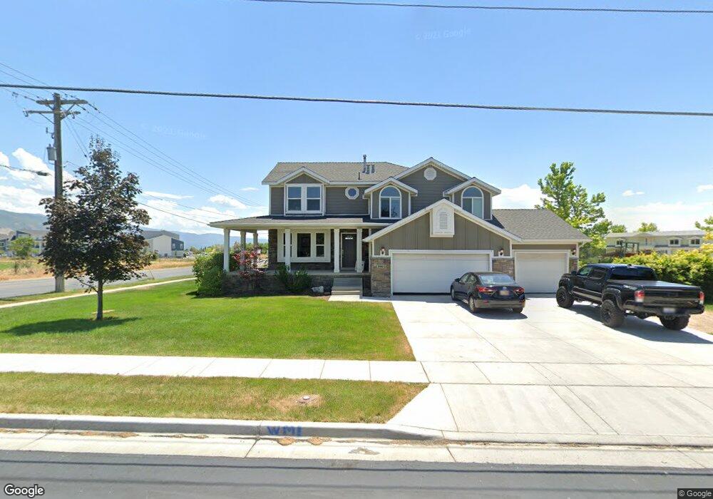
340 E Shepard Ln Kaysville, UT 84037
West Kaysville NeighborhoodEstimated Value: $744,000 - $880,000
4
Beds
3
Baths
3,321
Sq Ft
$240/Sq Ft
Est. Value
About This Home
This home is located at 340 E Shepard Ln, Kaysville, UT 84037 and is currently estimated at $797,252, approximately $240 per square foot. 340 E Shepard Ln is a home located in Davis County with nearby schools including Endeavour Elementary School, Farmington High, and Centennial Junior High School.
Ownership History
Date
Name
Owned For
Owner Type
Purchase Details
Closed on
Nov 26, 2021
Sold by
Forsberg Brandon
Bought by
Forsberg Brandon and Forsberg Tennille
Current Estimated Value
Home Financials for this Owner
Home Financials are based on the most recent Mortgage that was taken out on this home.
Original Mortgage
$100,000
Outstanding Balance
$85,291
Interest Rate
3.09%
Mortgage Type
Credit Line Revolving
Estimated Equity
$711,961
Purchase Details
Closed on
Aug 21, 2006
Sold by
Hosking Kenneth W and Hosking Rolayne
Bought by
Forsberg Brandon and Forsberg Tennille
Home Financials for this Owner
Home Financials are based on the most recent Mortgage that was taken out on this home.
Original Mortgage
$228,000
Outstanding Balance
$136,888
Interest Rate
6.76%
Mortgage Type
Purchase Money Mortgage
Estimated Equity
$660,364
Create a Home Valuation Report for This Property
The Home Valuation Report is an in-depth analysis detailing your home's value as well as a comparison with similar homes in the area
Home Values in the Area
Average Home Value in this Area
Purchase History
| Date | Buyer | Sale Price | Title Company |
|---|---|---|---|
| Forsberg Brandon | -- | First American Title | |
| Forsberg Brandon | -- | First American Title | |
| Forsberg Brandon | -- | Hickman Land Title Co |
Source: Public Records
Mortgage History
| Date | Status | Borrower | Loan Amount |
|---|---|---|---|
| Open | Forsberg Brandon | $100,000 | |
| Closed | Forsberg Brandon | $100,000 | |
| Open | Forsberg Brandon | $228,000 |
Source: Public Records
Tax History
| Year | Tax Paid | Tax Assessment Tax Assessment Total Assessment is a certain percentage of the fair market value that is determined by local assessors to be the total taxable value of land and additions on the property. | Land | Improvement |
|---|---|---|---|---|
| 2025 | $3,481 | $350,900 | $215,401 | $135,499 |
| 2024 | $3,268 | $334,400 | $207,219 | $127,181 |
| 2023 | $3,330 | $603,000 | $362,853 | $240,147 |
| 2022 | $3,356 | $343,750 | $197,797 | $145,953 |
| 2021 | $2,864 | $439,000 | $239,950 | $199,050 |
| 2020 | $2,578 | $384,000 | $205,963 | $178,037 |
| 2019 | $2,468 | $361,000 | $202,708 | $158,292 |
| 2018 | $2,295 | $334,000 | $172,808 | $161,192 |
| 2016 | $2,027 | $154,495 | $81,419 | $73,076 |
| 2015 | $2,032 | $147,070 | $81,419 | $65,651 |
| 2014 | $1,991 | $146,667 | $64,000 | $82,667 |
| 2013 | -- | $142,280 | $45,450 | $96,830 |
Source: Public Records
Map
Nearby Homes
- 1104 N 1880 Loop W
- 1647 W 1410 N
- 1181 Set Ct Unit 2
- 2172 Rifleman Dr
- 1843 W Burke Ln Unit 103
- 1883 Moss Ln Unit 236
- 1572 Stayner Dr
- 163 E 1400 S
- 1467 Brown Ln
- 1488 W Kiera Ct Unit 148
- 1482 W Kiera Ct Unit 145
- 1486 W Kiera Ct Unit 147
- 1484 W Kiera Ct Unit 146
- 1316 S 150 E
- 1317 S 150 E
- 1633 W Alpenglow Cir
- 1308 S 150 E
- 1882 W Old Fort Cir N
- 1898 W Old Fort Cir N
- 1434 W 550 N Unit 174
- 309 E Shepard Ln
- 345 E Shepard Ln
- 2271 S 350 E
- 373 E Shepard Ln
- 278 E Shepard Ln
- 290 E Shepard Ln
- 2139 S 275 E
- 2139 S 275 E Unit 205
- 2024 S 350 E
- 2153 S 275 E
- 2153 S 275 E Unit 204
- 1974 W 1075 N
- 1974 W 1075 N Unit 151
- 2059 S 350 E
- 2144 S 275 E
- 2144 S 275 E Unit 206
- 397 E Shepard Ln
- 1972 W 1075 N Unit 150
- 258 E Shepard Ln
- 1970 W 1075 N Unit 149
Your Personal Tour Guide
Ask me questions while you tour the home.