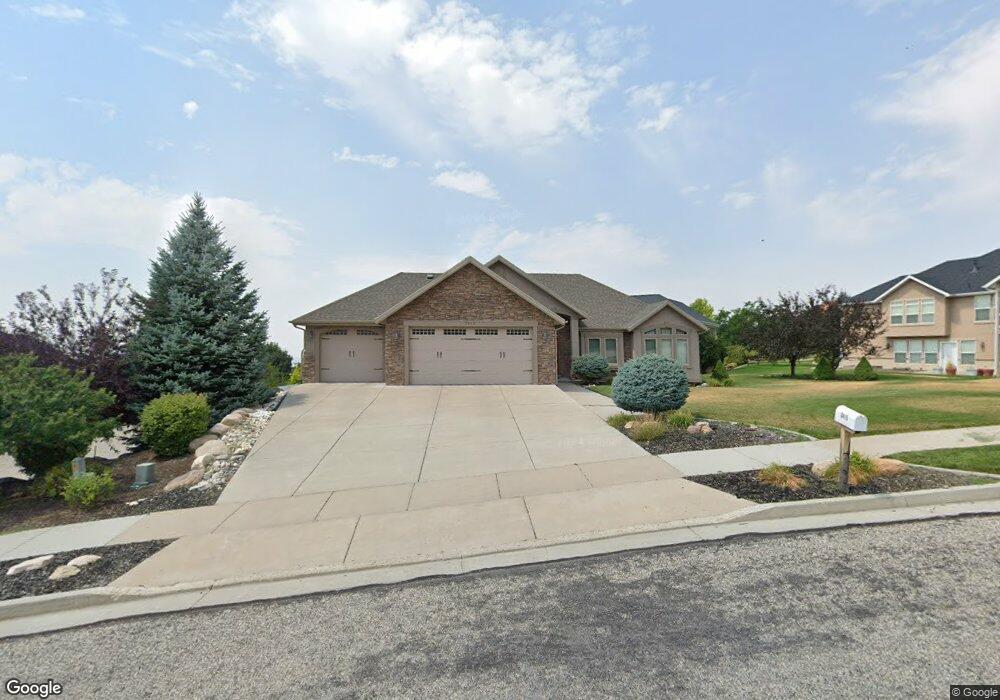
3415 N 1730 E North Logan, UT 84341
Estimated Value: $796,000 - $879,000
About This Home
This home is located at 3415 N 1730 E, North Logan, UT 84341 and is currently estimated at $829,257, approximately $180 per square foot. 3415 N 1730 E is a home located in Cache County with nearby schools including Greenville School, Cedar Ridge School, and North Cache Middle School.
Ownership History
We collect this data history from publicly available records. To have your information removed, we recommend requesting removal directly through your county’s website.
Purchase Details
Purchase Details
Home Financials for this Owner
Home Financials are based on the most recent Mortgage that was taken out on this home.Purchase Details
Home Financials for this Owner
Home Financials are based on the most recent Mortgage that was taken out on this home.Purchase Details
Home Financials for this Owner
Home Financials are based on the most recent Mortgage that was taken out on this home.Purchase Details
Home Financials for this Owner
Home Financials are based on the most recent Mortgage that was taken out on this home.Purchase Details
Home Financials for this Owner
Home Financials are based on the most recent Mortgage that was taken out on this home.Purchase Details
Home Values in the Area
Average Home Value in this Area
Purchase History
We collect this data history from publicly available records. To have your information removed, we recommend requesting removal directly through your county’s website.
| Date | Buyer | Sale Price | Title Company |
|---|---|---|---|
| -- | None Listed On Document | ||
| -- | Pinnacle Title | ||
| -- | Hickman Land Title | ||
| -- | Cache Title Company Inc | ||
| -- | American Secure Title | ||
| -- | Northern Title Company | ||
| -- | Northern Title Company |
Mortgage History
We collect this data history from publicly available records. To have your information removed, we recommend requesting removal directly through your county’s website.
| Date | Status | Borrower | Loan Amount |
|---|---|---|---|
| Previous Owner | $373,000 | ||
| Previous Owner | $58,100 | ||
| Previous Owner | $391,900 | ||
| Previous Owner | $52,762 | ||
| Previous Owner | $281,400 | ||
| Previous Owner | $254,775 |
Tax History
We collect this data history from publicly available records. To have your information removed, we recommend requesting removal directly through your county’s website.
| Year | Tax Paid | Tax Assessment Tax Assessment Total Assessment is a certain percentage of the fair market value that is determined by local assessors to be the total taxable value of land and additions on the property. | Land | Improvement |
|---|---|---|---|---|
| 2025 | $3,251 | $455,135 | $0 | $0 |
| 2024 | $3,338 | $434,815 | $0 | $0 |
| 2023 | $3,596 | $432,960 | $0 | $0 |
| 2022 | $3,762 | $432,960 | $0 | $0 |
| 2021 | $3,607 | $643,049 | $91,000 | $552,049 |
| 2020 | $3,418 | $571,043 | $91,000 | $480,043 |
| 2019 | $3,579 | $571,043 | $91,000 | $480,043 |
| 2018 | $3,263 | $504,060 | $75,450 | $428,610 |
| 2017 | $3,273 | $266,010 | $0 | $0 |
| 2016 | $3,325 | $209,485 | $0 | $0 |
| 2015 | $2,629 | $209,485 | $0 | $0 |
| 2014 | $2,570 | $209,485 | $0 | $0 |
| 2013 | -- | $210,805 | $0 | $0 |
Map
- 1888 E 3375 N
- 78 S 1000 E Unit 115
- 16 S 1000 E Unit 101
- 86 S 950 E
- 93 S 950 E Unit 18
- 1139 E Center St
- 1112 E 50 N
- 1034 E 50 N
- 105 E 3100 N
- 124 N 1140 E
- 894 E 130 N Unit 17
- 859 E 130 N
- 108 N 900 E
- 740 E 100 S
- 715 E Bluff St
- 2350 3025 N
- 803 E 160 N Unit 1
- 882 E 160 N Unit 4
- 940 E Canyon Rd
- 1087 E 160 N
- 1715 N Bronco Rd
- 1715 E 3450 N Unit 7
- 1715 E 3450 N
- 3493 N 1860 Cir E
- 3501 N 1800 E Unit 6
- 3501 N 1800 E
- 1615 N Bronco Rd Unit 5
- 1697 E 3450 N
- 1708 E 3450 N
- 1708 Bronco Rd Unit 8
- 3433 N 1800 E
- 3474 N 1800 E Unit 10
- 1718 E 3550 N Unit 5
- 1718 E 3550 N Unit 5
- 1718 E Mahogany Dr
- 1684 E 3450 N
- 3454 N 1800 E
- 1679 E 3450 N
- 1696 E 3550 N Unit 4
- 3395 N 1730 E
Ask me questions while you tour the home.