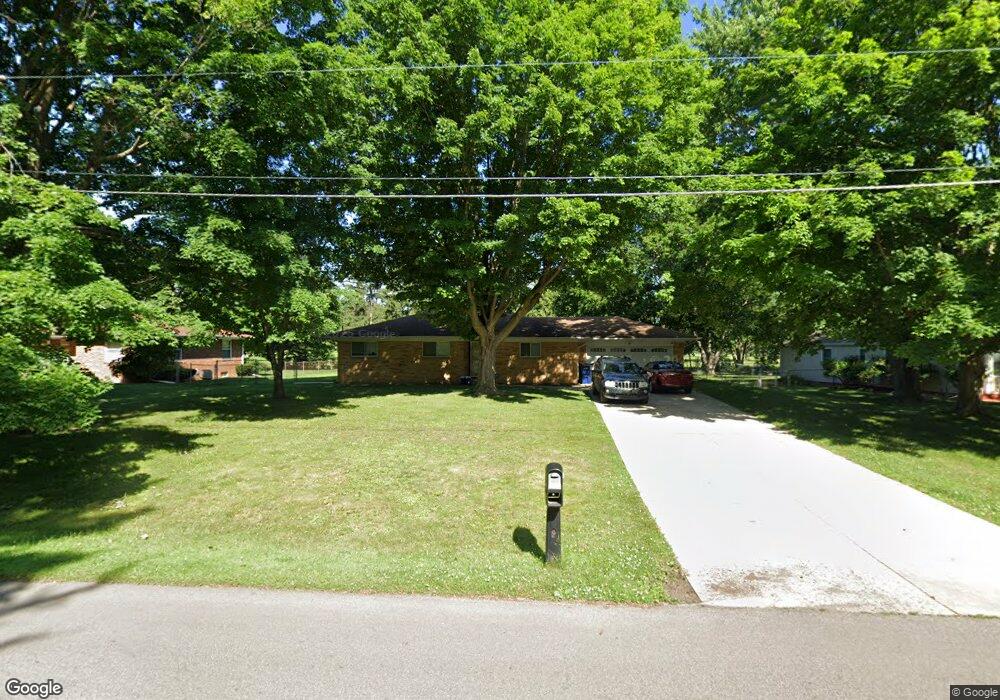
3418 Circle Dr Flint, MI 48507
Circle Neighborhood NeighborhoodEstimated Value: $116,000 - $146,000
3
Beds
1
Bath
1,303
Sq Ft
$102/Sq Ft
Est. Value
About This Home
This home is located at 3418 Circle Dr, Flint, MI 48507 and is currently estimated at $132,857, approximately $101 per square foot. 3418 Circle Dr is a home located in Genesee County with nearby schools including Freeman Elementary School, Flint Southwestern Classical Academy, and Burton Glen Charter Academy.
Ownership History
Date
Name
Owned For
Owner Type
Purchase Details
Closed on
Dec 30, 2004
Sold by
The Richard W Ingham Revocable Joint Tr and Ingham Robert W
Bought by
Davis Frederick W
Current Estimated Value
Home Financials for this Owner
Home Financials are based on the most recent Mortgage that was taken out on this home.
Original Mortgage
$83,200
Interest Rate
5.8%
Mortgage Type
Purchase Money Mortgage
Create a Home Valuation Report for This Property
The Home Valuation Report is an in-depth analysis detailing your home's value as well as a comparison with similar homes in the area
Home Values in the Area
Average Home Value in this Area
Purchase History
| Date | Buyer | Sale Price | Title Company |
|---|---|---|---|
| Davis Frederick W | $104,000 | Garrow Title Agency |
Source: Public Records
Mortgage History
| Date | Status | Borrower | Loan Amount |
|---|---|---|---|
| Open | Davis Frederick W | $15,600 | |
| Previous Owner | Davis Frederick W | $83,200 |
Source: Public Records
Tax History
| Year | Tax Paid | Tax Assessment Tax Assessment Total Assessment is a certain percentage of the fair market value that is determined by local assessors to be the total taxable value of land and additions on the property. | Land | Improvement |
|---|---|---|---|---|
| 2025 | $2,250 | $57,400 | $0 | $0 |
| 2024 | $1,994 | $58,000 | $0 | $0 |
| 2023 | $1,934 | $54,000 | $0 | $0 |
| 2022 | $0 | $45,000 | $0 | $0 |
| 2021 | $2,039 | $43,600 | $0 | $0 |
| 2020 | $1,767 | $40,700 | $0 | $0 |
| 2019 | $1,694 | $32,900 | $0 | $0 |
| 2018 | $1,787 | $32,400 | $0 | $0 |
| 2017 | $1,727 | $0 | $0 | $0 |
| 2016 | $1,714 | $0 | $0 | $0 |
| 2015 | -- | $0 | $0 | $0 |
| 2014 | -- | $0 | $0 | $0 |
| 2012 | -- | $34,300 | $0 | $0 |
Source: Public Records
Map
Nearby Homes
- 720 Algonquin Ave
- 3505 Comanche Ave
- 630 Buckingham Ave
- 621 Burroughs Ave
- 2910 Shawnee Ave
- 366 E Atherton Rd
- 3110 Menominee Ave
- 420 Burroughs Ave
- 4126 Circle Dr
- 352 Buckingham Ave
- 3009 Menominee Ave
- 4127 Custer Ave
- 326 Burroughs Ave
- 3914 Red Arrow Rd
- 617 McKeighan Ave
- 3218 Collingwood Pkwy
- 530 McKeighan Ave
- 3056 Shaw St
- 213 E Lakeview Ave
- 4424 Cheyenne Ave
- 3412 Circle Dr
- 3502 Circle Dr
- 3402 Circle Dr
- 3512 Circle Dr
- 3509 Circle Dr
- 3501 Circle Dr
- 3417 Circle Dr
- 701 Algonquin Ave
- 3602 Circle Dr Unit Bldg-Unit
- 3602 Circle Dr
- 3314 Circle Dr
- 703 Algonquin Ave
- 3401 Circle Dr
- 707 Algonquin Ave
- 3606 Circle Dr
- 709 Algonquin Ave
- 3325 Circle Dr
- 3306 Circle Dr
- 3317 Circle Dr
- 3616 Ogema Ave
Your Personal Tour Guide
Ask me questions while you tour the home.