Estimated Value: $300,075 - $363,000
Studio
1
Bath
1,116
Sq Ft
$301/Sq Ft
Est. Value
About This Home
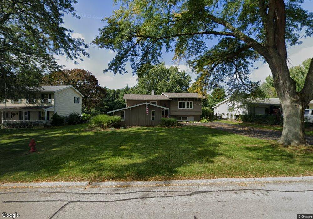
This home is located at 342 High Rd, Cary, IL 60013 and is currently estimated at $336,269, approximately $301 per square foot. 342 High Rd is a home located in McHenry County with nearby schools including Briargate Elementary School, Cary Jr High School, and Cary-Grove High School.
Ownership History
Date
Name
Owned For
Owner Type
Purchase Details
Closed on
Sep 6, 2022
Sold by
Brisco Timothy A
Bought by
Cook Janice A
Current Estimated Value
Purchase Details
Closed on
Aug 26, 2021
Sold by
Cook Janice
Bought by
Brisco Timothy A
Home Financials for this Owner
Home Financials are based on the most recent Mortgage that was taken out on this home.
Original Mortgage
$100,000
Interest Rate
3%
Mortgage Type
New Conventional
Purchase Details
Closed on
Jan 21, 2000
Sold by
Nass Larry W and Nass Jean H
Bought by
Cook Janice
Home Financials for this Owner
Home Financials are based on the most recent Mortgage that was taken out on this home.
Original Mortgage
$159,931
Interest Rate
8.21%
Mortgage Type
FHA
Create a Home Valuation Report for This Property
The Home Valuation Report is an in-depth analysis detailing your home's value as well as a comparison with similar homes in the area
Home Values in the Area
Average Home Value in this Area
Purchase History
| Date | Buyer | Sale Price | Title Company |
|---|---|---|---|
| Cook Janice A | -- | -- | |
| Brisco Timothy A | -- | Bchh Inc | |
| Cook Janice | $161,500 | Attorneys Title Guaranty Fun |
Source: Public Records
Mortgage History
| Date | Status | Borrower | Loan Amount |
|---|---|---|---|
| Previous Owner | Brisco Timothy A | $100,000 | |
| Previous Owner | Cook Janice | $159,931 |
Source: Public Records
Tax History
| Year | Tax Paid | Tax Assessment Tax Assessment Total Assessment is a certain percentage of the fair market value that is determined by local assessors to be the total taxable value of land and additions on the property. | Land | Improvement |
|---|---|---|---|---|
| 2024 | $6,457 | $84,674 | $22,172 | $62,502 |
| 2023 | $6,269 | $75,730 | $19,830 | $55,900 |
| 2022 | $5,724 | $67,129 | $25,536 | $41,593 |
| 2021 | $5,440 | $62,539 | $23,790 | $38,749 |
| 2020 | $5,271 | $60,325 | $22,948 | $37,377 |
| 2019 | $5,157 | $57,738 | $21,964 | $35,774 |
| 2018 | $4,843 | $53,338 | $20,290 | $33,048 |
| 2017 | $4,735 | $50,247 | $19,114 | $31,133 |
| 2016 | $4,683 | $47,127 | $17,927 | $29,200 |
| 2013 | -- | $50,261 | $16,724 | $33,537 |
Source: Public Records
Map
Nearby Homes
- 321 Cold Spring St
- 341 Cold Spring St
- 331 Cold Spring St
- 371 Cold Spring St
- 542 Cary Woods Cir
- 204 Country Commons Rd
- 258 Stonegate Rd
- Lots 2,3,4 Northwest Hwy
- 2016 Grove Ln
- 128 E Main St
- 124 E Main St
- 349 Park Ave
- 112 Pearl St
- 417 Haber Rd Unit 6
- 421 Haber Rd Unit 7
- 425 Haber Rd Unit 6
- 1104 Hillcrest Ave
- 735 Royal Glen Dr
- 2101 Riverview Ave
- 259 Firenze Dr Unit 110
Your Personal Tour Guide
Ask me questions while you tour the home.