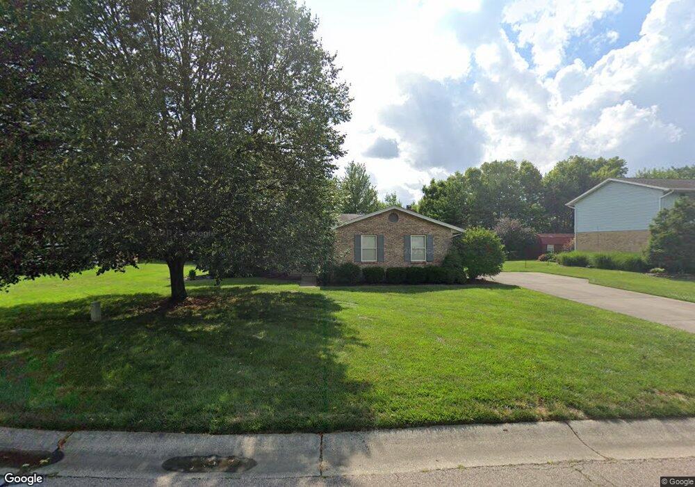
3432 Dust Commander Dr Hamilton, OH 45011
Estimated Value: $306,116 - $402,000
About This Home
This home is located at 3432 Dust Commander Dr, Hamilton, OH 45011 and is currently estimated at $357,529, approximately $191 per square foot. 3432 Dust Commander Dr is a home located in Butler County with nearby schools including Fairfield East Elementary School, Creekside Middle School, and Fairfield Senior High School.
Ownership History
We collect this data history from publicly available records. To have your information removed, we recommend requesting removal directly through your county’s website.
Purchase Details
Home Financials for this Owner
Home Financials are based on the most recent Mortgage that was taken out on this home.Purchase Details
Home Financials for this Owner
Home Financials are based on the most recent Mortgage that was taken out on this home.Home Values in the Area
Average Home Value in this Area
Purchase History
We collect this data history from publicly available records. To have your information removed, we recommend requesting removal directly through your county’s website.
| Date | Buyer | Sale Price | Title Company |
|---|---|---|---|
| $136,000 | -- | ||
| $128,900 | -- |
Mortgage History
We collect this data history from publicly available records. To have your information removed, we recommend requesting removal directly through your county’s website.
| Date | Status | Borrower | Loan Amount |
|---|---|---|---|
| Open | $108,800 | ||
| Closed | $128,900 |
Tax History
We collect this data history from publicly available records. To have your information removed, we recommend requesting removal directly through your county’s website.
| Year | Tax Paid | Tax Assessment Tax Assessment Total Assessment is a certain percentage of the fair market value that is determined by local assessors to be the total taxable value of land and additions on the property. | Land | Improvement |
|---|---|---|---|---|
| 2025 | $3,267 | $86,490 | $12,710 | $73,780 |
| 2024 | $3,267 | $86,490 | $12,710 | $73,780 |
| 2023 | $3,239 | $94,200 | $12,710 | $81,490 |
| 2022 | $3,297 | $64,530 | $12,710 | $51,820 |
| 2021 | $2,952 | $61,600 | $12,710 | $48,890 |
| 2020 | $3,053 | $61,600 | $12,710 | $48,890 |
| 2019 | $4,745 | $50,480 | $12,710 | $37,770 |
| 2018 | $2,852 | $50,480 | $12,710 | $37,770 |
| 2017 | $2,877 | $50,480 | $12,710 | $37,770 |
| 2016 | $3,031 | $50,480 | $12,710 | $37,770 |
| 2015 | $2,968 | $50,480 | $12,710 | $37,770 |
| 2014 | $2,795 | $50,480 | $12,710 | $37,770 |
| 2013 | $2,795 | $52,070 | $12,710 | $39,360 |
Map
- 7881 Jessies Way Unit 202
- 7881 Jessies Way
- 7912 Jessies Way
- 7918 Jessies Way
- 7245 Gateway Ave
- 480 Loren Ln
- 3760 Dust Commander Dr
- 3676 Saratoga Dr
- 3835 Schroeder Dr
- 7446 Preakness Ln
- 7434 Preakness Ln
- 7249 Woodberry Dr
- 7225 Woodberry Dr
- 3462 Elbert Dr
- 3463 Wood Ct
- 7126 Hearthwood Dr
- 3435 Berrywood Ct
- 3689 Stockbridge Ln
- 5518 Pacific Crest Ln
- 3657 Charfield Ln
- 3443 Dust Commander Dr
- 3453 Dust Commander Dr
- 3706 Sylvia Dr
- 3696 Sylvia Dr
- 3463 Dust Commander Dr
- 3442 Dust Commander Dr
- 3473 Dust Commander Dr
- 3452 Dust Commander Dr
- 3686 Sylvia Dr
- 3483 Dust Commander Dr
- 3707 Sylvia Dr
- 3460 Dust Commander Dr
- 3697 Sylvia Dr
- 3422 Dust Commander Dr
- 7562 Red Coat Dr
- 3717 Sylvia Dr
- 7745 Chelsea Ct
- 7735 Chelsea Ct
- 3687 Sylvia Dr
- 7755 Chelsea Ct
Ask me questions while you tour the home.