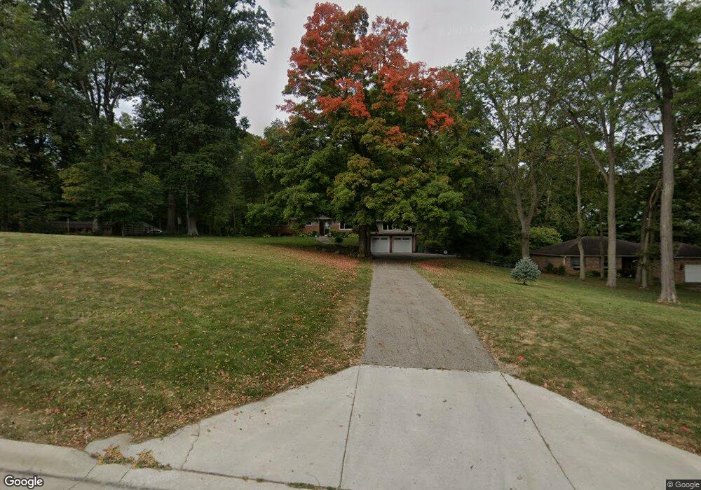
3435 Derr Rd Springfield, OH 45503
Estimated Value: $253,000 - $347,000
2
Beds
2
Baths
1,966
Sq Ft
$151/Sq Ft
Est. Value
About This Home
This home is located at 3435 Derr Rd, Springfield, OH 45503 and is currently estimated at $296,560, approximately $150 per square foot. 3435 Derr Rd is a home located in Clark County with nearby schools including Northridge Elementary School, Kenton Ridge Middle & High School, and Emmanuel Christian Academy.
Ownership History
Date
Name
Owned For
Owner Type
Purchase Details
Closed on
Aug 11, 2006
Sold by
Baxter Curtis M and Baxter Kelley A
Bought by
Lookabaugh Thomas and Lookabaugh Rita
Current Estimated Value
Home Financials for this Owner
Home Financials are based on the most recent Mortgage that was taken out on this home.
Original Mortgage
$116,800
Outstanding Balance
$69,296
Interest Rate
6.83%
Mortgage Type
Purchase Money Mortgage
Estimated Equity
$227,264
Purchase Details
Closed on
Sep 15, 1999
Sold by
Hill Donald L and Hill Linda L
Bought by
Baxter Curtis M
Home Financials for this Owner
Home Financials are based on the most recent Mortgage that was taken out on this home.
Original Mortgage
$102,000
Interest Rate
7.37%
Purchase Details
Closed on
May 2, 1988
Create a Home Valuation Report for This Property
The Home Valuation Report is an in-depth analysis detailing your home's value as well as a comparison with similar homes in the area
Home Values in the Area
Average Home Value in this Area
Purchase History
| Date | Buyer | Sale Price | Title Company |
|---|---|---|---|
| Lookabaugh Thomas | $146,000 | None Available | |
| Baxter Curtis M | $127,500 | -- | |
| -- | $75,000 | -- |
Source: Public Records
Mortgage History
| Date | Status | Borrower | Loan Amount |
|---|---|---|---|
| Open | Lookabaugh Thomas | $116,800 | |
| Previous Owner | Baxter Curtis M | $102,000 |
Source: Public Records
Tax History
| Year | Tax Paid | Tax Assessment Tax Assessment Total Assessment is a certain percentage of the fair market value that is determined by local assessors to be the total taxable value of land and additions on the property. | Land | Improvement |
|---|---|---|---|---|
| 2025 | $2,719 | $83,000 | $17,860 | $65,140 |
| 2024 | $2,630 | $62,130 | $17,470 | $44,660 |
| 2023 | $2,630 | $62,130 | $17,470 | $44,660 |
| 2022 | $2,639 | $62,130 | $17,470 | $44,660 |
| 2021 | $2,862 | $57,110 | $13,870 | $43,240 |
| 2020 | $2,865 | $57,110 | $13,870 | $43,240 |
| 2019 | $2,919 | $57,110 | $13,870 | $43,240 |
| 2018 | $2,279 | $42,660 | $12,600 | $30,060 |
| 2017 | $1,955 | $36,936 | $12,600 | $24,336 |
| 2016 | $1,941 | $36,936 | $12,600 | $24,336 |
| 2015 | $1,806 | $36,936 | $12,600 | $24,336 |
| 2014 | $1,806 | $36,936 | $12,600 | $24,336 |
| 2013 | $1,764 | $36,936 | $12,600 | $24,336 |
Source: Public Records
Map
Nearby Homes
- 1136 Foxboro Rd Unit 202
- 1139 Bradford Dr
- 1201 Kingsgate Rd
- 3052 Brixton Dr E
- 1039 Bradford Dr Unit 42
- 3631 Kingsgate Ln
- 1500 Kingsgate Rd Unit 19430
- 1502 Kingsgate Rd Unit 19432
- 1500 Kingsgate Rd
- 1502 Kingsgate Rd
- 615 Villa Rd Unit B
- 1503 Kingsgate Rd
- 1505 Kingsgate Rd
- 1507 Kingsgate Rd
- 3135 Imperial Blvd
- 1415 Montego Dr
- 3124 El Camino Dr
- 732 Grandview Dr Unit 732
- 3211 Haverhill St
- 1525 Providence Ave
- 3501 Derr Rd
- 3421 Derr Rd
- 3405 Derr Rd
- 3440 Derr Rd
- 3448 Derr Rd
- 3345 Derr Rd
- 3516 Derr Rd
- 3400 Derr Rd
- 3534 Derr Rd
- 3107 Brixton Dr W
- 3107 Brixton Dr W Unit 114
- 3333 Derr Rd
- 3111 Brixton Dr W
- 3103 Brixton Dr W Unit 115
- 3099 Brixton Dr W
- 3099 Brixton Dr W Unit 116
- 3115 Brixton Dr W
- 3115 Brixton Dr W
- 3338 Derr Rd
- 3095 Brixton Dr W
Your Personal Tour Guide
Ask me questions while you tour the home.