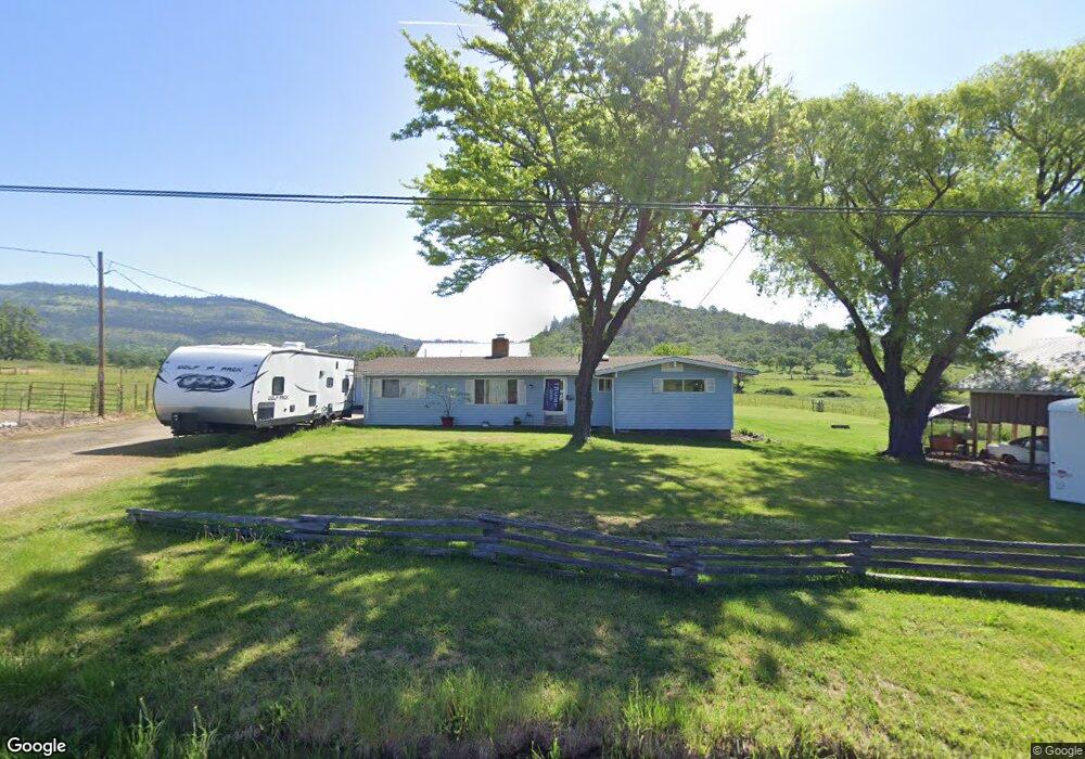
3445 Brophy Rd Eagle Point, OR 97524
Estimated Value: $469,136 - $582,000
3
Beds
3
Baths
1,572
Sq Ft
$333/Sq Ft
Est. Value
About This Home
This home is located at 3445 Brophy Rd, Eagle Point, OR 97524 and is currently estimated at $523,284, approximately $332 per square foot. 3445 Brophy Rd is a home located in Jackson County with nearby schools including Eagle Rock Elementary School, Eagle Point Middle School, and White Mountain Middle School.
Ownership History
Date
Name
Owned For
Owner Type
Purchase Details
Closed on
Jul 13, 1998
Sold by
Taylor Alice
Bought by
Dyer Donald E and Dyer Cynthia L
Current Estimated Value
Home Financials for this Owner
Home Financials are based on the most recent Mortgage that was taken out on this home.
Original Mortgage
$121,600
Outstanding Balance
$26,870
Interest Rate
8.95%
Estimated Equity
$496,414
Create a Home Valuation Report for This Property
The Home Valuation Report is an in-depth analysis detailing your home's value as well as a comparison with similar homes in the area
Purchase History
| Date | Buyer | Sale Price | Title Company |
|---|---|---|---|
| Dyer Donald E | $152,000 | Jackson County Title |
Source: Public Records
Mortgage History
| Date | Status | Borrower | Loan Amount |
|---|---|---|---|
| Open | Dyer Donald E | $121,600 | |
| Closed | Dyer Donald E | $24,358 |
Source: Public Records
Tax History
| Year | Tax Paid | Tax Assessment Tax Assessment Total Assessment is a certain percentage of the fair market value that is determined by local assessors to be the total taxable value of land and additions on the property. | Land | Improvement |
|---|---|---|---|---|
| 2026 | $2,399 | $206,790 | -- | -- |
| 2025 | $2,337 | $200,890 | $20,390 | $180,500 |
| 2024 | $2,337 | $195,160 | $19,910 | $175,250 |
| 2023 | $2,259 | $189,600 | $19,450 | $170,150 |
| 2022 | $2,201 | $189,600 | $19,450 | $170,150 |
| 2021 | $2,140 | $184,200 | $19,000 | $165,200 |
| 2020 | $2,311 | $178,960 | $18,560 | $160,400 |
| 2019 | $2,284 | $168,930 | $17,720 | $151,210 |
| 2018 | $2,234 | $164,130 | $17,320 | $146,810 |
| 2017 | $2,183 | $164,130 | $17,320 | $146,810 |
| 2016 | $2,129 | $154,950 | $16,550 | $138,400 |
| 2015 | $2,059 | $154,950 | $16,550 | $138,400 |
| 2014 | $2,001 | $146,300 | $15,820 | $130,480 |
Source: Public Records
Map
Nearby Homes
- 1881 Brophy Rd
- 460 Montclair Way
- 1918 Stevens Rd
- 633 E Archwood Dr Unit 89
- 633 E Archwood Dr Unit 86
- 633 E Archwood Dr Unit 44
- 633 E Archwood Dr Unit 12
- 633 E Archwood Dr Unit 70
- 633 E Archwood Dr Unit 53
- 633 E Archwood Dr Unit 130
- 633 E Archwood Dr Unit 125
- 633 E Archwood Dr Unit 59
- 633 E Archwood Dr Unit 43
- 278 Cambridge Terrace
- 21 Cerulean Terrace
- 1044 Havenwood Dr
- 1050 Azure Way
- 277 Cambridge Terrace
- 426 Westminster Dr
- 1017 Havenwood Dr
- 3415 Brophy Rd
- 3385 Brophy Rd
- 3535 Brophy Rd
- 3380 Brophy Rd
- 3370 Brophy Rd
- 3240 Brophy Rd
- 3205 Brophy Rd
- 3155 Brophy Rd
- 77 Worthington Rd
- 177 Worthington Rd
- 3660 Brophy Rd
- 3660 Brophy Rd
- 255 Worthington Rd
- 477 Worthington Rd
- 280 Worthington Rd
- 597 Worthington Rd
- 3043 Brophy Rd
- 4646 Brophy Rd
- 2383 Brophy Rd
- 688 Worthington Rd
Your Personal Tour Guide
Ask me questions while you tour the home.