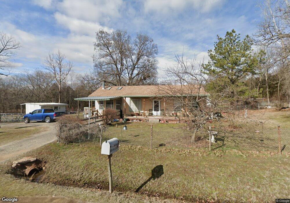
34853 E0810 Rd Bristow, OK 74010
Estimated Value: $111,000 - $202,000
2
Beds
1
Bath
1,328
Sq Ft
$110/Sq Ft
Est. Value
About This Home
This home is located at 34853 E0810 Rd, Bristow, OK 74010 and is currently estimated at $145,526, approximately $109 per square foot. 34853 E0810 Rd is a home located in Creek County with nearby schools including Edison Elementary School, Collins Elementary School, and Bristow Middle School.
Ownership History
Date
Name
Owned For
Owner Type
Purchase Details
Closed on
Oct 13, 2005
Sold by
Gage James H and Gage Martah E
Bought by
Hinshaw Howard A and Hinshaw Dena L
Current Estimated Value
Home Financials for this Owner
Home Financials are based on the most recent Mortgage that was taken out on this home.
Original Mortgage
$70,555
Outstanding Balance
$37,230
Interest Rate
5.73%
Mortgage Type
New Conventional
Estimated Equity
$108,296
Purchase Details
Closed on
Jan 16, 2004
Sold by
Fugate Gary and Fugate Denise
Create a Home Valuation Report for This Property
The Home Valuation Report is an in-depth analysis detailing your home's value as well as a comparison with similar homes in the area
Purchase History
| Date | Buyer | Sale Price | Title Company |
|---|---|---|---|
| Hinshaw Howard A | $68,500 | None Available | |
| -- | $62,000 | -- |
Source: Public Records
Mortgage History
| Date | Status | Borrower | Loan Amount |
|---|---|---|---|
| Open | Hinshaw Howard A | $70,555 |
Source: Public Records
Map
Nearby Homes
- 34520 W 221st St S
- 608 E 9th Ave
- 302 E 8th Ave
- 0 State Highway 48
- 619 E 6th Ave
- 133 W 8th Ave
- 247 W 11th Ave
- 106 N Main St
- 610 E 4th Ave
- 32380 W Highway 33
- Tract 1 W 211th St S
- Tract 2 W 211th St S
- 551 W 9th Ave
- 203 W 3rd Ave
- 84 Weatherwood Way
- 602 W 7th Ave
- 810 S Walnut
- 904 S Hickory St
- 23136 S 337th West Ave
- 1001 S Chestnut St
- 34853 W 221st St S
- 34984 W 221st St S
- 22241 S 349
- 34599 W 221st St S
- 34521 W 221st St S
- 238 McDonald Dr
- 35148 W 221st St S
- 0 W 221st St Unit 1115482
- 0 W 221st St Unit 1332028
- 0 W 221st St Unit 1302551
- 0 W 221st St Unit 1600108
- 0 W 221st St Unit 2036035
- 0 W 221st St Unit 2112415
- 34480 W 221st St S
- 400 McDonald Dr
- 1950 McDonald Dr
- 35145 E0810 Rd
- 34382 W 221st St S
- 343 McDonald Dr
- 408 E 12th Ave
Your Personal Tour Guide
Ask me questions while you tour the home.