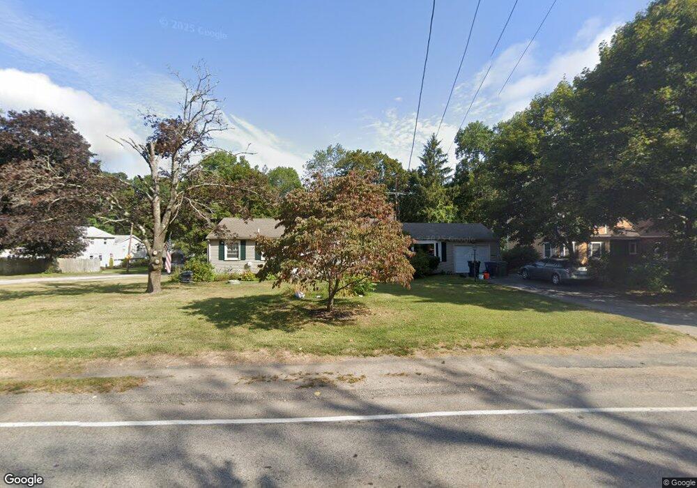
349 Cowesett Rd Warwick, RI 02886
Cowesett NeighborhoodEstimated Value: $468,000 - $532,000
About This Home
This home is located at 349 Cowesett Rd, Warwick, RI 02886 and is currently estimated at $486,396, approximately $305 per square foot. 349 Cowesett Rd is a home located in Kent County with nearby schools including Our Lady of Mercy School.
Ownership History
We collect this data history from publicly available records. To have your information removed, we recommend requesting removal directly through your county’s website.
Purchase Details
Home Values in the Area
Average Home Value in this Area
Purchase History
We collect this data history from publicly available records. To have your information removed, we recommend requesting removal directly through your county’s website.
| Date | Buyer | Sale Price | Title Company |
|---|---|---|---|
| $117,000 | -- |
Mortgage History
We collect this data history from publicly available records. To have your information removed, we recommend requesting removal directly through your county’s website.
| Date | Status | Borrower | Loan Amount |
|---|---|---|---|
| Open | $97,231 | ||
| Closed | $108,000 |
Tax History
We collect this data history from publicly available records. To have your information removed, we recommend requesting removal directly through your county’s website.
| Year | Tax Paid | Tax Assessment Tax Assessment Total Assessment is a certain percentage of the fair market value that is determined by local assessors to be the total taxable value of land and additions on the property. | Land | Improvement |
|---|---|---|---|---|
| 2025 | $4,881 | $384,300 | $109,800 | $274,500 |
| 2024 | $4,571 | $315,900 | $92,500 | $223,400 |
| 2023 | $4,483 | $315,900 | $92,500 | $223,400 |
| 2022 | $4,407 | $235,300 | $66,400 | $168,900 |
| 2021 | $4,407 | $235,300 | $66,400 | $168,900 |
| 2020 | $4,407 | $235,300 | $66,400 | $168,900 |
| 2019 | $4,407 | $235,300 | $66,400 | $168,900 |
| 2018 | $3,940 | $189,400 | $66,400 | $123,000 |
| 2017 | $3,833 | $189,400 | $66,400 | $123,000 |
| 2016 | $3,833 | $189,400 | $66,400 | $123,000 |
| 2015 | $3,916 | $188,700 | $80,900 | $107,800 |
| 2014 | $3,785 | $188,700 | $80,900 | $107,800 |
| 2013 | $3,734 | $188,700 | $80,900 | $107,800 |
Map
- 175 Birkshire Dr
- 36 Edmond Dr
- 16 Superior St
- 91 Love Ln
- 58 Rip Van Winkle Cir
- 66 Bokar St
- 135 Red Chimney Dr
- 162 Larchmont Rd
- 40 Poppy Place
- 187 Love Ln
- 117 Larchmont Rd
- 180 Diamond Hill Rd
- 3800 Post Rd Unit 5
- 322 Sleepy Hollow Farm Rd
- 3399 Post Rd
- 3940 Post Rd Unit 26
- 190 Arnolds Neck Dr
- 1 Cassidy
- 4160 Post Rd Unit 28
- 53 Greenbush Rd
- 175 Sturbridge Dr
- 165 Sturbridge Dr
- 185 Sturbridge Dr
- 170 Birkshire Dr
- 160 Birkshire Dr
- 178 Sturbridge Dr
- 166 Sturbridge Dr
- 155 Sturbridge Dr
- 150 Birkshire Dr
- 315 Cowesett Rd
- 188 Sturbridge Dr
- 156 Sturbridge Dr
- 325 Cowesett Rd
- 67 Spinnaker Ln
- 140 Birkshire Dr
- 59 Spinnaker Ln
- 295 Cowesett Rd
- 141 Sturbridge Dr
- 165 Birkshire Dr
- 77 Spinnaker Ln
Ask me questions while you tour the home.