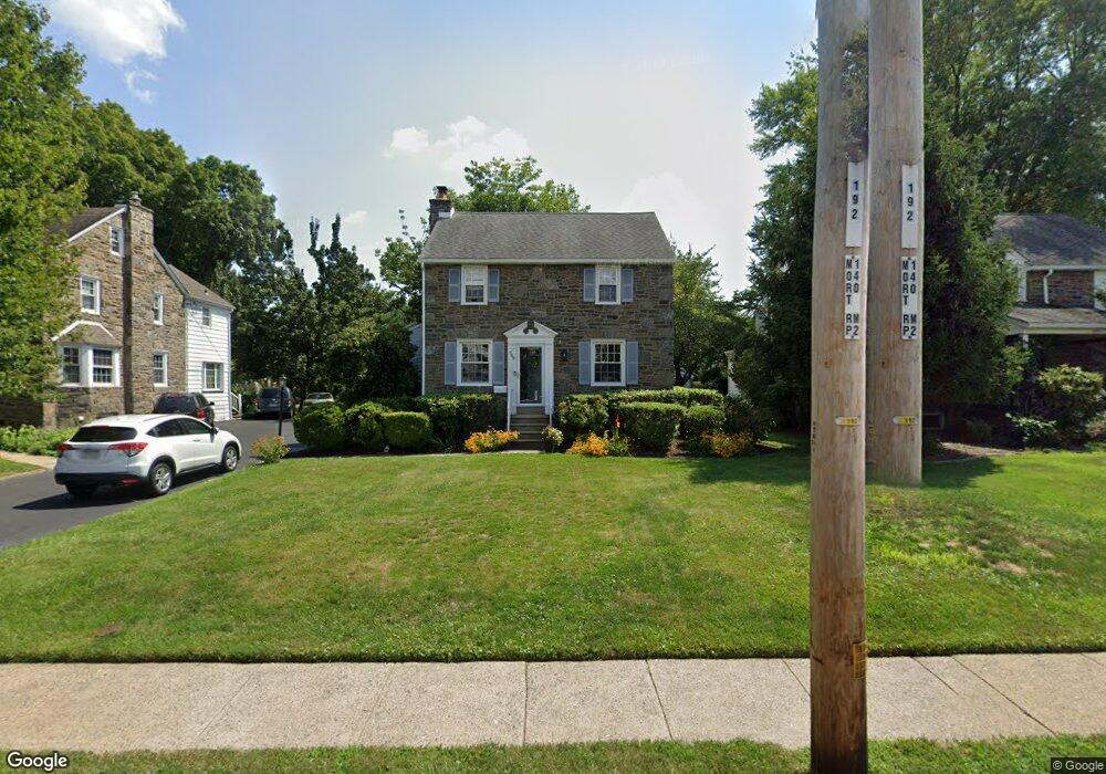
349 Powell Rd Springfield, PA 19064
Estimated Value: $493,000 - $560,000
3
Beds
2
Baths
2,530
Sq Ft
$209/Sq Ft
Est. Value
About This Home
This home is located at 349 Powell Rd, Springfield, PA 19064 and is currently estimated at $528,374, approximately $208 per square foot. 349 Powell Rd is a home located in Delaware County with nearby schools including Springfield High School, St Francis Of Assisi School, and Holy Cross School.
Ownership History
Date
Name
Owned For
Owner Type
Purchase Details
Closed on
Apr 15, 1994
Sold by
Fox Robert K and Fox Mary Ann
Bought by
Sadoff Joseph D and Sadoff Janine M
Current Estimated Value
Home Financials for this Owner
Home Financials are based on the most recent Mortgage that was taken out on this home.
Original Mortgage
$145,800
Interest Rate
7.6%
Mortgage Type
Purchase Money Mortgage
Create a Home Valuation Report for This Property
The Home Valuation Report is an in-depth analysis detailing your home's value as well as a comparison with similar homes in the area
Home Values in the Area
Average Home Value in this Area
Purchase History
| Date | Buyer | Sale Price | Title Company |
|---|---|---|---|
| Sadoff Joseph D | $153,500 | -- |
Source: Public Records
Mortgage History
| Date | Status | Borrower | Loan Amount |
|---|---|---|---|
| Closed | Sadoff Joseph D | $145,800 |
Source: Public Records
Tax History
| Year | Tax Paid | Tax Assessment Tax Assessment Total Assessment is a certain percentage of the fair market value that is determined by local assessors to be the total taxable value of land and additions on the property. | Land | Improvement |
|---|---|---|---|---|
| 2025 | $8,854 | $315,000 | $114,190 | $200,810 |
| 2024 | $8,854 | $315,000 | $114,190 | $200,810 |
| 2023 | $8,525 | $315,000 | $114,190 | $200,810 |
| 2022 | $8,341 | $315,000 | $114,190 | $200,810 |
| 2021 | $12,917 | $315,000 | $114,190 | $200,810 |
| 2020 | $8,391 | $185,180 | $54,900 | $130,280 |
| 2019 | $8,194 | $185,180 | $54,900 | $130,280 |
| 2018 | $8,077 | $185,180 | $0 | $0 |
| 2017 | $7,890 | $185,180 | $0 | $0 |
| 2016 | $1,016 | $185,180 | $0 | $0 |
| 2015 | $1,037 | $185,180 | $0 | $0 |
| 2014 | $1,037 | $185,180 | $0 | $0 |
Source: Public Records
Map
Nearby Homes
- 231 E Woodland Ave
- 264 Pancoast Ave
- 364 S Rolling Rd
- 720 Evans Rd
- 253 Saxer Ave
- 493 Wheatsheaf Rd
- 334 Parham Rd
- 341 Harwicke Rd
- 225 Lynbrooke Rd
- 658 E Leamy Ave
- 359 Spring Valley Rd
- 238 Alliston Rd
- 249 Gleaves Rd
- 436 Kerr Ln
- 933 Greenbriar Ln
- 114 Providence Rd
- 412 Foster Dr
- 120 W Springfield Rd
- 1291 Country Club Dr Unit Q137
- 1363 Palmer Dr Unit O122
- 345 Powell Rd
- 353 Powell Rd
- 339 Powell Rd
- 211 E Woodland Ave
- 335 Powell Rd
- 201 E Woodland Ave
- 221 E Woodland Ave
- 217 E Woodland Ave
- 227 E Woodland Ave
- 331 Powell Rd
- 348 Prospect Rd
- 344 Prospect Rd
- 340 Prospect Rd
- 348 Powell Rd
- 350 Powell Rd
- 346 Powell Rd
- 352 Powell Rd
- 344 Powell Rd
- 354 Powell Rd
- 342 Powell Rd
Your Personal Tour Guide
Ask me questions while you tour the home.