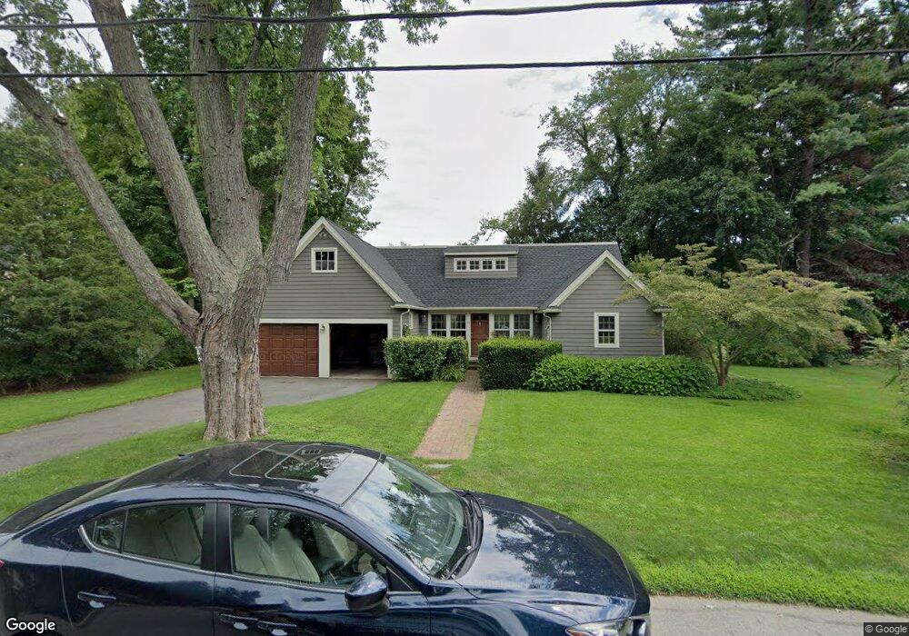
35 Amherst Rd Wellesley, MA 02482
Dana Hall NeighborhoodEstimated Value: $2,016,000 - $2,376,000
About This Home
This home is located at 35 Amherst Rd, Wellesley, MA 02482 and is currently estimated at $2,180,637, approximately $772 per square foot. 35 Amherst Rd is a home located in Norfolk County with nearby schools including Hunnewell Elementary School, Wellesley Middle School, and Wellesley Sr High School.
Ownership History
We collect this data history from publicly available records. To have your information removed, we recommend requesting removal directly through your county’s website.
Purchase Details
Purchase Details
Home Values in the Area
Average Home Value in this Area
Purchase History
We collect this data history from publicly available records. To have your information removed, we recommend requesting removal directly through your county’s website.
| Date | Buyer | Sale Price | Title Company |
|---|---|---|---|
| -- | -- | ||
| $320,000 | -- |
Mortgage History
We collect this data history from publicly available records. To have your information removed, we recommend requesting removal directly through your county’s website.
| Date | Status | Borrower | Loan Amount |
|---|---|---|---|
| Previous Owner | $144,000 |
Tax History
We collect this data history from publicly available records. To have your information removed, we recommend requesting removal directly through your county’s website.
| Year | Tax Paid | Tax Assessment Tax Assessment Total Assessment is a certain percentage of the fair market value that is determined by local assessors to be the total taxable value of land and additions on the property. | Land | Improvement |
|---|---|---|---|---|
| 2025 | $16,787 | $1,633,000 | $1,151,000 | $482,000 |
| 2024 | $16,292 | $1,565,000 | $1,099,000 | $466,000 |
| 2023 | $16,396 | $1,432,000 | $1,005,000 | $427,000 |
| 2022 | $14,670 | $1,256,000 | $831,000 | $425,000 |
| 2021 | $14,758 | $1,256,000 | $831,000 | $425,000 |
| 2020 | $14,519 | $1,256,000 | $831,000 | $425,000 |
| 2019 | $14,532 | $1,256,000 | $831,000 | $425,000 |
| 2018 | $13,814 | $1,156,000 | $743,000 | $413,000 |
| 2017 | $13,641 | $1,157,000 | $744,000 | $413,000 |
| 2016 | $13,344 | $1,128,000 | $731,000 | $397,000 |
| 2015 | $13,017 | $1,126,000 | $731,000 | $395,000 |
Map
- 9 Hampden St
- 11 Sterling Rd
- 43 Atwood St
- 98 Brook St
- 42 Temple Rd
- 75 Grove St Unit 225
- 580 Washington St Unit 104
- 580 Washington St Unit 304
- 286 Linden St Unit 286
- 296 Linden St
- 20 Hill Top Rd
- 100 Linden St Unit 205
- 5 Abbott St
- 11 Oak St Unit 33
- 29 Cottage St
- 21 Westerly St Unit 1
- 31 Alba Rd
- 33 Linden St
- 26 Pleasant St Unit B
- 11 Skyline Dr
Ask me questions while you tour the home.