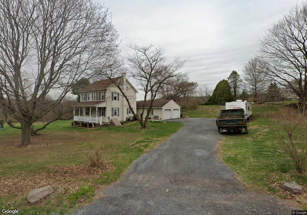
35 Andrew Dr Mohnton, PA 19540
Estimated Value: $312,000 - $345,000
3
Beds
1
Bath
1,248
Sq Ft
$261/Sq Ft
Est. Value
About This Home
This home is located at 35 Andrew Dr, Mohnton, PA 19540 and is currently estimated at $326,286, approximately $261 per square foot. 35 Andrew Dr is a home with nearby schools including Brecknock Elementary School, Governor Mifflin Intermediate School, and Governor Mifflin Middle School.
Ownership History
Date
Name
Owned For
Owner Type
Purchase Details
Closed on
Sep 10, 2018
Sold by
Wagner Allen S
Bought by
Wagner Allen S
Current Estimated Value
Purchase Details
Closed on
Dec 27, 2017
Sold by
Weber Leon S
Bought by
Wagner Allen S
Home Financials for this Owner
Home Financials are based on the most recent Mortgage that was taken out on this home.
Original Mortgage
$145,809
Interest Rate
4.4%
Mortgage Type
FHA
Purchase Details
Closed on
May 29, 1958
Bought by
Weber Leon S and Weber Norma
Create a Home Valuation Report for This Property
The Home Valuation Report is an in-depth analysis detailing your home's value as well as a comparison with similar homes in the area
Home Values in the Area
Average Home Value in this Area
Purchase History
| Date | Buyer | Sale Price | Title Company |
|---|---|---|---|
| Wagner Allen S | -- | None Available | |
| Wagner Allen S | $1,000 | None Available | |
| Wagner Allen S | $148,500 | -- | |
| Weber Leon S | -- | -- |
Source: Public Records
Mortgage History
| Date | Status | Borrower | Loan Amount |
|---|---|---|---|
| Previous Owner | Wagner Allen S | $145,809 |
Source: Public Records
Tax History
| Year | Tax Paid | Tax Assessment Tax Assessment Total Assessment is a certain percentage of the fair market value that is determined by local assessors to be the total taxable value of land and additions on the property. | Land | Improvement |
|---|---|---|---|---|
| 2025 | $1,335 | $111,800 | $54,800 | $57,000 |
| 2024 | $4,625 | $111,800 | $54,800 | $57,000 |
| 2023 | $4,453 | $111,800 | $54,800 | $57,000 |
| 2022 | $4,397 | $111,800 | $54,800 | $57,000 |
| 2021 | $4,341 | $111,800 | $54,800 | $57,000 |
| 2020 | $4,341 | $111,800 | $54,800 | $57,000 |
| 2019 | $4,258 | $111,800 | $54,800 | $57,000 |
| 2018 | $4,153 | $110,500 | $53,900 | $56,600 |
| 2017 | $4,066 | $110,500 | $53,900 | $56,600 |
| 2016 | $1,050 | $110,500 | $53,900 | $56,600 |
| 2015 | $1,050 | $110,500 | $53,900 | $56,600 |
| 2014 | $1,009 | $110,500 | $53,900 | $56,600 |
Source: Public Records
Map
Nearby Homes
- 466 Witmer Rd
- 39 Gill Rd
- 2152 Old Lancaster Pike
- 702 Wyomissing Rd
- 32 Stonehill Dr
- 2185 Welsh Rd
- 525 Mohns Hill Rd
- 33 E Main St
- 114 Cedarwood Dr
- 820 Oregon Rd
- 30 W Fairview St
- 40 W Wyomissing Ave
- 338 Candy Rd
- 5028 Vista Ct
- 106 Pear St
- 201 Slichter Dr
- 78 Chestnut St
- 1295 Reading Rd
- 56 N Church St
- 17 E Summit St
Your Personal Tour Guide
Ask me questions while you tour the home.