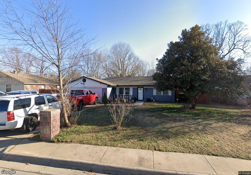
3509 Cannon Ave Springdale, AR 72762
Estimated Value: $231,971 - $272,000
Studio
2
Baths
1,423
Sq Ft
$179/Sq Ft
Est. Value
About This Home
This home is located at 3509 Cannon Ave, Springdale, AR 72762 and is currently estimated at $254,993, approximately $179 per square foot. 3509 Cannon Ave is a home located in Washington County with nearby schools including Thurman G. Smith Elementary School, Central Junior High School, and Hellstern Middle School.
Ownership History
Date
Name
Owned For
Owner Type
Purchase Details
Closed on
Aug 18, 2017
Sold by
Cossey Terry L
Bought by
Correa Hernandez Miguel A
Current Estimated Value
Home Financials for this Owner
Home Financials are based on the most recent Mortgage that was taken out on this home.
Original Mortgage
$117,000
Outstanding Balance
$97,394
Interest Rate
3.96%
Mortgage Type
Future Advance Clause Open End Mortgage
Estimated Equity
$157,599
Purchase Details
Closed on
Nov 10, 1989
Bought by
Cossey Leroy and Lily Mae
Purchase Details
Closed on
Sep 13, 1985
Bought by
Capps Charles E and Capps Brenda R
Purchase Details
Closed on
Jan 1, 1985
Bought by
Arkette Inc
Create a Home Valuation Report for This Property
The Home Valuation Report is an in-depth analysis detailing your home's value as well as a comparison with similar homes in the area
Purchase History
| Date | Buyer | Sale Price | Title Company |
|---|---|---|---|
| Correa Hernandez Miguel A | $130,000 | Waco Title Co | |
| Cossey Leroy | $54,000 | -- | |
| Capps Charles E | -- | -- | |
| Arkette Inc | -- | -- |
Source: Public Records
Mortgage History
| Date | Status | Borrower | Loan Amount |
|---|---|---|---|
| Open | Correa Hernandez Miguel A | $117,000 |
Source: Public Records
Tax History
| Year | Tax Paid | Tax Assessment Tax Assessment Total Assessment is a certain percentage of the fair market value that is determined by local assessors to be the total taxable value of land and additions on the property. | Land | Improvement |
|---|---|---|---|---|
| 2025 | $973 | $40,880 | $14,000 | $26,880 |
| 2024 | $1,004 | $40,880 | $14,000 | $26,880 |
| 2023 | $1,039 | $40,880 | $14,000 | $26,880 |
| 2022 | $1,448 | $29,830 | $7,000 | $22,830 |
| 2021 | $1,340 | $29,830 | $7,000 | $22,830 |
| 2020 | $1,233 | $29,830 | $7,000 | $22,830 |
| 2019 | $1,074 | $20,380 | $6,000 | $14,380 |
| 2018 | $1,074 | $20,380 | $6,000 | $14,380 |
| 2017 | $1,064 | $20,380 | $6,000 | $14,380 |
| 2016 | $1,064 | $20,380 | $6,000 | $14,380 |
| 2015 | $1,064 | $20,380 | $6,000 | $14,380 |
| 2014 | $1,016 | $19,460 | $6,000 | $13,460 |
Source: Public Records
Map
Nearby Homes
- 4077 Glenstone Terrace Unit E
- 1101 Karena St
- 1459 Fredonia St
- 3407 Cheryl Ave
- 1004 Daline St
- 3956 Chevalier Ave
- 1104 Letha Dr
- 802 Andy St
- 1107 White Rd
- 0.78 AC 528 N 40th St
- 718 N 40th St
- 2046 Pine Woods Rd
- 659 Westbury St
- 548 Westford St
- 524 Westford St
- 1300 Silent Grove Rd
- 2427 Summer Oak St
- 355 Andy St
- 2350 N 48th St
- 5085 Elm Springs Rd
- 3511 Cannon Ave
- 3507 Cannon Ave
- 3508 Birchwood Ave
- 3510 Birchwood Ave
- 3506 Birchwood Ave
- 3505 Cannon Ave
- 3508 Cannon Ave
- 3506 Cannon Ave
- 3510 Cannon Ave
- 3504 Birchwood Ave
- 3504 Cannon Ave
- 3503 Cannon Ave
- 1403 N 40th St
- 0 Cannon Ave
- 3502 Birchwood Ave
- 3509 Birchwood Ave
- 3502 Cannon Ave
- 1401 N 40th St
- 3509 Edward Ave
- 3507 Birchwood Ave
Your Personal Tour Guide
Ask me questions while you tour the home.