Estimated Value: $252,000 - $297,000
3
Beds
2
Baths
2,092
Sq Ft
$129/Sq Ft
Est. Value
About This Home
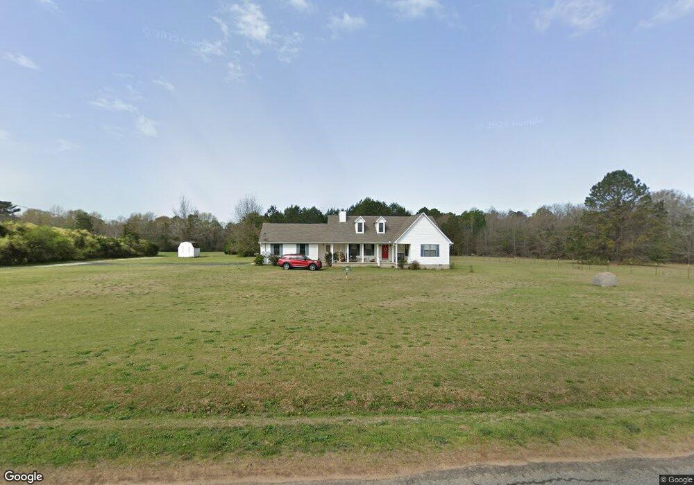
This home is located at 351 Barker Rd, Byron, GA 31008 and is currently estimated at $270,147, approximately $129 per square foot. 351 Barker Rd is a home located in Peach County with nearby schools including Kay Road Elementary School, Fort Valley Middle School, and Peach County High School.
Ownership History
Date
Name
Owned For
Owner Type
Purchase Details
Closed on
Apr 24, 2024
Sold by
Mygrant Bennie A
Bought by
Mygrant Bennie A and Mygrant Elizabeth Patterson
Current Estimated Value
Purchase Details
Closed on
Nov 18, 2020
Sold by
Mygrant Laura E
Bought by
Mygrant Bennie A
Purchase Details
Closed on
Jul 25, 2008
Sold by
Mygrant Bennie A
Bought by
Mygrant Bennie A and Mygrant Laura E
Home Financials for this Owner
Home Financials are based on the most recent Mortgage that was taken out on this home.
Original Mortgage
$177,946
Interest Rate
6.43%
Mortgage Type
FHA
Purchase Details
Closed on
Mar 25, 1998
Bought by
Mygrant Bennie A
Purchase Details
Closed on
Nov 4, 1997
Bought by
Barker Randolph F
Create a Home Valuation Report for This Property
The Home Valuation Report is an in-depth analysis detailing your home's value as well as a comparison with similar homes in the area
Home Values in the Area
Average Home Value in this Area
Purchase History
| Date | Buyer | Sale Price | Title Company |
|---|---|---|---|
| Mygrant Bennie A | -- | -- | |
| Mygrant Bennie A | -- | -- | |
| Mygrant Bennie A | -- | -- | |
| Mygrant Laura E | $168,500 | -- | |
| Mygrant Bennie A | $83,500 | -- | |
| Barker Randolph F | -- | -- |
Source: Public Records
Mortgage History
| Date | Status | Borrower | Loan Amount |
|---|---|---|---|
| Previous Owner | Mygrant Laura E | $177,946 |
Source: Public Records
Tax History
| Year | Tax Paid | Tax Assessment Tax Assessment Total Assessment is a certain percentage of the fair market value that is determined by local assessors to be the total taxable value of land and additions on the property. | Land | Improvement |
|---|---|---|---|---|
| 2025 | $1,873 | $68,720 | $8,920 | $59,800 |
| 2024 | $1,925 | $66,480 | $8,920 | $57,560 |
| 2023 | $1,849 | $63,120 | $6,160 | $56,960 |
| 2022 | $1,653 | $55,840 | $6,160 | $49,680 |
| 2021 | $1,693 | $49,680 | $6,160 | $43,520 |
| 2020 | $1,861 | $55,080 | $6,160 | $48,920 |
| 2019 | $1,825 | $53,680 | $6,160 | $47,520 |
| 2018 | $1,834 | $53,680 | $6,160 | $47,520 |
| 2017 | $1,842 | $53,680 | $6,160 | $47,520 |
| 2016 | $1,857 | $54,400 | $6,880 | $47,520 |
| 2015 | $1,821 | $53,160 | $5,640 | $47,520 |
| 2014 | $1,823 | $53,160 | $5,640 | $47,520 |
| 2013 | -- | $53,160 | $5,640 | $47,520 |
Source: Public Records
Map
Nearby Homes
- 0 Barker Rd Unit 243030
- 0 Barker Rd Unit 14258525
- 0 Barker Rd Unit 175053
- 571 Barker Rd
- 124 Hawks Ridge Trace
- 171 Hawks Ridge Trace
- 109 Red Tail Cir
- 161 Rowland Cir
- 450 Jones Rd
- 907 Cliett Rd
- 129 Amanda Dr
- 518 Southland Trail
- 112 Early Dr
- 117 Early Dr
- 510 Southland Trail
- 538 Southland Trail
- 251 Hampton Oaks Way
- 165 Early Dr
- 144 Summit Dr
- 147 Early Dr
- 319 Barker Rd
- 551 Polly Dr
- 489 Barker Rd
- 0 Barker Rd Unit 20043964
- 0 Barker Rd Unit M165708
- 0 Barker Rd Unit 223091
- 229 Barker Rd
- 446 Polly Dr
- 244 Barker Rd
- 353 Kimberly Dr
- 572 Barker Rd
- 574 Barker Rd
- 232 Polly Dr
- 401 Kimberly Dr
- 832 Kay Rd
- 0 Cumberland Shores Subdivision
- 284 Polly Dr
- 450 Kimberly Dr
- 488 Kimberly Dr
- 911 Ga Highway 247 Connector
Your Personal Tour Guide
Ask me questions while you tour the home.