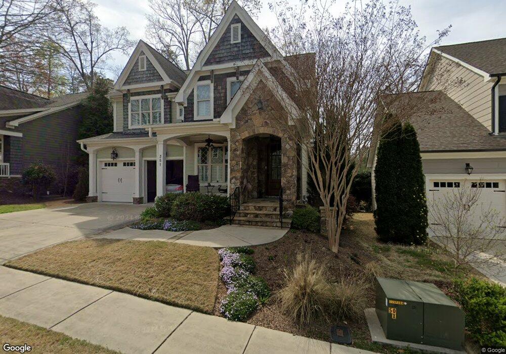
351 Dark Forest Dr Chapel Hill, NC 27516
Estimated Value: $738,625 - $819,000
4
Beds
4
Baths
2,810
Sq Ft
$271/Sq Ft
Est. Value
About This Home
This home is located at 351 Dark Forest Dr, Chapel Hill, NC 27516 and is currently estimated at $760,406, approximately $270 per square foot. 351 Dark Forest Dr is a home located in Chatham County with nearby schools including Margaret B. Pollard Middle School and Woods Charter.
Ownership History
Date
Name
Owned For
Owner Type
Purchase Details
Closed on
Oct 10, 2018
Sold by
Fisher John A and Fisher Linda C
Bought by
Hueske Joel D and Hueske Barbara S
Current Estimated Value
Purchase Details
Closed on
Nov 29, 2012
Sold by
Homes By Dickerson Inc
Bought by
Fisher John A and Fisher Linda C
Home Financials for this Owner
Home Financials are based on the most recent Mortgage that was taken out on this home.
Original Mortgage
$250,000
Interest Rate
3.44%
Mortgage Type
New Conventional
Purchase Details
Closed on
Apr 18, 2012
Sold by
Nnp Briar Chapel Llc
Bought by
Homes By Dickerson Inc
Create a Home Valuation Report for This Property
The Home Valuation Report is an in-depth analysis detailing your home's value as well as a comparison with similar homes in the area
Home Values in the Area
Average Home Value in this Area
Purchase History
| Date | Buyer | Sale Price | Title Company |
|---|---|---|---|
| Hueske Joel D | $485,000 | None Available | |
| Fisher John A | $430,000 | None Available | |
| Homes By Dickerson Inc | $150,000 | None Available |
Source: Public Records
Mortgage History
| Date | Status | Borrower | Loan Amount |
|---|---|---|---|
| Previous Owner | Fisher John A | $250,000 |
Source: Public Records
Tax History
| Year | Tax Paid | Tax Assessment Tax Assessment Total Assessment is a certain percentage of the fair market value that is determined by local assessors to be the total taxable value of land and additions on the property. | Land | Improvement |
|---|---|---|---|---|
| 2025 | $6,274 | $735,559 | $116,000 | $619,559 |
| 2024 | $4,152 | $486,808 | $92,800 | $394,008 |
| 2023 | $3,958 | $486,808 | $92,800 | $394,008 |
| 2022 | $3,812 | $486,808 | $92,800 | $394,008 |
| 2021 | $0 | $486,808 | $92,800 | $394,008 |
| 2020 | $3,542 | $490,477 | $90,000 | $400,477 |
| 2019 | $3,894 | $490,477 | $90,000 | $400,477 |
| 2018 | $3,633 | $484,411 | $90,000 | $394,411 |
| 2017 | $3,633 | $484,411 | $90,000 | $394,411 |
| 2016 | $2,825 | $371,005 | $90,000 | $281,005 |
| 2015 | $2,780 | $371,005 | $90,000 | $281,005 |
| 2014 | -- | $371,005 | $90,000 | $281,005 |
| 2013 | -- | $371,005 | $90,000 | $281,005 |
Source: Public Records
Map
Nearby Homes
- 85 Saxapahaw Run
- 57 Vandalia Ave
- 41 N Serenity Hill Cir
- 44 Owen Towne Rd
- 38 Owen Towne Rd
- 2184 Briar Chapel Pkwy
- 1564 Great Ridge Pkwy
- 156 Serenity Hill Cir
- 22 Treywood Ln
- 1682 Great Ridge Pkwy
- 51 Tarwick Ave
- 371 Wildwind Dr
- 646 Great Ridge Pkwy
- 676 Tobacco Farm Way
- 700 Tobacco Farm Way
- 540 Patterson Dr
- 614 Great Ridge Pkwy
- 366 Old Piedmont Cir
- 560 Great Ridge Pkwy
- 361 Old Piedmont Cir
- 351 Dark Forest Dr Unit LT444
- 347 Dark Forest Dr Unit LT443
- 353 Dark Forest Dr Unit LOT68
- 353 Dark Forest Dr
- 343 Dark Forest Dr Unit LT442
- 343 Dark Forest Dr
- 373 Dark Forest Dr
- 688 Bennett Mountain Trace Unit Lt77
- 688 Bennett Mountain Trace
- 335 Dark Forest Dr Unit LOT15
- 335 Dark Forest Dr
- 381 Dark Forest Dr
- 384 Dark Forest Dr
- 672 Bennett Mountain Trace Unit LT78
- 672 Bennett Mountain Trace
- 330 Dark Forest Dr Unit LOT16
- 330 Dark Forest Dr
- 393 Dark Forest Dr
- 1239 Great Ridge Pkwy
- 1235 Great Ridge Pkwy
Your Personal Tour Guide
Ask me questions while you tour the home.