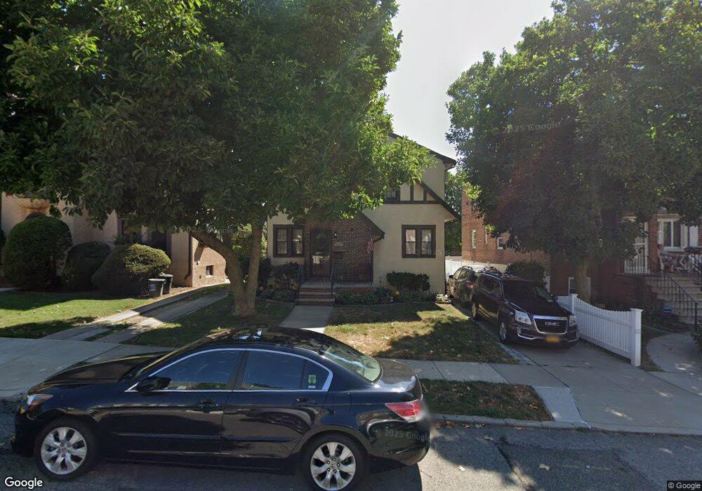
3515 191st St Flushing, NY 11358
Auburndale NeighborhoodEstimated Value: $986,000 - $1,160,000
Studio
--
Bath
1,590
Sq Ft
$698/Sq Ft
Est. Value
About This Home
This home is located at 3515 191st St, Flushing, NY 11358 and is currently estimated at $1,109,968, approximately $698 per square foot. 3515 191st St is a home located in Queens County with nearby schools including P.S. 32 - State Street, I.S. 25 Adrien Block, and Francis Lewis High School.
Ownership History
Date
Name
Owned For
Owner Type
Purchase Details
Closed on
Mar 2, 2004
Sold by
Madaio ( Life Estate Interest Andrew Ar and Scuderi
Bought by
Scuderi Andrea D and Scuderi Joseph
Current Estimated Value
Purchase Details
Closed on
Apr 1, 1998
Sold by
Madaio Andrew Arthur
Bought by
Scuderi Andrea D and Scuderi Joseph
Create a Home Valuation Report for This Property
The Home Valuation Report is an in-depth analysis detailing your home's value as well as a comparison with similar homes in the area
Home Values in the Area
Average Home Value in this Area
Purchase History
We collect this data history from publicly available records. To have your information removed, we recommend requesting removal directly through your county’s website.
| Date | Buyer | Sale Price | Title Company |
|---|---|---|---|
| Scuderi Andrea D | -- | -- | |
| Scuderi Andrea D | -- | -- | |
| Scuderi Andrea D | -- | Chicago Title Insurance Co | |
| Scuderi Andrea D | -- | Chicago Title Insurance Co |
Source: Public Records
Tax History
| Year | Tax Paid | Tax Assessment Tax Assessment Total Assessment is a certain percentage of the fair market value that is determined by local assessors to be the total taxable value of land and additions on the property. | Land | Improvement |
|---|---|---|---|---|
| 2026 | $10,046 | $50,046 | $14,347 | $35,699 |
| 2025 | $9,844 | $50,018 | $15,010 | $35,008 |
| 2024 | $9,844 | $49,014 | $16,665 | $32,349 |
| 2023 | $9,326 | $46,434 | $13,391 | $33,043 |
| 2022 | $8,755 | $71,040 | $20,400 | $50,640 |
| 2021 | $8,777 | $59,400 | $20,400 | $39,000 |
| 2020 | $8,823 | $60,600 | $20,400 | $40,200 |
| 2019 | $8,544 | $66,720 | $20,400 | $46,320 |
| 2018 | $7,590 | $38,695 | $13,648 | $25,047 |
| 2017 | $7,150 | $36,547 | $14,846 | $21,701 |
| 2016 | $6,638 | $36,547 | $14,846 | $21,701 |
| 2015 | $3,939 | $34,735 | $15,872 | $18,863 |
| 2014 | $3,939 | $34,038 | $17,186 | $16,852 |
Source: Public Records
Map
Nearby Homes
- 192-14 35th Ave
- 36-20 190th St
- 34-26 192nd St
- 35-20 Utopia Pkwy
- 191-10 37th Ave
- 36-11 Utopia Pkwy
- 34-12 192nd St
- 37-16 191st St Unit 152
- 17203 35th Ave
- 190-05 39th Ave Unit 142
- 3617 194th St
- 36-10 Utopia Pkwy Unit E4
- 172-12 Crocheron Ave Unit C3
- 189-19 39th Ave Unit 117
- 191-02 39th Ave
- 34-35 Jordan St
- 193-02 39th Ave Unit 1
- 33-22 Jordan St
- 36-07 171st St Unit 35
- 19112 Station Rd
- 3509 191st St Unit 8
- 3509 191st St Unit 3A
- 3509 191st St Unit 6A
- 3509 191st St Unit 3B
- 3509 191st St Unit 9A
- 3509 191st St Unit 9B
- 3509 191st St
- 3505 191st St Unit 7A
- 3505 191st St
- 3505 191st St Unit 4A
- 3505 191st St Unit 5B
- 3505 191st St Unit 5A
- 3505 191st St Unit 6A
- 3509 191st St
- 35-01-09 191st St
- 35-01-09 191st St
- 3511 191st St
- 191-2 35th Ave Unit 3B
- 191-4 35th Ave Unit 3A
- 35-1 191st St Unit 5B
Your Personal Tour Guide
Ask me questions while you tour the home.