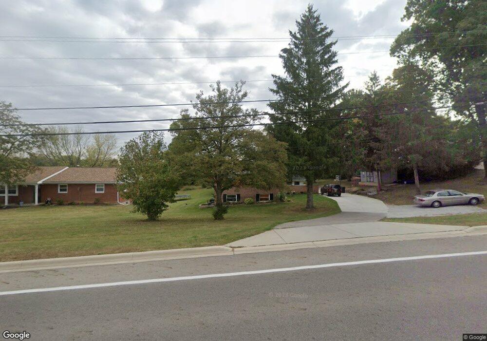
3516 Derr Rd Springfield, OH 45503
Estimated Value: $265,000 - $301,000
3
Beds
3
Baths
1,362
Sq Ft
$206/Sq Ft
Est. Value
About This Home
This home is located at 3516 Derr Rd, Springfield, OH 45503 and is currently estimated at $281,023, approximately $206 per square foot. 3516 Derr Rd is a home located in Clark County with nearby schools including Northridge Elementary School, Kenton Ridge Middle & High School, and Emmanuel Christian Academy.
Ownership History
Date
Name
Owned For
Owner Type
Purchase Details
Closed on
Jul 24, 2017
Sold by
Newland Dora Lee
Bought by
Page Andrew M and Page Sarah N
Current Estimated Value
Home Financials for this Owner
Home Financials are based on the most recent Mortgage that was taken out on this home.
Original Mortgage
$109,600
Interest Rate
4.03%
Mortgage Type
New Conventional
Create a Home Valuation Report for This Property
The Home Valuation Report is an in-depth analysis detailing your home's value as well as a comparison with similar homes in the area
Home Values in the Area
Average Home Value in this Area
Purchase History
| Date | Buyer | Sale Price | Title Company |
|---|---|---|---|
| Page Andrew M | $137,000 | Team Title Closing Services |
Source: Public Records
Mortgage History
| Date | Status | Borrower | Loan Amount |
|---|---|---|---|
| Closed | Page Andrew M | $109,600 |
Source: Public Records
Tax History
| Year | Tax Paid | Tax Assessment Tax Assessment Total Assessment is a certain percentage of the fair market value that is determined by local assessors to be the total taxable value of land and additions on the property. | Land | Improvement |
|---|---|---|---|---|
| 2025 | $2,390 | $83,680 | $19,080 | $64,600 |
| 2024 | $2,311 | $54,660 | $18,410 | $36,250 |
| 2023 | $2,311 | $54,660 | $18,410 | $36,250 |
| 2022 | $2,320 | $54,660 | $18,410 | $36,250 |
| 2021 | $2,744 | $54,800 | $14,490 | $40,310 |
| 2020 | $2,747 | $54,800 | $14,490 | $40,310 |
| 2019 | $2,799 | $54,800 | $14,490 | $40,310 |
| 2018 | $2,765 | $51,900 | $11,940 | $39,960 |
| 2017 | $1,970 | $49,889 | $11,935 | $37,954 |
| 2016 | $1,957 | $49,889 | $11,935 | $37,954 |
| 2015 | $1,996 | $49,889 | $11,935 | $37,954 |
| 2014 | $1,996 | $49,889 | $11,935 | $37,954 |
| 2013 | $1,949 | $49,889 | $11,935 | $37,954 |
Source: Public Records
Map
Nearby Homes
- 1136 Foxboro Rd Unit 202
- 1162 Kingsgate Rd
- 1201 Kingsgate Rd
- 3052 Brixton Dr E
- 1139 Bradford Dr
- 1039 Bradford Dr Unit 42
- 3631 Kingsgate Ln
- 1500 Kingsgate Rd Unit 19430
- 1502 Kingsgate Rd Unit 19432
- 1500 Kingsgate Rd
- 1502 Kingsgate Rd
- 1503 Kingsgate Rd
- 1505 Kingsgate Rd
- 1507 Kingsgate Rd
- 1415 Montego Dr
- 3135 Imperial Blvd
- 3124 El Camino Dr
- 1811 Saint Andrews Ct
- 1644 Delmar Dr
- 4256 Midfield St Unit 9
- 3448 Derr Rd
- 3534 Derr Rd
- 1155 Scanlon Ln
- 1131 Scanlon Ln
- 3440 Derr Rd
- 3115 Brixton Dr W
- 3115 Brixton Dr W
- 3111 Brixton Dr W
- 1136 Brixton Dr N
- 1117 Scanlon Ln
- 3107 Brixton Dr W
- 3107 Brixton Dr W Unit 114
- 1138 Brixton Dr N Unit 110
- 1138 Brixton Dr N
- 1173 Scanlon Ln
- 1148 Scanlon Ln
- 1138 Scanlon Ln
- 3106 Brixton Dr W
- 3106 Brixton Dr W
- 1137 Brixton Dr N
Your Personal Tour Guide
Ask me questions while you tour the home.