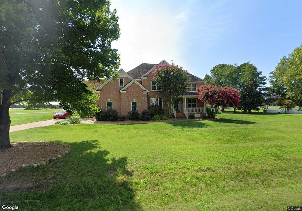
3518 Mott Ln Williamsburg, VA 23185
Jamestown NeighborhoodEstimated Value: $668,000 - $850,142
4
Beds
5
Baths
3,265
Sq Ft
$240/Sq Ft
Est. Value
About This Home
This home is located at 3518 Mott Ln, Williamsburg, VA 23185 and is currently estimated at $784,036, approximately $240 per square foot. 3518 Mott Ln is a home located in James City County with nearby schools including Matoaka Elementary School, Lois Hornsby Middle School, and Jamestown High School.
Ownership History
Date
Name
Owned For
Owner Type
Purchase Details
Closed on
Oct 8, 2021
Sold by
Decamp Caroline
Bought by
Evans Kristina J and Evans Eric P
Current Estimated Value
Home Financials for this Owner
Home Financials are based on the most recent Mortgage that was taken out on this home.
Original Mortgage
$661,500
Outstanding Balance
$551,864
Interest Rate
2.25%
Mortgage Type
New Conventional
Estimated Equity
$232,172
Purchase Details
Closed on
Feb 25, 2005
Sold by
B R C Co
Bought by
Nuzzi John D
Home Financials for this Owner
Home Financials are based on the most recent Mortgage that was taken out on this home.
Original Mortgage
$85,600
Interest Rate
5.7%
Mortgage Type
New Conventional
Create a Home Valuation Report for This Property
The Home Valuation Report is an in-depth analysis detailing your home's value as well as a comparison with similar homes in the area
Home Values in the Area
Average Home Value in this Area
Purchase History
| Date | Buyer | Sale Price | Title Company |
|---|---|---|---|
| Evans Kristina J | $735,000 | Classic Settlements Inc | |
| Nuzzi John D | $107,000 | -- |
Source: Public Records
Mortgage History
| Date | Status | Borrower | Loan Amount |
|---|---|---|---|
| Open | Evans Kristina J | $661,500 | |
| Previous Owner | Nuzzi John D | $85,600 |
Source: Public Records
Tax History
| Year | Tax Paid | Tax Assessment Tax Assessment Total Assessment is a certain percentage of the fair market value that is determined by local assessors to be the total taxable value of land and additions on the property. | Land | Improvement |
|---|---|---|---|---|
| 2025 | $5,354 | $645,100 | $93,500 | $551,600 |
| 2024 | $5,032 | $645,100 | $93,500 | $551,600 |
| 2023 | $5,032 | $579,100 | $93,500 | $485,600 |
| 2022 | $4,807 | $579,100 | $93,500 | $485,600 |
| 2021 | $4,210 | $501,200 | $89,100 | $412,100 |
| 2020 | $4,210 | $501,200 | $89,100 | $412,100 |
| 2019 | $4,210 | $501,200 | $89,100 | $412,100 |
| 2018 | $4,210 | $501,200 | $89,100 | $412,100 |
| 2017 | $4,145 | $493,500 | $89,100 | $404,400 |
| 2016 | $4,145 | $493,500 | $89,100 | $404,400 |
| 2015 | $2,040 | $485,800 | $89,100 | $396,700 |
| 2014 | $3,741 | $485,800 | $89,100 | $396,700 |
Source: Public Records
Map
Nearby Homes
- 3737 Captain Wynne Dr
- 2661 Sir Thomas Way
- 2509 Fair Chase
- 2529 Fair Chase
- 3316 Reades Way
- 406 London Company Way
- 125 Arena St
- 3005 E Bay
- 3000 S Chase
- 2509 Nathaniell Powell Rd
- 217 Robertson St
- 107 Castle Ln
- 336 Fairway Lookout
- 371 Fairway Lookout
- 108 Greenbrier
- 127 Constance Ave
- 2917 Richard Grove S
- 402 Prosperity Ct
- 120 Constance Ave
- 3312 Pinedell Ln
Your Personal Tour Guide
Ask me questions while you tour the home.