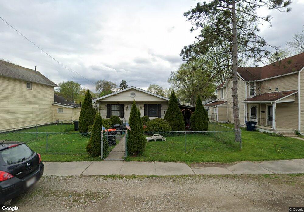
353 N 10th St Newark, OH 43055
Estimated Value: $161,000 - $187,000
About This Home
This home is located at 353 N 10th St, Newark, OH 43055 and is currently estimated at $176,897, approximately $184 per square foot. 353 N 10th St is a home located in Licking County with nearby schools including John Clem Elementary School, Liberty Middle School, and Newark High School.
Ownership History
We collect this data history from publicly available records. To have your information removed, we recommend requesting removal directly through your county’s website.
Purchase Details
Purchase Details
Purchase Details
Purchase Details
Home Values in the Area
Average Home Value in this Area
Purchase History
We collect this data history from publicly available records. To have your information removed, we recommend requesting removal directly through your county’s website.
| Date | Buyer | Sale Price | Title Company |
|---|---|---|---|
| -- | Green Robin Lyn | ||
| -- | None Available | ||
| $56,000 | -- | ||
| $5,000 | -- |
Tax History
We collect this data history from publicly available records. To have your information removed, we recommend requesting removal directly through your county’s website.
| Year | Tax Paid | Tax Assessment Tax Assessment Total Assessment is a certain percentage of the fair market value that is determined by local assessors to be the total taxable value of land and additions on the property. | Land | Improvement |
|---|---|---|---|---|
| 2025 | $1,935 | $51,420 | $10,330 | $41,090 |
| 2024 | $1,887 | $51,420 | $10,330 | $41,090 |
| 2023 | $1,883 | $51,420 | $10,330 | $41,090 |
| 2022 | $1,767 | $42,950 | $5,810 | $37,140 |
| 2021 | $1,854 | $42,950 | $5,810 | $37,140 |
| 2020 | $1,896 | $42,950 | $5,810 | $37,140 |
| 2019 | $1,532 | $33,390 | $4,830 | $28,560 |
| 2018 | $1,533 | $0 | $0 | $0 |
| 2017 | $1,468 | $0 | $0 | $0 |
| 2016 | $1,050 | $0 | $0 | $0 |
| 2015 | $1,067 | $0 | $0 | $0 |
| 2014 | $669 | $0 | $0 | $0 |
| 2013 | $4,294 | $0 | $0 | $0 |
Map
- 210 W Shields St
- 214 W Shields St
- 413 Sherwood Dr W
- 370 Buckingham St
- 395 Mount Vernon Rd
- 152 Fairfield Ave
- 218 Granville St
- 195 Jefferson Rd
- 99 Hoover St
- 206 Jefferson Rd
- 361 Granville St
- 293 Merchant St
- 563 Kibler Ave
- 18 E Oak St
- 456 Hudson Ave
- 12 E Saint Clair St
- 249 W Locust St
- 562 Prior Ave
- 97 Manning St
- 101 Manning St
Ask me questions while you tour the home.