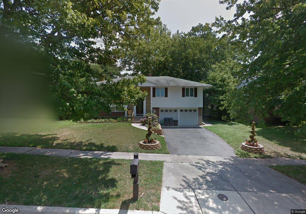
3531 Kings Point Rd Randallstown, MD 21133
Estimated Value: $369,000 - $401,000
4
Beds
3
Baths
1,186
Sq Ft
$328/Sq Ft
Est. Value
About This Home
This home is located at 3531 Kings Point Rd, Randallstown, MD 21133 and is currently estimated at $388,906, approximately $327 per square foot. 3531 Kings Point Rd is a home located in Baltimore County with nearby schools including Hernwood Elementary School, Deer Park Middle Magnet School, and New Town High.
Ownership History
Date
Name
Owned For
Owner Type
Purchase Details
Closed on
Jul 19, 2010
Sold by
Palmer Elston A
Bought by
Hatcher Dawn
Current Estimated Value
Purchase Details
Closed on
Jan 26, 1978
Sold by
Ockenfels Wilbert H
Bought by
Palmer Elston A
Create a Home Valuation Report for This Property
The Home Valuation Report is an in-depth analysis detailing your home's value as well as a comparison with similar homes in the area
Home Values in the Area
Average Home Value in this Area
Purchase History
| Date | Buyer | Sale Price | Title Company |
|---|---|---|---|
| Hatcher Dawn | $217,500 | -- | |
| Palmer Elston A | $54,500 | -- |
Source: Public Records
Tax History
| Year | Tax Paid | Tax Assessment Tax Assessment Total Assessment is a certain percentage of the fair market value that is determined by local assessors to be the total taxable value of land and additions on the property. | Land | Improvement |
|---|---|---|---|---|
| 2025 | $3,226 | $243,900 | -- | -- |
| 2024 | $3,226 | $230,200 | $82,100 | $148,100 |
| 2023 | $1,575 | $222,333 | $0 | $0 |
| 2022 | $3,226 | $214,467 | $0 | $0 |
| 2021 | $2,969 | $206,600 | $82,100 | $124,500 |
| 2020 | $2,969 | $194,033 | $0 | $0 |
| 2019 | $2,793 | $181,467 | $0 | $0 |
| 2018 | $2,687 | $168,900 | $68,100 | $100,800 |
| 2017 | $2,609 | $161,700 | $0 | $0 |
| 2016 | $3,327 | $154,500 | $0 | $0 |
| 2015 | $3,327 | $147,300 | $0 | $0 |
| 2014 | $3,327 | $147,300 | $0 | $0 |
Source: Public Records
Map
Nearby Homes
- 9800 Clanford Rd
- 9908 Hoyt Cir
- 9713 Mendoza Rd
- 9708 Eustice Rd
- 9605 Mendoza Rd
- 3558 Corn Stream Rd
- 9617 Axehead Ct
- 3524 Orchard Shade Rd
- 3668 Waterwheel Square
- 3901 Tiverton Rd
- 3 Lemuels Ct
- 3715 Peace Chance Dr
- 9713 Tulsemere Rd
- 10520 Marriottsville Rd
- 3200 Peddicoat Ct
- 9301 Silver Charm Dr
- 9322 Master Derby Dr
- 9401 Summer Squal Dr
- 9839 Branchleigh Rd
- 3819 Pikeswood Dr
- 3529 Kings Point Rd
- 3533 Kings Point Rd
- 3502 Diaz Ct
- 3535 Kings Point Rd
- 3527 Kings Point Rd
- 9820 Plowline Rd
- 3504 Diaz Ct
- 3532 Kings Point Rd
- 3534 Kings Point Rd
- 3530 Kings Point Rd
- 3500 Diaz Ct
- 9819 Kerrigan Ct
- 3528 Kings Point Rd
- 9818 Plowline Rd
- 9817 Kerrigan Ct
- 9903 Gunstock Rd
- 9815 Kerrigan Ct
- 3526 Kings Point Rd
- 3600 Kings Point Rd
- 3501 Diaz Ct
Your Personal Tour Guide
Ask me questions while you tour the home.