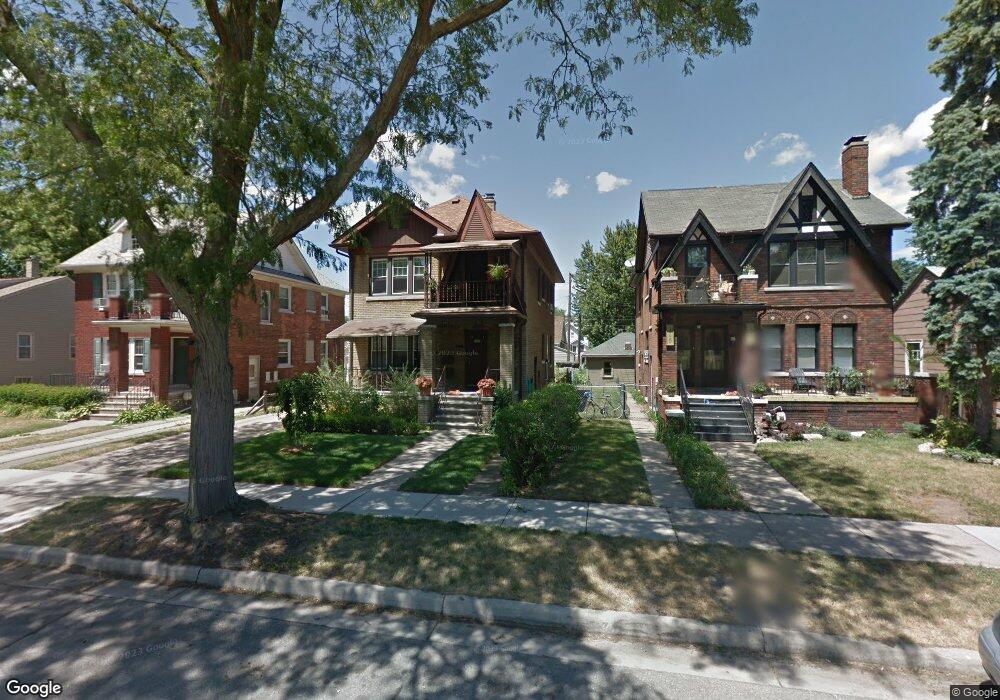
355 E Maplehurst St Ferndale, MI 48220
Estimated Value: $350,000 - $400,000
4
Beds
2
Baths
1,824
Sq Ft
$203/Sq Ft
Est. Value
About This Home
This home is located at 355 E Maplehurst St, Ferndale, MI 48220 and is currently estimated at $370,138, approximately $202 per square foot. 355 E Maplehurst St is a home located in Oakland County with nearby schools including Ferndale Lower Elementary Campus, Ferndale Upper Elementary Campus, and Ferndale Middle School.
Ownership History
Date
Name
Owned For
Owner Type
Purchase Details
Closed on
Feb 17, 2017
Sold by
Adams David and Adams Marsha
Bought by
Adams David and Adams Marsha
Current Estimated Value
Purchase Details
Closed on
Aug 11, 2015
Sold by
Bunyan Patrick J
Bought by
Adams David and Adams Marsha
Purchase Details
Closed on
Nov 16, 2010
Sold by
Sellers John W and Ballard Taffy
Bought by
Adams David J and Adams Marsha L
Purchase Details
Closed on
Sep 24, 2010
Sold by
Sellers John W and Sellers Mary
Bought by
Sellers John W
Purchase Details
Closed on
Oct 22, 1998
Sold by
Sellers Mary and Sellers John B
Bought by
Sellers Mary and Selelrs John William
Create a Home Valuation Report for This Property
The Home Valuation Report is an in-depth analysis detailing your home's value as well as a comparison with similar homes in the area
Home Values in the Area
Average Home Value in this Area
Purchase History
| Date | Buyer | Sale Price | Title Company |
|---|---|---|---|
| Adams David | -- | None Available | |
| Adams David | $46,000 | Attorney | |
| Adams David J | $97,000 | Capital Title Ins Agency | |
| Sellers John W | -- | None Available | |
| Sellers Mary | -- | Capital Title Ins Agency |
Source: Public Records
Tax History
| Year | Tax Paid | Tax Assessment Tax Assessment Total Assessment is a certain percentage of the fair market value that is determined by local assessors to be the total taxable value of land and additions on the property. | Land | Improvement |
|---|---|---|---|---|
| 2025 | $3,916 | $173,660 | $0 | $0 |
| 2024 | $3,789 | $166,460 | $0 | $0 |
| 2023 | $3,661 | $154,950 | $0 | $0 |
| 2022 | $3,643 | $141,300 | $0 | $0 |
| 2021 | $3,646 | $134,000 | $0 | $0 |
| 2020 | $3,479 | $128,460 | $0 | $0 |
| 2019 | $3,516 | $115,450 | $0 | $0 |
| 2018 | $3,513 | $101,120 | $0 | $0 |
| 2017 | $3,807 | $100,370 | $0 | $0 |
| 2016 | $3,426 | $92,310 | $0 | $0 |
| 2015 | -- | $86,140 | $0 | $0 |
| 2014 | -- | $70,660 | $0 | $0 |
| 2011 | -- | $63,970 | $0 | $0 |
Source: Public Records
Map
Nearby Homes
- 525 E Lewiston Ave
- 502 E Lewiston Ave
- 535 E Lewiston Ave
- 449 E Oakridge St
- 187 Vester St
- 490 E Cambourne St
- 350 Vester St
- 2840 Horton St
- 88 Wellesley Dr
- 49 Amherst Rd
- 3116 Horton St
- 2808 Goodrich St
- 571 W Saratoga St
- 1032 E Breckenridge St
- 629 W Lewiston Ave
- 1489 Woodward Heights
- 3291 Minerva St
- 541 Albany St
- 705 W Breckenridge St
- 726 W Breckenridge St
- 349 E Maplehurst St
- 339 E Maplehurst St
- 367 E Maplehurst St
- 371 E Maplehurst St
- 371 E Maplehurst St
- 333 E Maplehurst St
- 356 E Woodland St
- 364 E Woodland St
- 348 E Woodland St
- 364 E Maplehurst St
- 325 E Maplehurst St
- 330 E Woodland St Unit Bldg-Unit
- 330 E Woodland St
- 370 E Woodland St
- 340 E Maplehurst St
- 340 E Maplehurst St
- 358 E Maplehurst St
- 340 E Woodland St
- 338 DEWEY ST. E Woodland St
- 348 E Maplehurst St
Your Personal Tour Guide
Ask me questions while you tour the home.