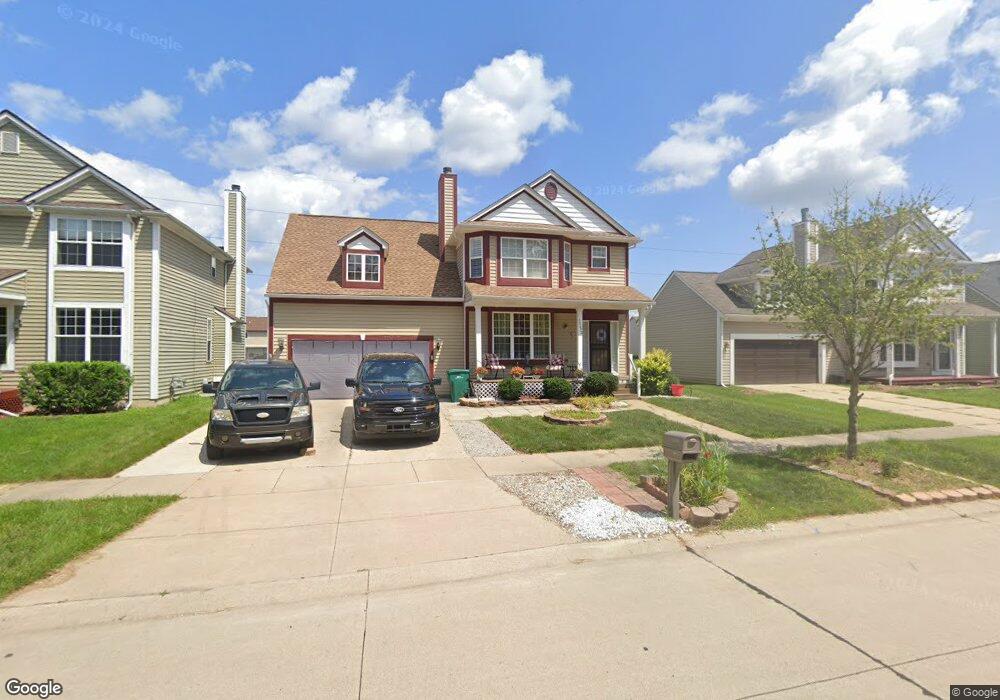
35672 Hawthorne Dr Romulus, MI 48174
Estimated Value: $312,695 - $340,000
4
Beds
3
Baths
2,435
Sq Ft
$135/Sq Ft
Est. Value
About This Home
This home is located at 35672 Hawthorne Dr, Romulus, MI 48174 and is currently estimated at $328,424, approximately $134 per square foot. 35672 Hawthorne Dr is a home located in Wayne County with nearby schools including Wick Elementary School, Romulus Middle School, and Romulus Senior High School.
Ownership History
Date
Name
Owned For
Owner Type
Purchase Details
Closed on
Dec 21, 2010
Sold by
The Bank Of New York Mellon
Bought by
Brewer Shaunda M
Current Estimated Value
Home Financials for this Owner
Home Financials are based on the most recent Mortgage that was taken out on this home.
Original Mortgage
$87,817
Outstanding Balance
$59,563
Interest Rate
4.75%
Mortgage Type
FHA
Estimated Equity
$268,861
Purchase Details
Closed on
Oct 7, 2009
Sold by
Ingram Sterlin and Ingram Celestine
Bought by
The Bank Of New York Mellon and The Bank Of New York
Purchase Details
Closed on
Nov 30, 2004
Sold by
F J Pinehollow Inc
Bought by
Ingram Sterlin
Purchase Details
Closed on
Nov 10, 2003
Sold by
Elro Corp
Bought by
F J Pinehollow Inc
Create a Home Valuation Report for This Property
The Home Valuation Report is an in-depth analysis detailing your home's value as well as a comparison with similar homes in the area
Home Values in the Area
Average Home Value in this Area
Purchase History
| Date | Buyer | Sale Price | Title Company |
|---|---|---|---|
| Brewer Shaunda M | $90,000 | None Available | |
| The Bank Of New York Mellon | $68,000 | None Available | |
| Ingram Sterlin | -- | Multiple | |
| F J Pinehollow Inc | $47,500 | Greco |
Source: Public Records
Mortgage History
| Date | Status | Borrower | Loan Amount |
|---|---|---|---|
| Open | Brewer Shaunda M | $87,817 |
Source: Public Records
Tax History
| Year | Tax Paid | Tax Assessment Tax Assessment Total Assessment is a certain percentage of the fair market value that is determined by local assessors to be the total taxable value of land and additions on the property. | Land | Improvement |
|---|---|---|---|---|
| 2025 | $2,249 | $141,800 | $0 | $0 |
| 2024 | $2,260 | $133,300 | $0 | $0 |
| 2023 | $2,167 | $121,400 | $0 | $0 |
| 2022 | $2,573 | $108,200 | $0 | $0 |
| 2021 | $2,491 | $98,400 | $0 | $0 |
| 2020 | $2,317 | $86,500 | $0 | $0 |
| 2019 | $2,322 | $77,100 | $0 | $0 |
| 2018 | $1,510 | $71,100 | $0 | $0 |
| 2017 | $1,142 | $70,500 | $0 | $0 |
| 2016 | $2,000 | $55,700 | $0 | $0 |
| 2015 | $3,943 | $42,900 | $0 | $0 |
| 2013 | $3,820 | $41,600 | $0 | $0 |
| 2012 | $1,301 | $46,200 | $5,000 | $41,200 |
Source: Public Records
Map
Nearby Homes
- 35773 Surrey Ct
- 8080 Wayne Rd
- 35344 Ecorse Rd
- 000 Waynecorse
- 35815 Cypress St
- 35750 Beverly Rd
- 37207 Ecorse Rd
- 6505 Dexter St
- 0000 Park Place
- 9274 Chamberlain St
- 7175 Ozga St
- 6299 Hunt St
- Lot 215 2nd St
- Lot 214 2nd St
- 6243 Hunt St
- 6130 Wayne Rd
- 7063 Sargent St
- Lot 227 Dexter St
- 000 Cincinnati St
- 6073 Biddle St
- 35698 Hawthorne Dr Unit Bldg-Unit
- 35698 Hawthorne Dr
- 35646 Hawthorne Dr
- 35722 Hawthorne Dr
- 35622 Hawthorne Dr
- 35619 Concord Dr
- 35746 Hawthorne Dr
- 35598 Hawthorne Dr
- 35643 Concord Dr
- 35671 Concord Dr
- 35620 Concord Dr
- 35695 Concord Dr
- 35570 Hawthorne Dr
- 35772 Hawthorne Dr
- 35599 Hawthorne Dr
- 35545 Concord Dr
- 35798 Hawthorne Dr
- 35571 Hawthorne Dr
- 35552 Hawthorne Dr
- 7785 Surrey Dr
Your Personal Tour Guide
Ask me questions while you tour the home.