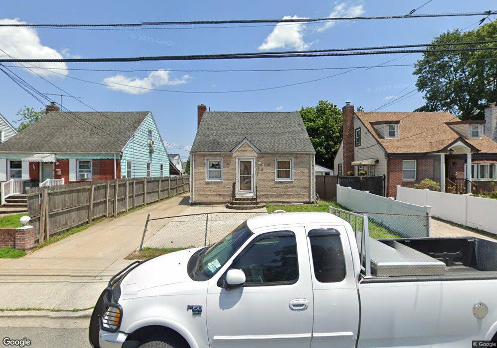
357 Locust Ave Uniondale, NY 11553
Estimated Value: $565,805 - $659,000
            
                --
                Bed


                1
                Bath


                1,120
                Sq Ft


                    $547/Sq Ft
                    Est. Value


About This Home
This home is located at 357 Locust Ave, Uniondale, NY 11553 and is currently estimated at $612,403, approximately $546 per square foot. 357 Locust Ave is a home located in Nassau County with nearby schools including Walnut Street Elementary School, Turtle Hook Middle School, and Uniondale High School.
Ownership History
                Date
                Name
                Owned For
                Owner Type
            
                    Purchase Details
                Closed on
            
            
                Apr 20, 2005
            
        
                Sold by
            
            
                Ayala Osman
            
        
                            Current Estimated Value
                        
                        
                    Purchase Details
                Closed on
            
            
                Sep 9, 2003
            
        
                Sold by
            
            
                Martinez Rogelio
            
        
                Bought by
            
            
                Ayala Osman
            
        
            Create a Home Valuation Report for This Property
            
    
                The Home Valuation Report is an in-depth analysis detailing your home's value as well as a comparison with similar homes in the area
                
            
        Home Values in the Area
Average Home Value in this Area
Purchase History
| Date | Buyer | Sale Price | Title Company | 
|---|---|---|---|
| -- | -- | -- | |
| Ayala Osman | $250,000 | -- | 
                Source: Public Records
            
        Tax History Compared to Growth
Tax History
| Year | Tax Paid | Tax Assessment Tax Assessment Total Assessment is a certain percentage of the fair market value that is determined by local assessors to be the total taxable value of land and additions on the property. | Land | Improvement | 
|---|---|---|---|---|
| 2025 | $8,193 | $372 | $179 | $193 | 
| 2024 | $3,208 | $372 | $179 | $193 | 
| 2023 | $6,892 | $372 | $179 | $193 | 
| 2022 | $6,892 | $372 | $119 | $253 | 
| 2021 | $8,693 | $354 | $113 | $241 | 
| 2020 | $6,597 | $491 | $396 | $95 | 
| 2019 | $6,114 | $491 | $396 | $95 | 
| 2018 | $5,569 | $491 | $0 | $0 | 
| 2017 | $2,925 | $491 | $396 | $95 | 
| 2016 | $5,716 | $491 | $396 | $95 | 
| 2015 | $2,237 | $491 | $396 | $95 | 
| 2014 | $2,237 | $491 | $396 | $95 | 
| 2013 | $2,160 | $491 | $396 | $95 | 
                Source: Public Records
                    
            
        Map
Nearby Homes
        - 335 Locust Ave
 - 388 Maplegrove Ave
 - 737 Lowell Rd
 - 641 Lowell Rd
 - 666 Lowell Rd
 - 730 Goodrich St
 - 1033 Tulsa St
 - 727 Beck St
 - 159 Gilroy Ave
 - 692 Beck St
 - 117 Spring Dr
 - 121 Spring Dr
 - 133 Spring Dr
 - 546 Clark Place
 - 103 Gilroy Ave
 - 727 Windsor Rd
 - 537 Duryea Ave
 - 331 Spring Dr
 - 571 Richmond Rd
 - 383 Summer Ct Unit C383